WordPress Indoor Map Plugin

November 11, 2020

WordPress Indoor Map Plugin for indoor maps is an easy way to integrate building directory to your WordPress website. Keep the tenant info in sync on all your channels – web, mobile and kiosk. It allows you to connect locations on map with WordPress pages, show logos and additional info.

We have developed WordPress indoor map plugin for 3D Wayfinder. Plugin comes with stand-alone location management, but in can be used also with directory content from 3D Wayfinder.
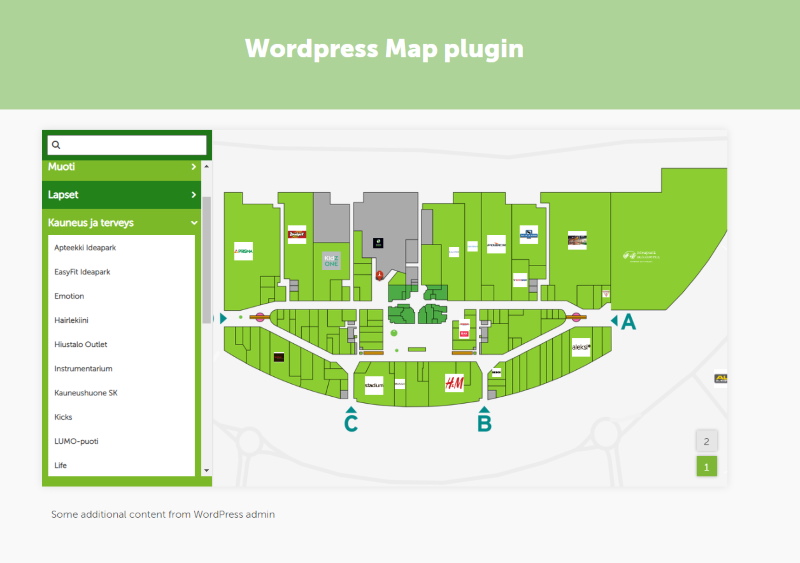
Wordpress embedded map with locations and search

Plugin provides map, that can be included in any WordPress page. Besides interactive map, there are also search and browsing features. Floorplans are clickable, and it is also possible to link WordPress pages with map. This is a very useful plugin for all shopping malls, universities, airports, train stations and other similar institutions. The customer can open the 3D wayfinder map from their own device and click and move as needed.

Until the end of December we are offering WordPress Map plugin for $750 (one time fee, no monthly costs).

Named offer stands for all webpages on WordPress platform (we have done integrations with other CMS-software also, contact us about other options). 

The plugin is not yet listed in WordPress plugin directory, but it will be soon. we are working on adding simple 2D floor plan editor, so maps can be designed directly inside WordPress.

« »

Mobile Wayfinder Maps for Maze

November 3, 2020

We have made a mobile-friendly web application for large corn maze. Application helps to navigate in the maze, but at same time it will not disappear the fun of finding the right path in maze. Continue reading to see, how that’s possible.

Our customer Port Farms is operating large corn maze in Pennsylvania, not far from Cleveland and Pittsburgh. The maze labyrinth will be updated every year and it is more than 500 feet in length and 300 feet wide.

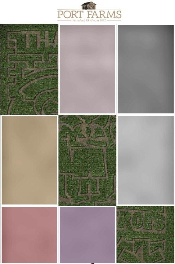
We have created a web-based mobile application for Port Farms, with a map of the maze. When starting, the map tiles are not visible. At the entry point of each section, there is QR-code and by scanning the code a part of the maze map will open.

3D Wayfinder R&D AS custom made solution - corn maze map with partly open map tiles.
Maze mobile map application

It is similar to strategic computer games, where you cannot see the whole map, but just the part you have discovered. By using 3D Wayfinder geolocation API, the actual location is shown by a red dot.

You may ask, why do you need to provide the map in maze or labyrinth at all? One thing is to wonder around the maze and finally get your way out. Another thing is to explore (and in some way we may even say to “conquer”) the maze and discover it. Without needing paper and pen, you just scan the QR codes and open up the map. But it doesn’t mean that you will see the right way through. You still have to try and guess.

3D Wayfinder with similar tiled maps can be used in any other maze, labyrinth or theme park. By scanning the code or following the link, you can add information layers to the map and get the needed info at the right location.

« »