
Our sales can help you find the best wayfinding solution for you or your customer.


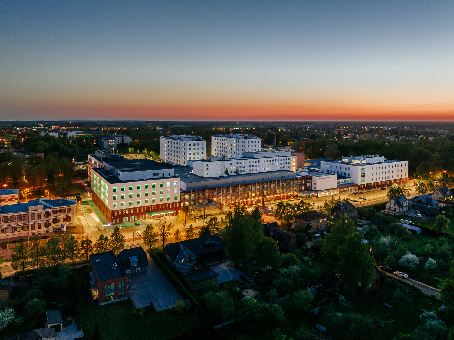

Tartu University Hospital (Tartu Ülikooli Kliinikum) is the main teaching hospital of the University of Tartu. It is also the largest hospital in southern Estonia. The hospital was founded in 1804 and today includes around 30 clinics and services with approximately 965 beds. A large part of the hospital operates at the Maarjamõisa medical campus in Tartu. The complex includes several connected buildings and wings marked from A to M. In addition, visitors need to navigate between different floors, clinics, wards and registration areas. For first-time visitors, such a large medical complex can be difficult to understand. Therefore, Tartu University Hospital wayfinding required a clear and detailed digital solution.
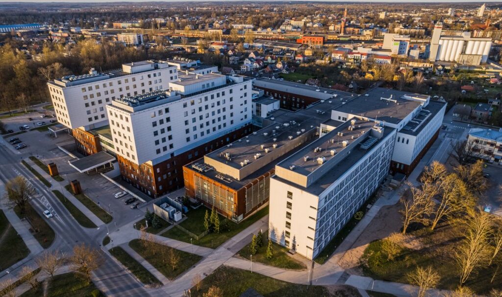
As part of the Hospital Wayfinder project, 3D Wayfinder created a large and highly detailed interactive 3D model of the Tartu University Hospital campus. The solution shows the structure of the hospital in three dimensions. Visitors can see individual buildings, wings, floors and connections between different parts of the complex. As a result, users get a clear overview of the hospital before starting their route. The interactive 3D map is available through a self-service touchscreen kiosk at the hospital.
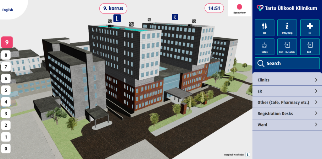
Visitors can use the kiosk to search for their destination and receive clear visual route guidance. The Tartu University Hospital wayfinding system includes important destinations such as clinics, wards, registration desks and the emergency department. Visitors can also find cafés, toilets, information points, entrances and exits.
In addition, users can switch between floors directly on the map. Building labels clearly show the different hospital wings and help visitors understand how they connect. Frequently searched destinations are also available through large quick-access buttons. Therefore, users can find important services with fewer steps.
Large hospitals can be challenging to navigate because several buildings, floors and corridors often form one connected complex. A traditional 2D floor plan does not always show these relationships clearly. The interactive 3D model adds spatial context. Visitors can view the hospital from an overview perspective, select a floor and see how different wings connect. This makes the Tartu University Hospital wayfinding solution both a navigation tool and a detailed digital representation of the medical campus.
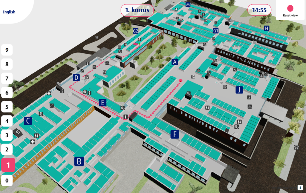
3D Wayfinder developed the solution specifically as part of its Hospital Wayfinder concept. It combines a detailed 3D hospital model, destination search, floor selection and visual route guidance in one touchscreen interface. The current solution does not use indoor positioning. Instead, visitors start their journey from the wayfinding kiosk. They search for the required destination and view the route from the kiosk location.
For a large medical campus such as Tartu University Hospital, clear navigation is especially important. The interactive 3D wayfinding solution helps patients and visitors understand the building and find the correct clinic, ward or service more easily.
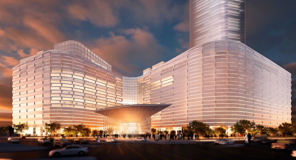
Assima Mall is a major shopping and entertainment destination in the heart of Kuwait City. The mall spans six floors and includes retail stores, restaurants, cafés, entertainment areas, a cinema, gym, spa and hypermarket. With many destinations spread across several levels, clear shopping mall wayfinding is an important part of the visitor experience.
3D Wayfinder provides Assima Mall wayfinding with an interactive digital directory that helps visitors quickly find stores, services and other points of interest.
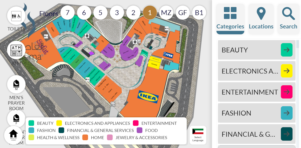
The user interface is built around interactive 3D model. It is a very large, impressive, and detailed model. Visitors can search for a destination, select it from the directory and immediately see its location on the map. The system then calculates and displays a visual route from the visitor’s current position to the selected destination.
Since Assima Mall covers six floors, the wayfinding system also helps users understand when they need to change levels. Visitors can switch between floor views and follow routes that include escalators, elevators and other connections between floors. This makes complex routes easier to understand than with traditional static directories.
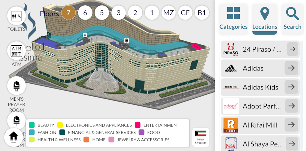
The interface is designed for quick and intuitive use on interactive kiosks. Users can search, select destinations, change floors, zoom the map and follow route guidance without navigating through complicated menus. The 3D map also gives visitors a better understanding of the building layout and helps them recognise surrounding spaces before they start walking.
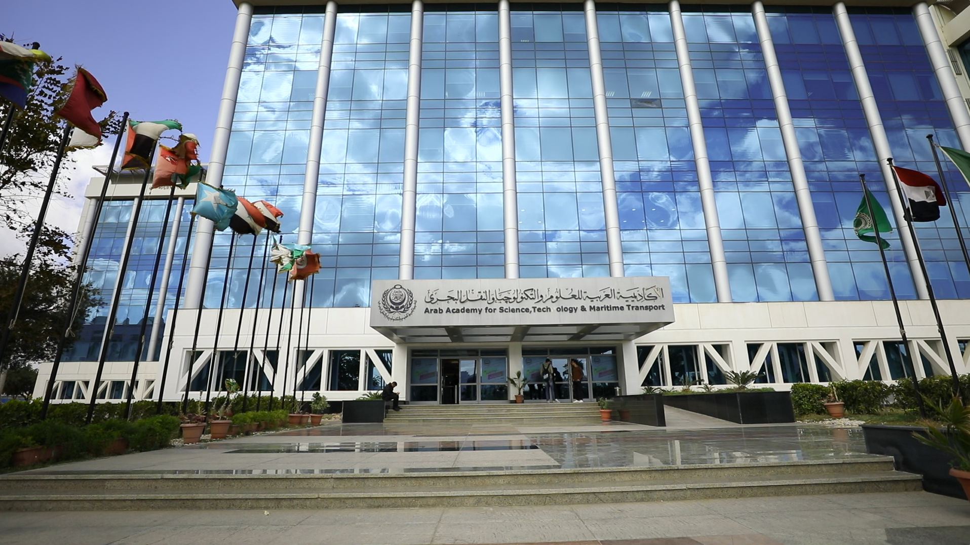
Finding the right building, classroom or facility can be challenging on a large university campus. Therefore, effective university campus wayfinding plays an important role in creating a smooth experience for students, staff and visitors. At the Arab Academy for Science, Technology & Maritime Transport, 3D Wayfinder helps make campus navigation clearer with an interactive digital map.
The Arab Academy for Science, Technology & Maritime Transport (AASTMT) is an educational institution that started its activities in Alexandria, Egypt, in 1972. Today, the Academy operates several campuses and provides education across a wide range of disciplines.
Its academic areas include maritime transport and technology, engineering, computing, business and management, as well as other fields. As a result, the Academy brings together students, lecturers, employees and visitors who need to move between different buildings, departments and facilities every day. For a complex educational environment like this, clear university campus wayfinding can make everyday navigation significantly easier.
3D Wayfinder created an interactive digital wayfinding solution for the Arab Academy for Science, Technology & Maritime Transport. Instead of relying only on traditional signs or static maps, users can explore the campus through an easy-to-understand digital interface and 3D model.

The interactive 3D model gives users a clear visual overview of the surrounding area and its different locations. In addition, visitors can search for destinations and use visual route guidance to understand where they need to go. This makes the system especially useful for new students and first-time visitors who may not yet be familiar with the campus. At the same time, the solution can also support staff, guests and people attending conferences or other events. The template is simple and logical, and it is our most frequently used “Default” template.

Ultimately, effective university campus wayfinding helps turn a complex physical environment into a clear and understandable digital experience. With 3D Wayfinder, the Arab Academy for Science, Technology & Maritime Transport provides students and visitors with a simple visual tool for finding their way around the campus.
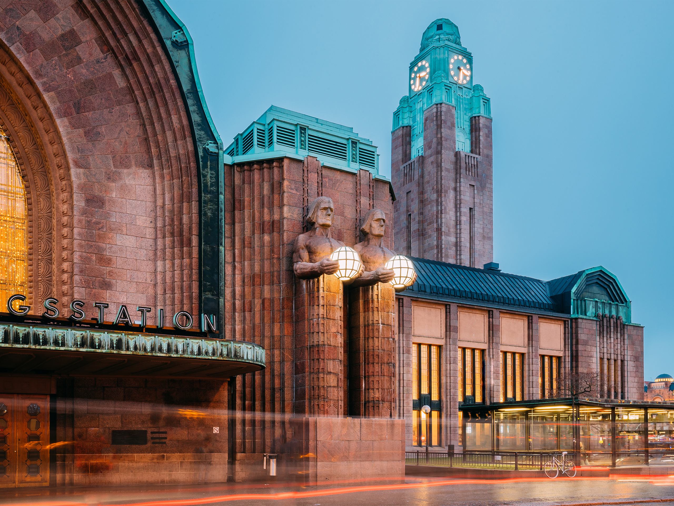
Helsingin Päärautatieasema, also known as Helsinki Central Station, is Finland’s busiest transit hub. Around 200,000 passengers pass through the station every day, and about half of them are there to catch a train. In addition, the station connects directly to Rautatientori, Helsinki’s busiest metro station. Tram and bus stops are also located right outside its doors. All of this movement takes place inside a landmark building dating back to 1919. Built from granite and topped by its famous clock tower. Helsinki Central Station combines historic architecture with the demands of modern public transport.
Helsinki Central Station brings together long-distance trains, commuter rail, the metro, trams, and buses under one historic building. Such a scale means that passengers often switch between several modes of transportation within a few minutes, especially during rush hour. Many travelers are tourists or first-time visitors, so language barriers add another layer to an already complex journey. That’s why helping every passenger reach their destination quickly takes more than signage, especially at a station of this size and heritage.
To solve the problem, the 3D Wayfinder team built an indoor navigation system tailored to the station’s layout and traffic patterns. The Helsinki Central Station wayfinding interactive screen sits in the middle of the main entrance, showing clear routes to platforms, metro entrances, tram stops, and station exits. Whether the goal is a quick visit to a shop, a café, or the bathroom, travelers get step-by-step directions instead of a static map to interpret on their own. Moreover, the interface supports multiple languages. So visitors who don’t speak Finnish or Swedish can navigate just as easily as locals.

As for the interface, a white-and-gray layout with green accents keeps the map at the center of attention. A menu on the right adds detail about the venue without competing with it. As a result, the solution feels less like a kiosk and more like a clean transit map. Giving people what they need at a glance.

Thanks to this, passengers move through the station with more confidence and less hesitation. Especially at places that used to cause bottlenecks. Both tourists and infrequent travelers benefit from Helsinki Central Station wayfinding and language support. Which removes a major source of confusion. All of this helps Finland’s busiest transit hub function with machine-like precision and handle its heavy passenger volume more effectively.
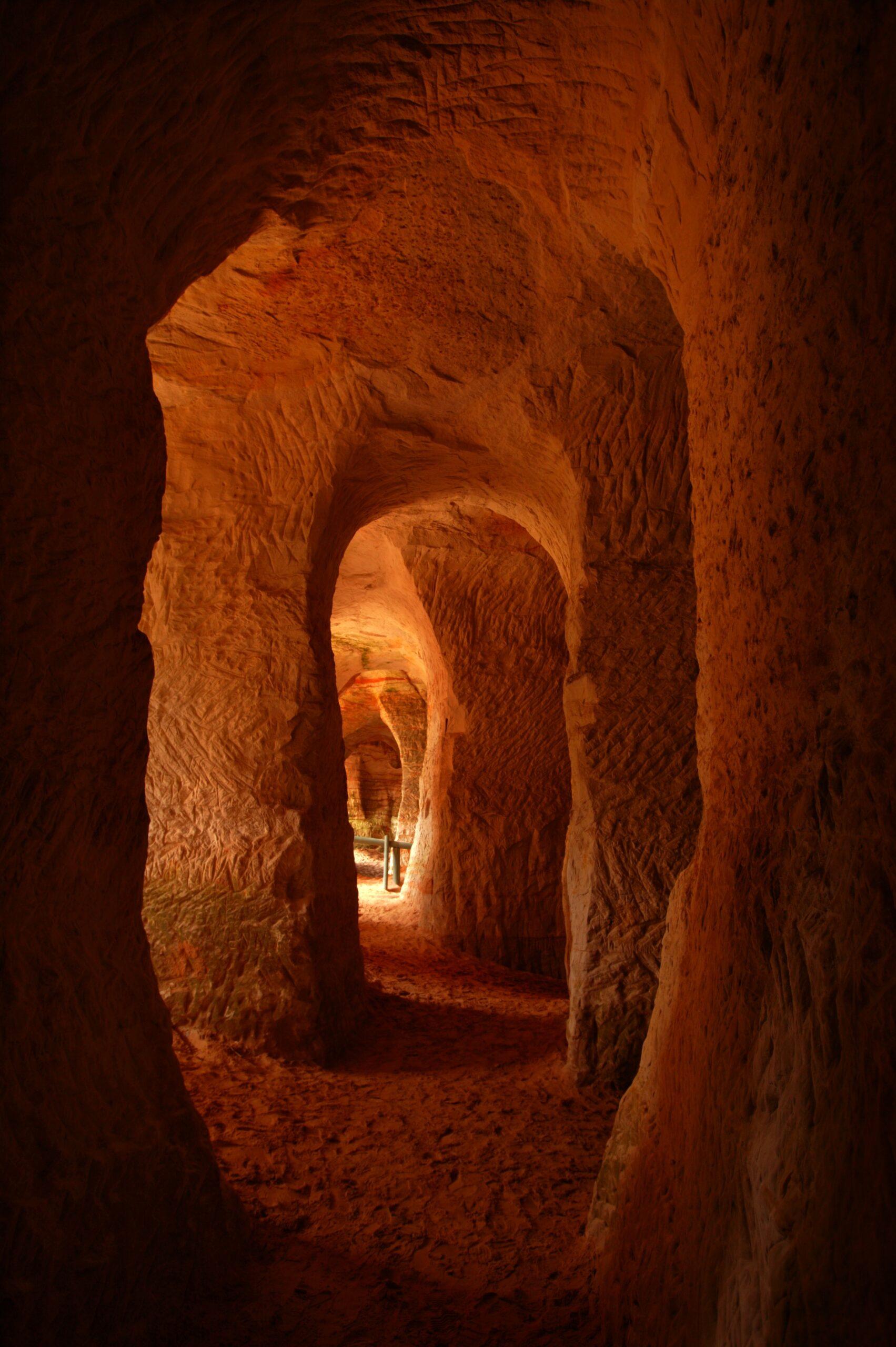
The Piusa caves are among Estonia’s most mysterious and unique natural landmarks. Formed during glass sand mining between 1922 and 1966, this underground world features towering sandstone pillars, vaulted ceilings, and nearly 20 kilometres of tunnels. Today, the caves serve as the Baltic region’s largest bat hibernation site. Authorities protect the area strictly for nature conservation.
The caves once welcomed visitors, but authorities closed them in 2006 because of a collapse risk. Yet interest in Piusa has only grown. The Piusa Visitor Centre now ranks among the most popular attractions in South-Eastern Estonia. This raises an important question: how can visitors experience a site they cannot enter?
The answer lies in modern 3D technology. The Piusa Visitor Centre, Võrumaa Development Centre, Võru Municipality, Maperions, and the Estonia–Latvia Interreg programme joined forces and launched an ambitious project. The partners aimed to create a highly realistic 3D model of the Piusa cave system. The model lets visitors explore the caves virtually.
The 3D Wayfinder team led the work and used its experience in complex spatial environments. This time, however, the goal was even more ambitious: to capture the caves in their entirety, with maximum realism.
To achieve this, we chose photogrammetry—a method that creates accurate 3D models from lots of photographs while preserving natural colours and fine details. Working underground presented significant challenges: darkness, humidity, low temperatures, and the need for perfectly consistent lighting.
We divided the cave into smaller sections. We photographed one area at a time with nearly 20 construction lights and a 360° camera. Also captured around 1,200 images during 52 hours underground. Planned each step carefully to ensure precision.
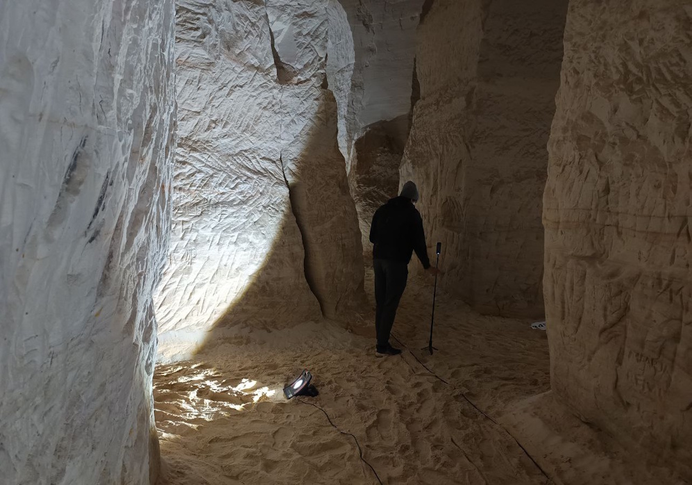
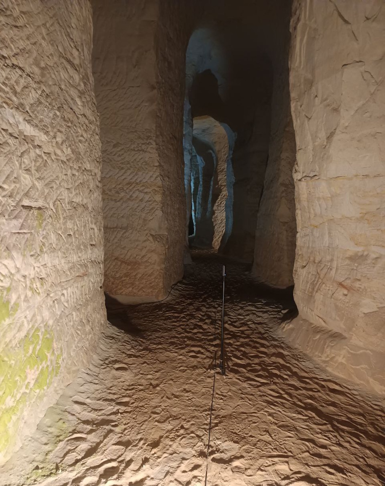
The captured data was processed into 16 separate 3D sections, which were cleaned, refined, and combined into a single model. A key challenge was reducing file size while maintaining visual quality. Through advanced optimisation techniques and texture baking, the final model was reduced by nearly 90%—without sacrificing detail.
The completed Piusa Caves 3D model was deployed on the 3D Wayfinder platform, complete with interactive pathways, a user-friendly interface, and even animated bats. The result is a safe, immersive experience that allows visitors to explore a cave system that remains closed in the physical world.
The Piusa cave 3D model is a powerful example of how digital technology can preserve and present natural heritage—opening closed spaces in a completely new and engaging way.
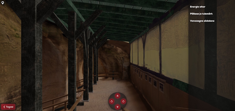
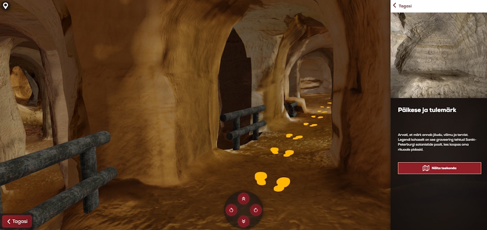
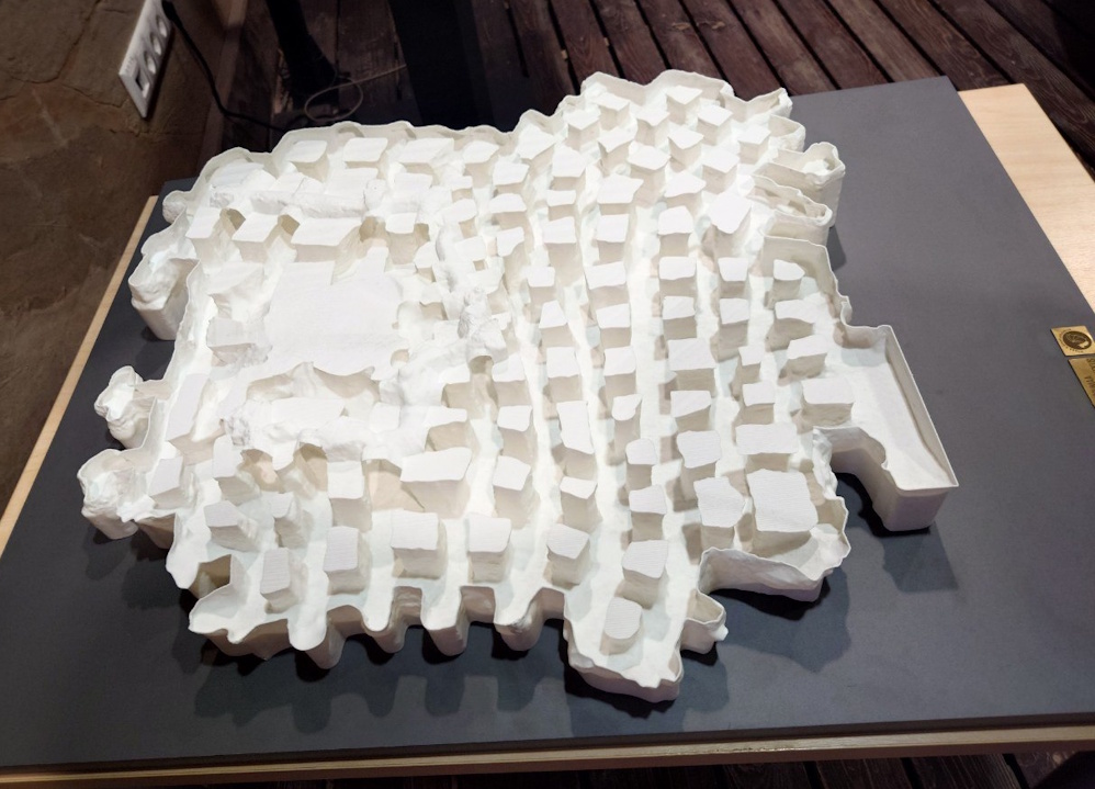
In addition to the Piusa Caves virtual 3D model, we also created a physical 3D scale model of the cave system, which is now on display at the Piusa Visitor Centre. Visitors can explore the layout and structure of the caves up close, see how the tunnels and chambers connect, and get a clear sense of the cave network’s scale—right there at the centre.
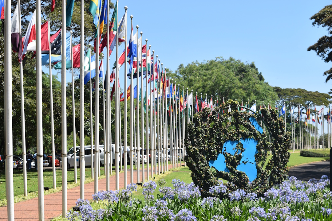
The United Nations Office at Nairobi (UNON) is one of four major UN office sites and hosts a joint presence of many UN agencies. The UN designated it as its African headquarters in 1996. United Nations Office at Nairobi also hosts the global headquarters of the United Nations Environment Programme (UNEP) and the United Nations Human Settlements Programme (UN-Habitat).
The complex includes a “green” building that is fully energy- and carbon-neutral and houses UNEP and UN-Habitat. It stands as Africa’s first of its kind, recycling water and using natural light to cut reliance on artificial lighting. The design leverages natural airflow instead of air conditioning, and solar panels generate all the energy the building consumes. UN Secretary-General Ban Ki-moon and Kenyan President Mwai Kibaki opened the building in 2011.
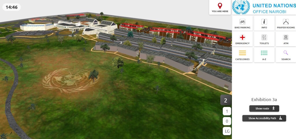
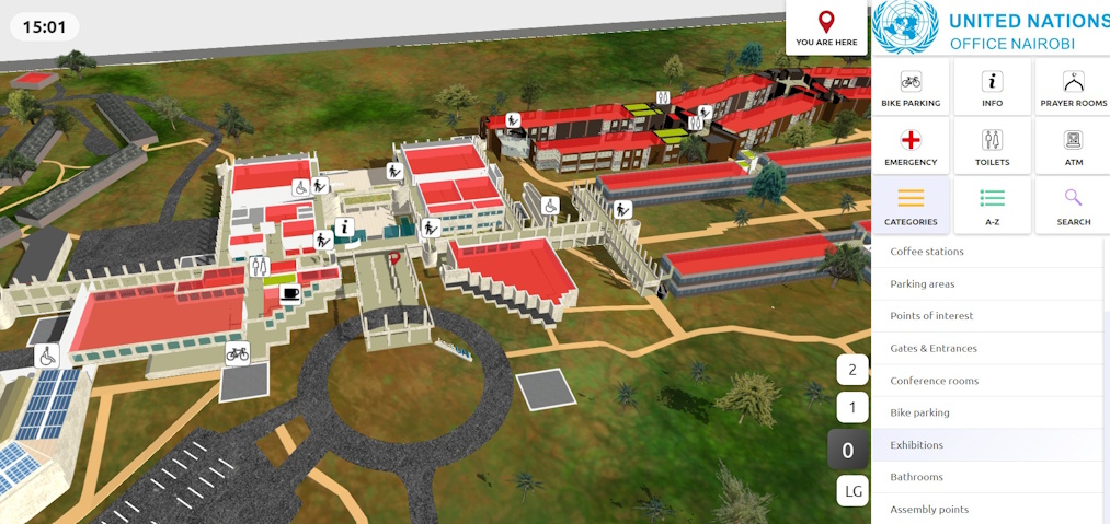
The 3D Wayfinder map covers the entire UN Nairobi headquarters and works only on the local network. We designed the map to be clear and minimalistic so visitors can orient themselves in a few clicks. The view opens as a 3D campus model. The map makes buildings easy to distinguish, keeps names highly legible, and preserves correct proportions even at high zoom. The menu offers quick search and clear categories, so users can find UNEP or UN-Habitat in an instant.
When a user selects a destination, the system draws a clear route and guides them between floors and buildings. Use the floor selector to change levels, while icons mark stairs, elevators, and entrances. The map highlights wheelchair-accessible paths so wheelchair users can plan a comfortable route. We keep labels short and use uniform, high-contrast icons to maintain readability on large screens. Detailed 3D modeling shows building volumes and landmarks, while the simple interface keeps the experience fast and smooth. Overall, the map combines clean design, accurate spatial imagery, and clear directions to help people navigate this very large complex with confidence.
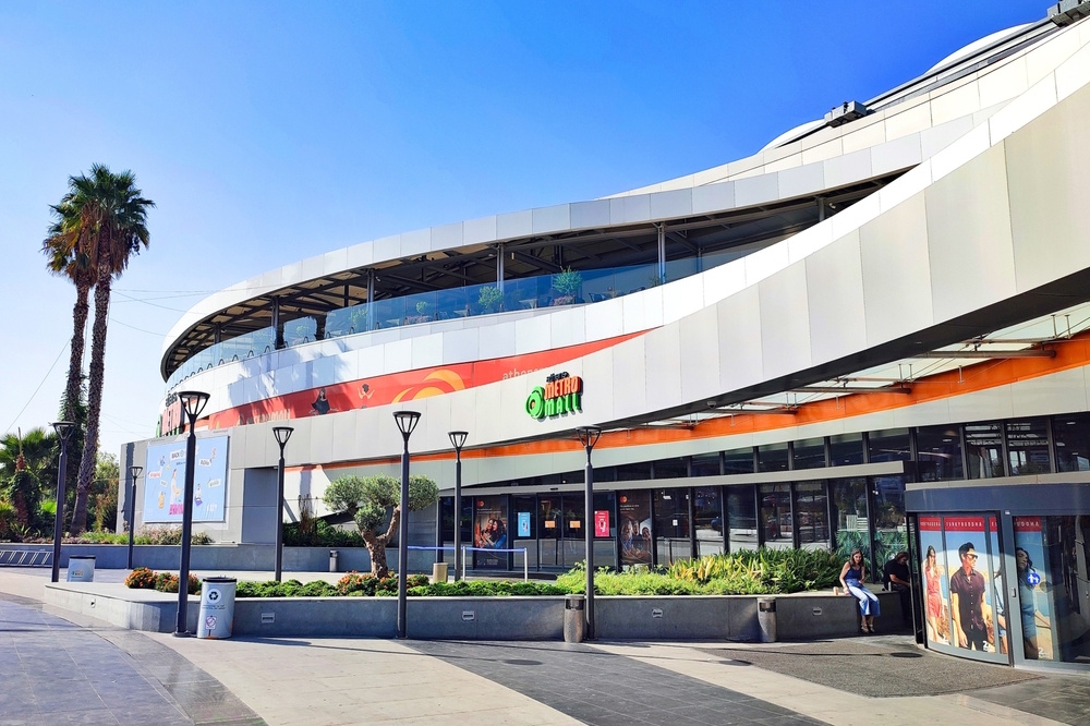
The Metro Mall in Athens, Greece, is a beautiful shopping center. Where you can find pleasure and entertainment for the whole family, young and old! there you will find your favorite brands in a specially designed space that will turn your walk into an experience! The shopping center has 5 floors, 95 stores, 18 coffees and restaurants and five cinemas.
The shopping center wanted visitors to use the map on every device – kiosks, website and phones. We proposed a budget-friendly approach: a popular, proven template. We styled a simple, intuitive 2D map to match the client’s colors and logos. Visitors scan a QR code to open the map on their phones. The phone UI matches the kiosk and web versions. The result delivers a simple, clean, and very easy indoor navigation experience that aligns with the client’s homepage map.
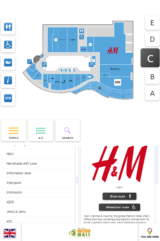
This project is different as 3D Wayfinder used this opportunity to test new solutions as a pilot project. One of the updates what 3D Wayfinder applied was offline software in case the internet connection is down. In the past it was stand-alone solution that you needed to update when the map changes but now it can be done online.
Metro Mall got a high-quality solution in the form of an indoor navigation solution that customers are happy to use. 3DWayfinder also offers an advertising module that department stores can use to generate revenue. You can read more about it here.
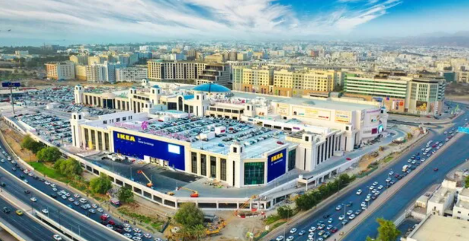
Oman Avenues Mall is one of the largest shopping malls in Oman. Beyond its sheer scale and architectural finesse, Oman Avenues Mall functions as a cultural crossroads, where locals, expats, and tourists converge in a shared rhythm of commerce and connection. Avenues Mall features an impressive selection of prestigious retail brands, fine dining options and entertainment experiences for the discerning visitor.
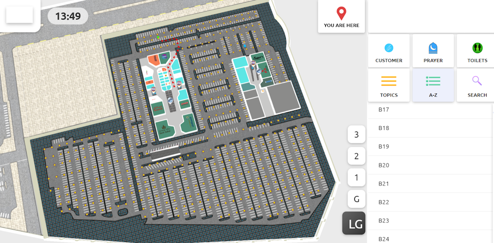
The mall wanted a standout kiosk solution and navigation that starts in the parking lot. We understood the challenge and accepted it. We delivered a medium-detailed 3D map and a lifetime software license.
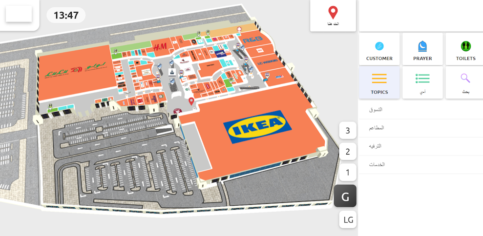
We built a QR map with a custom smartphone page and placed QR codes in each parking area. Visitors scan a code to open the map at their parking spot, choose a destination and later go back to the car. We provided a lifetime software license and host the solution on an EU cloud to meet strict data-protection standards. The simple rollout caused no issues, and we finished quickly.
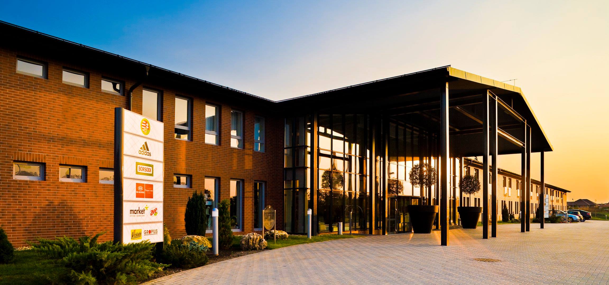
Globall Hotel is a four-star hotel in Hungary, offering top-class services in the areas of health, events and sports. The hotel has 81 Superior rooms and 4 Junior suites. In addition, the hotel has 5 UEFA-standard football fields and many other sports facilities. An interesting fact is that the Hungarian national football team prepares for its matches there.
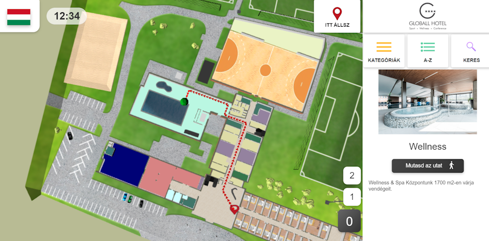
Hotel areas are often large and hotel guests need a map to navigate. 3D Wayfinder solutions are ideal for hotel navigation. We offer offline wayfinding, QR code-based solutions and many other options to make the hotel visit as pleasant as possible. The hotel turned to 3D Wayfinder for high-quality indoor navigation software. We applied for the project, and the client selected us over several major indoor navigation vendors because we consistently deliver high quality.
Our Hungarian partner helped us a lot and provided a high level of service to the client. Users can open the map at a kiosk or by scanning a QR-code on their phones. This project was special because our Hungarian partner handled both the modeling and the data entry. The final product shows that our partners can create models, enter data, and build routes while 3D Wayfinder provides support from the side.
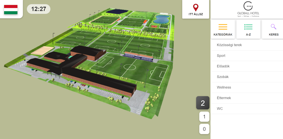
Our Hungarian team used SketchUp for 3D modeling, which surprised us because most teams model buildings with Blender or other high-end 3D tools. The outcome looks excellent, and we commend our partner for the strong work.
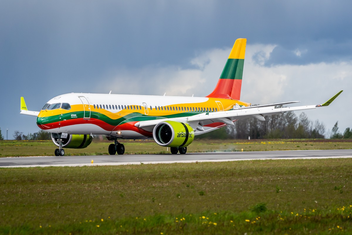
Vilnius Airport is the largest commercial airport in Lithuania. In 2020, Vilnius Airport welcomed 1.3 million passengers and in 2024 this number was 4.8 million passengers. The Airport occupies an area of 326 ha, and the length of the airfield perimeter is 10.54 km. The airport is located on a plateau in the south of Vilnius. It is only 7 km or 15 minutes drive by car from the centre of the capital. The airport provides aviation and non-aviation services to national and foreign economic entities, as well as natural persons. 2024 Vilnius Airport built new beautiful terminal.
Vilnius Airport faces a familiar yet sensitive challenge for travelers: getting to the right flight on time while gates, check-in lines and security corridors change dynamically, and passengers must be routed to either Schengen or non-Schengen areas. 3D Wayfinder solves this with an integrated experience that combines an interactive 3D map, indoor navigation, and real-time flight information on both kiosk terminals and a QR-code map for smartphones.
All information, what normally displayed on screens, such as flight numbers, destinations, departure times, check-in desks and gates, are also visible in the 3D Wayfinder system. Any changes to flight data are automatically transferred to the 3D Wayfinder interface, so passengers can see not only when and from which gate their flight will depart, but also a dynamically calculated route that reflects the current situation.
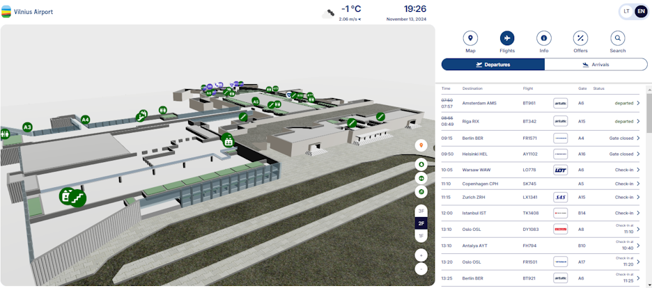
The 3D map acts as a real-time navigation graph. Check-in desks and gates are linked to routes that display step-by-step instructions before and after security. When the gate changes, the system immediately changes the route. When check-in opens, the user immediately sees where to go. Importantly, the navigation distinguishes between Schengen and non-Schengen flows.
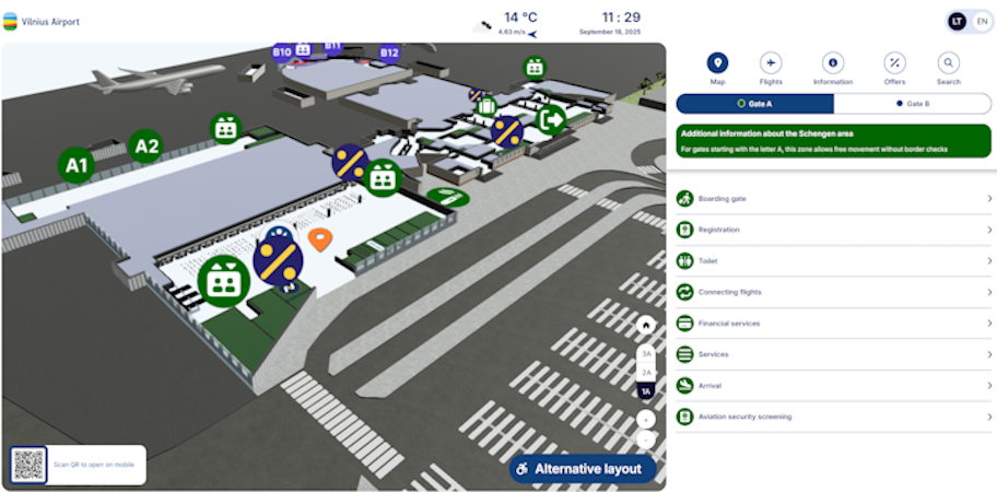
In addition to route finding, the map links to service points and adds branded pins and location-based offers. As travelers follow their route, they can discover nearby shops or cafes and their offers, which will be displayed on the map both on their phone and at kiosks.
Vilnius Airport has received a high-quality and suitable solution. The combination of a 3D map, real-time flight data and real-time changing routes increases the confidence of airport visitors in arriving at the gate on time. Also, a clear division of Schengen and non-Schengen junctions reduces wrong turns among airport visitors. The airport benefits from operational clarity and the confidence that passengers will get to the plane on time. It also benefits from a new advertising channel and passengers get a more relaxed and understandable experience visiting the airport.