We have added import and export functionality to 3D Wayfinder. Users can manage location data in any spreadsheet software and then easily import all locations, with descriptions, groups and tags to 3D Wayfinder content management system. Import and export is based on CSV-format, so MS Excel or other open-source spreadsheet software can be used to prepare the location list.
When creating large wayfinding projects, there might be over thousand locations. ring all locations one-by-one can be really time consuming process. With import tool, you can instantly create multiple locations with only two clicks. When you need to change location data, you can use the same POI ID-s, in this case the existing location data will be updated without creating any duplicates.
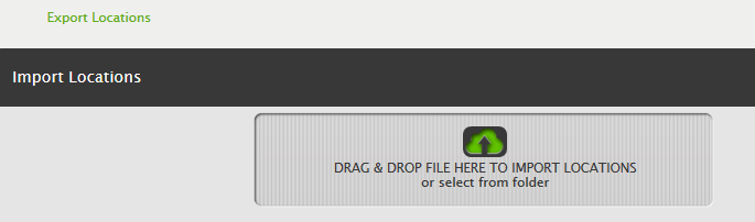
The Import and export tool can be found on the Locations page in 3D Wayfinder Administration:
The easiest way is to export a copy first and then load the CSV file into Excel or other spreadsheet software. After making changes, save the file into a semi-colon separated CSV file.
Imported columns are:
- id;
- name en;
- name [iso code for 2. language];
- description en;
- description [iso code for 2. language];
- type;
- show in menu;
- always visible;
- room_id;
- groups;
- tags
It is possible to import names and descriptions in any language which are previously inserted in Administration. Language ISO code must be included in the column name. For language codes, please see the language set-up page.
It is possible to add also tags and groups. When a group or tags already exist, the location will be connected with the existing one. If it doesn’t exist, a new one will be created. So the import tool makes also possible to create new groups and tags automatically. You can also add multiple groups or tags by separating them with a comma.
For more information, please see the user manual.