3D Wayfinder gives you innovative 3D map platform where you can build best ski resort app. All needed functions are available: 3D maps, positioning, guidance, search, filtering ski tracks and much more.
Alpine skiing is fun and many people love it. It is more than just taking the lift up and skiing down to the ski lift entrance again. Skiing is active vacation with everything it should include: planning trips, taking meals, socializing etc. You can plan your ski-routes as the longest ski tracks can be more than 10 kilometers long in Alpine region. While skiing down the hills you can enjoy the sun, have a drink in cafeterias and enjoy the social life.

There has been worries that ski resorts have less snow and the season periods of the ski resorts (when the ski-tracks can be opened) is decreasing. Weather it is temporary phenomenon or climate change is a different topics, but what we know is that ski resorts have to use modern technologies too. This is for providing better experience for all the skiers and snowboarders and manage the communication with visitors.
3D Wayfinder ski resort application
Ski resort app works on both, Android and Apple iOS, but the same way it can be used as a customized web-application or it can be embedded to any website (with some limitations in functionality).
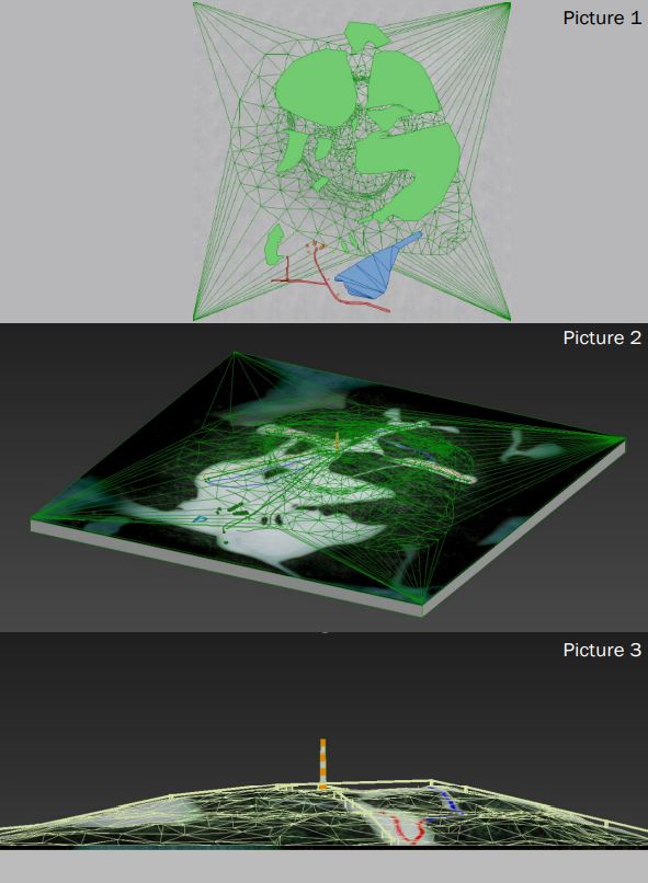
3D maps can be very detailed because ski hill, ski tracks, lifts and objects like forests and buildings can be added. The picture shows complexity of creating 3D maps based on regular height-maps. Later there will be added ski trails, trees, houses and lifts as 3D models.

To estimate the work for modelling 3D maps of the ski tracks, please contact our sales.
3D Wayfinder for ski-resorts can be accessed in different ways. 3D Wayfinder can be used in touch-screen kiosks. These can be weatherproof screens near lifts or entrances, or simple information kiosks near hotel receptions. Interactive 3D maps are certainly more advanced way to browse ski tracks than 2D drawings, we have mostly seen. 3D Wayfinder can be integrated to the website or used as web-based app. Printed signs or labels can use QR-codes to open 3D Wayfinder with the 3D map of the mountain or ski resort.
Positioning
3D Wayfinder uses Bluetooth beacons for indoor positioning as the GPS signal is weak inside the buildings. Positioning in ski resorts is much simpler as we can use regular GPS positioning. The mobile application (or web application) positions the user according to the GPS signal and will let user navigate from point A to point B. For alpine skiing, positioning allows user to see the the location so that he or she can see the tracks and find the nearest cafeterias or toilets or find the ski lift to another hill.
Application services in ski resort
3D Wayfinder offers several different options for creating a ski resort app. It is also possible to add several different services to the application. The system can be integrated with many other systems. In the application, it is possible to buy e-tickets using QR-code. In addition, you can mark the gathering places of groups anywhere on the mountain and sharing meeting point in messenger. It allow to plan your journey on mountain and select ski tracks based on your level and skills.

For large mountains there is possible to add help button. If in trouble or if user need of help from ski resort staff or emergency services. User just pushes one button and their location information with help signal is sent!
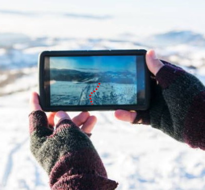
Also you can use the first person view solution, which is essentially a 3D replay from descending from ski mountain. To share on social media or keep as a memory.
3D Maps and First-Person-View
In ski resorts and mountains, it is important to use 3D maps. This is because you cannot see the other side of the mountain in 2D map, but in the ski hills it is important to see the other side of the mountain where you want to go as the tracks are usually not only in one side.
First-Person-View is the term from computer games. It means you will see the game through players’ eyes. By looking the route with First-Person-View, you see how it might feels to ski down the hills in real life. It is like simulation of the skiing, so why not to go through the planned tracks by looking route in 3D.

As the main land-marks on ski resorts can be modelled out in 3D, for ski lifts and tracks we can use vectors. This means that zooming out the map, will not reduce the size of the vectors. The same way you will see important roads on map applications.
For more information, please contact us.
