
Large gardens have a unique challenge. Visitors can easily lose their way, while staff need to keep track of thousands of plants and ongoing maintenance tasks. A botanical garden may contain thousands of species across greenhouses, terraces, outdoor beds and different levels. Meanwhile, the team behind the scenes needs to know which plants require watering, fresh soil, pruning or treatment. Both challenges come down to the same thing: having one clear picture of the entire garden. Garden wayfinding with 3D Wayfinder brings this information together on a single interactive map designed for both visitors and staff.
Garden Wayfinding Maps That Match the Real Environment
Most gardens still use traditional paper maps. They work well up to a certain point, but paper maps flatten a space that is often anything but flat. Gardens may climb hills, include several greenhouses and contain multiple sections within the same building. In addition, the landscape can look completely different in May and November.
3D Wayfinder handles this by modelling the base map, buildings, paths and specimens according to the actual environment. Visitors can see where they are, where they want to go and what is located on another level. As a result, the garden wayfinding map becomes more than a visual overview. It provides practical guidance and helps visitors understand the layout of the garden.
Every Plant Can Be a Point of Interest
Compared with a shopping centre, where the main points of interest are usually stores or services, a botanical garden may contain thousands of individual species. Each one can have its own story. In 3D Wayfinder, any plant, tree, sculpture, bench or other location can become a point of interest. It can include a name, photo, description, native region, bloom time and other relevant information.
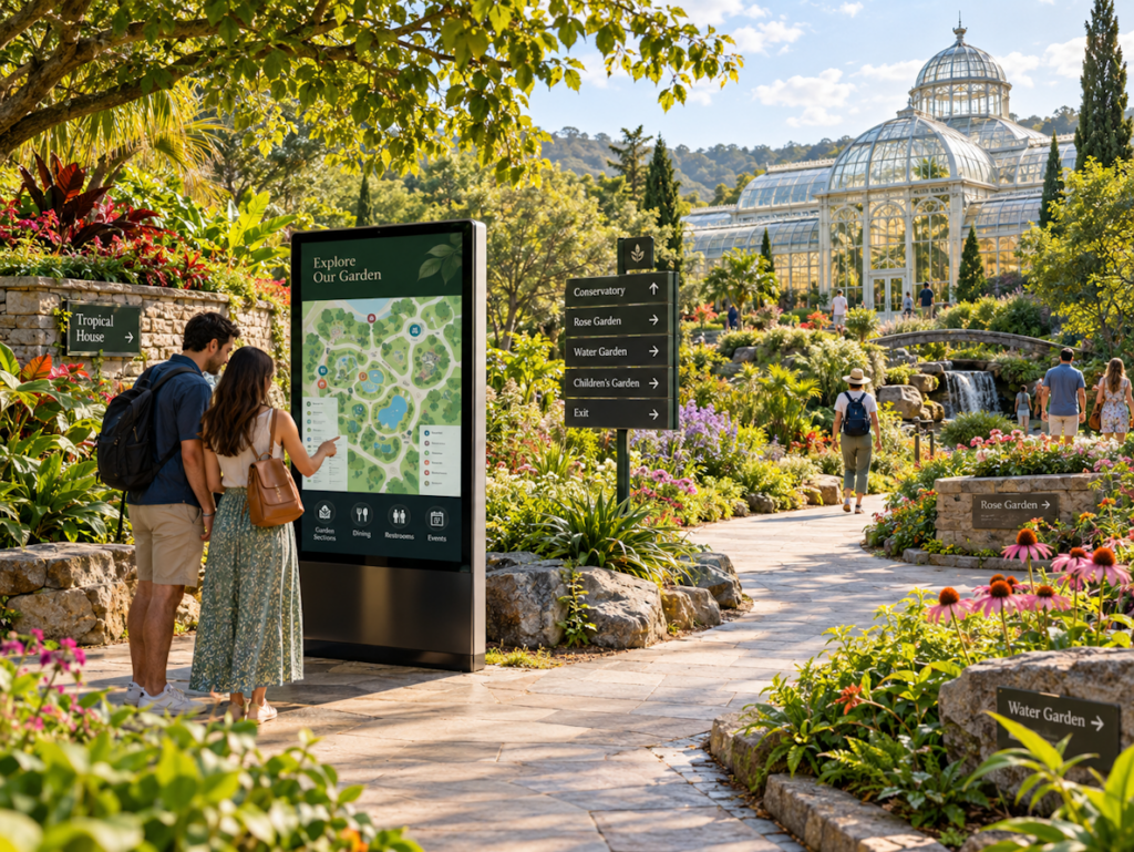
Visitors can tap a plant on an interactive kiosk or open the same information on their phone. They can also search for a specific species and receive walking directions directly to it. In this way, garden wayfinding becomes more than navigation. The interactive map also works as a digital guide to the collection. Visitors do not necessarily need a printed booklet or scheduled tour to discover the garden. The map can also include practical information such as toilets, cafés, shops, step-free routes and current events. Information can be provided in multiple languages, allowing the garden to tell its story to a wider range of visitors.
Garden Wayfinding as a Maintenance Tool
The same map can also support the people who maintain the garden. Each point of interest can contain internal information that visitors cannot see. In practice, this creates an information model for living plants and specimens.
Staff can record what happened to each plant and when. This may include:
- watering;
- feeding;
- repotting;
- soil changes;
- pruning;
- pest treatment;
- relocation.
Over time, the garden wayfinding system becomes a visual maintenance history. Because every record is connected to a location on the map, patterns can also become easier to identify. For example, if plants in one part of a greenhouse repeatedly require treatment, staff can see the affected area directly on the map instead of searching through spreadsheets. The system can also make onboarding easier. A new seasonal employee can open the map on a tablet, see relevant plant information and understand the maintenance routine much faster.
One Garden, Two Types of Information
Gardens depend on two different kinds of knowledge. Visitors want to explore the garden, find specific species and learn something along the way. Gardeners and maintenance teams need to understand what is happening with individual plants on a daily basis. Traditionally, this information is stored in separate places. 3D Wayfinder brings both sides together within the same 3D model while keeping public and internal information separate.
With garden wayfinding, visitors receive clear navigation and useful information, while staff gain a visual overview of plant locations and maintenance history. The result is one central source of information for the entire garden, with each user seeing exactly the information they need. If you would like your garden to be mapped and easily monitored, please contact us.