Wayfinder With Digital Signage Software

November 2, 2017

We have tested 3D Wayfinder integration with Digitalsignage.com software. Integrating wayfinding with digital signage media management gives additional purpose for advertising screens.

DigitalSignage.com is created by MediaSignage Inc. It is free digital signage software. Including signage player and media content management. Their software is used in over 200 countries. Since the first release, the software has been installed on hundreds of thousands of PCs.

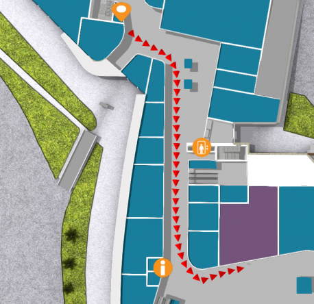
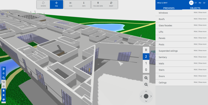
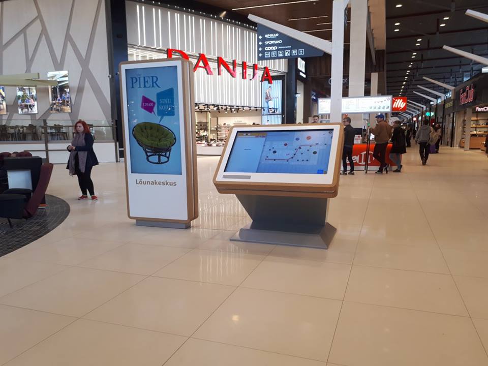
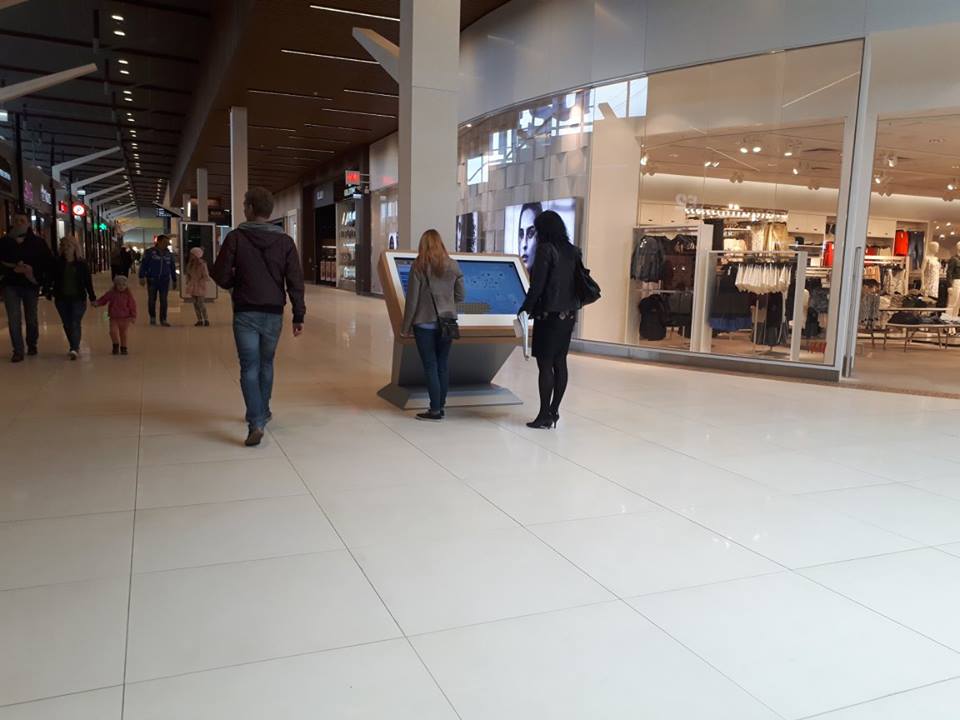
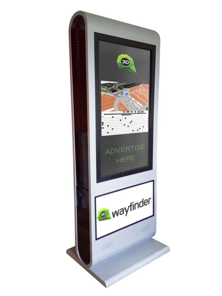
DigitalSignage.com software is web-based. So it is really easy to use 3D Wayfinder as a part of the media player screen layout. Let’s say, that there are top and bottom advertisement banners on the portrait screen and wayfinding application is set-up on the middle of screen.

Wayfinder kiosk

Screensaver mode

More advanced integration is switching advertisements with wayfinding application. This is something, we call “screensaver mode” when creating layouts for 3D Wayfinder. With Digital Signage software the simple way is to switch between wayfinding and advertising screen. Digital signage itself lets you create switching timelines, channels and content. We do not go into that much. Because there are plenty of examples in their documentation.

More sophisticated way to change between 2D map and screensaver can accomplish with event and triggers. Under Digitalsignage.com documentation http://docs.digitalsignage.com/ look for remote values. It describes what should be include in your app to be able to send event to their server.

Two functions that are important in 3D Wayfinder events case are ‘onSessionStart’ and ‘onSessionEnd’. They both are used by our statistics module. But if you do not have any need for statistics then you could overwrite these functions.

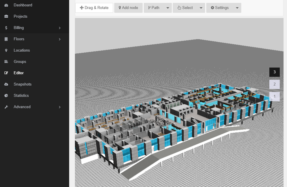
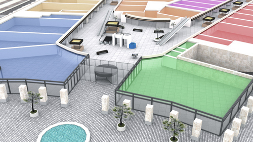
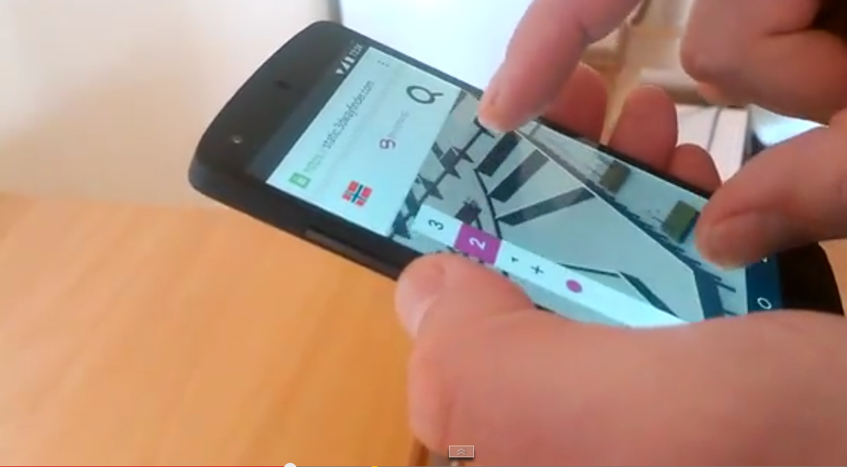
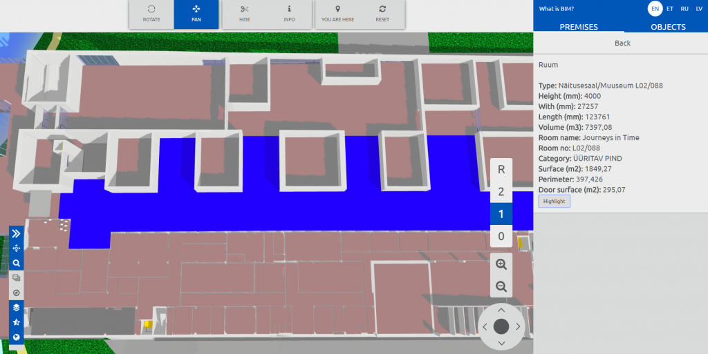
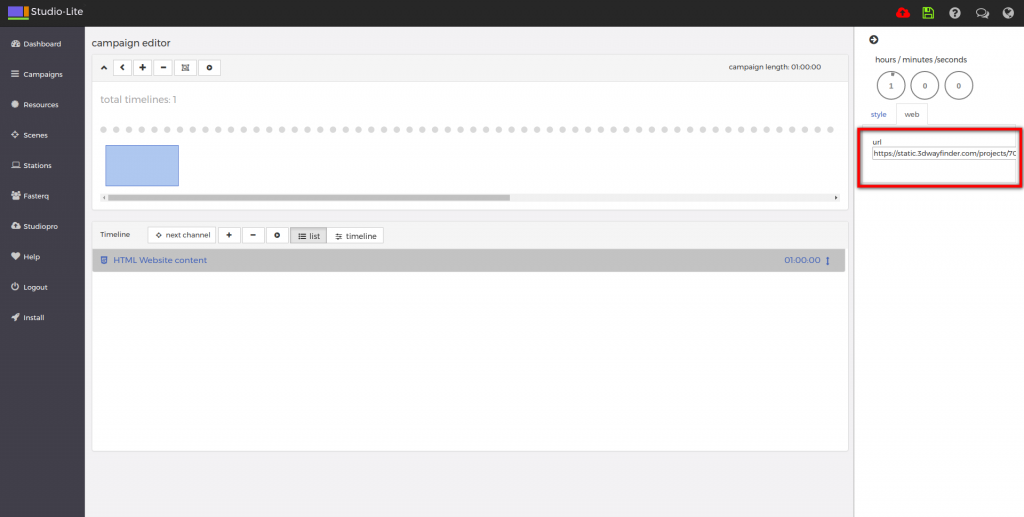
With signage free version you can use our 2D map with ease. Just include HTML component into your campaign and add link to your project.

digital signage

From documentation we could find out that signage players HTML component does not support webgl. But according to docs we should be able to get out 3D maps working with Browser component and signage player should be working on windows machine. Browser component is available for enterprise users.

« »

3D Wayfinder had Guests From Tartu Art School

October 2, 2017

Our office was really crowded last week when we had visitors from Tartu Art School. More than 20 people who have just started their studies to become 3D modellers.

uus

Tartu Art School is the only school in Estonia that teaches 3D modelling and visualization as a vocation. As a part of their curriculum the students visit different companies to see how their skills could be used in the future.

Since 3D models have such a big part in our work, it is also important for us to introduce our company to potential future employees or users of our app.

photo_2017-10-02_11-59-01 visitors

So we talked about what we do and how we do it and how students could use our product. 3D Wayfinder is currently used for mostly way-finding applications. But that doesn’t mean it couldn’t be used in variety of cases. It’s also perfect for presenting architectural models or – why not – make a virtual art gallery.

It is interesting and useful for us to see what kind of applications the students can find for 3D Wayfinder. So we can make it more flexible and beneficial for a wider range of customers.

« »

New Administration Panel is Up and Working

September 7, 2017

It has taken some time and lots of effort but we have finally made it. New 3D Wayfinder administration panel is finally online and usable for all clients.

new admin

We have made many smaller and bigger improvements to make 3D Wayfinder administration panel  easier to use. Especially for new clients. For example the editor has been changed to make it more logical. All the materials have previews for better overview and managing of 2D maps is more convenient.

It should also be more comfortable for those who prefer to use our app on smartphones or tablets.

There are still some kinks to straighten out so if you notice something that isn’t working the way it is supposed to, let us know.

“Sign in” leads straight to new administration panel but if you prefer to use the old one, go to old.3dwayfinder.com or use the link at the bottom of the sign in page. 

« »

Indoor Positioning Demo with Custom Floors and iBeacons

July 18, 2017

Now it is possible to order indoor positioning demo application. For demo we will send you required amount of iBeacons devices and create custom 2D or 3D floor plan. With 3D Wayfinder mobile application it is possible to see indoor positioning with wayfinding functionality.

iBeacons are Bluetooth low energy (BLE) devices that can broadcast their identifier to nearby portable electronic devices such as mobile phones or tablets. Also iBeacons don’t cost much and their batteries can last over year which makes them perfect for indoor positioning.

 beacon1_2

We can provide you with a custom demo map with pre-installed iBeacon locations. We will also send beacons for the demo floor plan, usually 3-6 is enough for a 1-2 room demo.  

By installing 3D Wayfinder mobile app, you can test and see iBeacon-based positioning on your real building. To order demo map with beacons, please fill the request form.

Read more about 3D Wayfinder mobile app, iBeacons and indoor positioning.

« »

Wayfinding Kiosk with Raspberry Pi

July 11, 2017

We have recently experimented with a Raspberry Pi 3 Model B, to see how it can work as media player for digital signage display or wayfinding information kiosk. As a result we can say, it works well with 2D wayfinding maps and with 3D Wayfinder Advertisement Module.

What is Raspberry Pi?

Raspberry Pi is a small credit card sized linux based open source computer. It is equipped with:
– Broadcom 64-bit quad core CPU clocked @ 1.2 GHz,
– 1GB of RAM,
– built-in WLAN and BLE modules,
– HDMI output.

But everything is soldered to the board hence there is no option to upgrade, except for the microSD card. You can also have a nice box for it, so it doesn’t look like a hackers development board.

Raspberry Pi

Compared to other small form factor computers like Intel NUC or Gigabyte BRIX, it is much cheaper. Raspberry Pi with a nice case and microSD card would cost about 50..70 USD. The NUC or BRIX boxes start at 110..130 USD new, and you still need to equip them with a hard drive (SSD/HDD) and memory module(s) (DDR3/DDR4 SO-DIMM RAM) which would cost you about an extra 30 USD for a 32GB SSD and ~25 USD for DDR3 or ~30 USD for DDR4. Totalling up to about 165..190 USD.

Raspberry PI plays in Full HD, so it is not a problem to use large resolution screens.

Wayfinding with Raspberry Pi

Enable WebGL

For 3D the Raspberry is still a bit weak and by default it doesn’t have WebGL enabled. To enable WebGL you have to:
1. Open up the terminal application (or command prompt if you prefer to call it that)
2. run command sudo raspi-config
3. navigate to Advanced Options
4. enable GL support.

The GPU on the Raspberry PI 3 Model B doesn’t support floating point textures, so we cannot use transparent textures.

To build wayfinding or digital signage project based on Raspberry Pi you need to use a special linux distribution that opens a browser in full-screen mode instead of the regular desktop interface.

At the same time the kiosk based on Raspberry Pi is quite bullet-proof. There’s no need to worry about excessive power consumption as it actually only consumes about 3.7W under full load and only about 1.4W when playing a FullHD video, which is roughly 10% of the Intel NUCs ~38W while under full system load and ~18W while watching a FullHD video.

chart

It boots up fast from a microSD card which can be easily replaced when it wears out or breaks.

Although remote managing a kiosk that uses a Raspberry Pi can prove to be quite a cumbersome task as you cannot use regular GUI remote management tools like Teamviewer or LogMeIn. The fastest way to remote manage the Raspberry Pi is to use SSH, which is a CLI (Command Line Interface) and this might scare-off most of the users that are not used to poking around via a CLI.

« »

Choosing the Best Wayfinding Software

July 5, 2017

There are lots of different wayfinding software and it might be difficult to decide which solution to pick. We have used our experience and gathered some suggestions that will help you choose the best wayfinding application.

Over all the best wayfinding software application is always the one that adapts exactly to your specific needs. Having more options and can help to cater this.

Best Wayfinding software should be..

Wayfinding application should be easily integrated with other applications. One of the most common integration is showing social media content in wayfinding applications. As shopping malls and other public building usually have their news already on Twitter, they would like to include the news feed also in wayfinding.

path-top-down-view

Have a look at our wayfinding possibilities here.

You can choose to buy the product and do all the hosting and managing yourself. Or you can pay for this service. In that case make sure how much you can control the app once it’s up and running. Are you able to change the opening and closing times yourself? Can you add a new location and generate a path way? Or do you need to contact the company for every little change.

Look and feel customization is also something that should be provided. Choosing from existing templates is more cost effective than custom designs but even then it should be possible to change the basic things like the font, it’s size and colors.

Nowadays you can pretty much always choose between 2D or 3D maps. 3D maps are effective and showy on the screen, but it could be costly and time consuming if you want to change the location of the kiosk. The best wayfinding software should provide the option to use both.

3a

You should also check how accurate and detailed the maps are going to be. Although the best way to ensure accuracy is to provide correct data yourself.

Even if you want to use only information kiosks in the beginning, it never hurts to be prepared. If you choose the application that is also mobile friendly, it will save time and money in the future.

Indoor positioning and navigation

The indoor positioning and navigation ability is a must while using the wayfinder mobile app. Right now the iBeacon technology, that uses smartphone’s Bluetooth connection seems to be the most reliable one. Navigation system can also use WiFi networks but it is cost effective only in places like big malls, where every shop already has their own network.

nexus_5

When visitors are searching for something, targeted ads are most impactful. Customers can be attracted by giving out coupons, offering special deals, providing additional information. While nobody is using the information kiosk for wayfinding, the whole screen could be used to display ads.

And last but not least, the pricing. Make sure to find out beforehand what are you going to pay for. For example: will it cost more when you want to add another kiosk later?

There are some other questions you should ask:

Can you use the app online?

Is multiple language support provided?

Can the specific routes for disabled access be displayed?

Will the app collect user data for statistics?

To find the answers to these questions contact: info@3dwayfinder.com.

Have a nice summer,

3D Wayfinder Team

« »

Creating BIM Applications with 3D Wayfinder

June 15, 2017

3D Wayfinder is now being used for Building Information Model (BIM) applications. By creating BIM kiosk software for Estonian National Museum we have added many new and useful features to our software and improved the performance for larger models.

Estonian State Real Estate Ltd ordered Building Information Model solution from us for recently opened Estonian National Museum. Now the visitors can easily explore the 3D model of the whole construction. Also they get the overview of the building by all the details.

erm2016

What is BIM applications?

BIM model is a digital equivalent of the building. It can contain everything from doors to electric fixtures. Although BIM applications technology and methodology is more common in the design of the building. It has large potential benefits for buildings management and maintenance phase.

Estonian National Museum’s new building is meant both for exhibitions and scientific work with net area of 33 879 square meters. We received a model of a building made with Revit, Autodesk software for BIM. It contained highly detailed information – e.g. all the pipes – so it needed a lots of simplifying.

erm_wayfinder_BIM

After the adaptations we still had a huge file with close to 12 000 separate elements. It is the largest model we have had in 3D Wayfinder. It was also the reason why we changed the logic of initializing POI data to make the loading of large objects faster.

Table view for all objects in BIM model was done by using Spreadcell. Spreadcell has easy upload from MS Excel files and it provides table-view, sorting etc by webservices (in JSON format). All the objects are divided into separate groups so the final user can choose what do they want to see, hide or find.

ERM_wayfinder_BIM

Kiosk design

We also built and designed the kiosk from scratch. Since most of the modern kiosk hardware is only enough for showing advertisements or 2D wayfinding plans. The kiosk is equipped with a landscape LCD screen, a touch panel and a dedicated graphics card. It makes kiosk suitable for applications that require greater graphical computing capabilities.

ERM_BIM_kiosk

3D Wayfinder application helps to make BIM useful for those who have no access to specific softwares themselves. For example we can integrate BIM with different management softwares. Also add the ability to write comments. In this way we make it easier for different parties to collaborate on centrally shared model.

« »

New Wayfinding Directory for Lõunakeskus

June 6, 2017

Lõunakeskus, one of the largest shopping centers in Estonia, has undergone a large scale upgrade.  It is now larger, freshly modernized and it uses large wayfinding kiosks with clean user interface and integrated location data.

Lõunakeskus is the largest shopping center in southern Estonia and one of the largest shopping centers in Estonia. After the upgrade the size of the main building is now 72 000 square-meters. There is now a cinema, a hotel and around 30 new shops and diners.

custom wayfinding kiosk front panel

There are 5 large 55-inch custom kiosks for the wayfinding application. Kiosks are landscape and set up with an angle that is easy for the client to use. Previously Lõunakeskus  also used printed directories near the information kiosks, but now the wayfinding kiosks are the only source of directory.

wayfinder kiosk near digital signage display

The wayfinding applications user interface is designed in a really “clean” way. There is 2D map with the directory menu. It is also possible to choose between 4 languages, zoom and move the map, change floors, see the You-are-here spot etc. Larger tenants also have logos on the map, which makes it easier for the customer to navigate and find the desired location.

wayfinding kiosk being used in Estonian largest shopping mall

Data for the wayfinding directory comes from the shopping centers own CMS, that is being used for their website. The data is provided to 3D Wayfinder application in XML-format and it contains all locations and location groups. All the location groups are generated dynamically upon loading the application and locations are added to the location groups along with their descriptions, names and links to images. On the map there are predefined overlay areas, each of which are linked to a POI in our system, a POI that has only the “room_id” attribute set and the “room_id” is unique for each POI. In this case we are using the “room_id” attribute for highlighting locations on the map.

« »

New Feature in Navigation: Group Hierarchy

April 13, 2017

We have added new feature in navigation to our administration panel for creating sub-groups. This brings whole new possibilities for wayfinding and other areas.

Any location or POI (Place of Interest) can belong to one or many groups. So for example “Adidas” can be found under “Sport”, “Clothing” and “Footwear”. In many cases there has been need for sub groups. For example “McDonald’s” belongs to group Fastfood, which at the same time belongs to group Food.

Now we have in 3D Wayfinder Administration Panel option for groups, where it is possible to mark its parent group. This gives a powerful tool for filtering locations and in many cases is very useful. For example retail stores can show the whole product directory, so visitors can browse for the needed product group and then see where it is located in store or find the shortest way to it.

To create and manage sub-groups you have to open “Groups” in 3D Wayfinder Administration panel. Then for each group you can choose its parent group.

groups_of_groups_in_wayfinder_new_feature_of_navigation

This feature is not available in our old Administration panel, so you have to log in to new Admin application.

Be careful not to create loops!

Groups can be accesses also by our Javascript API, so it is possible to use group browsing in embedded 3D Wayfinder application or wayfinding template.

« »