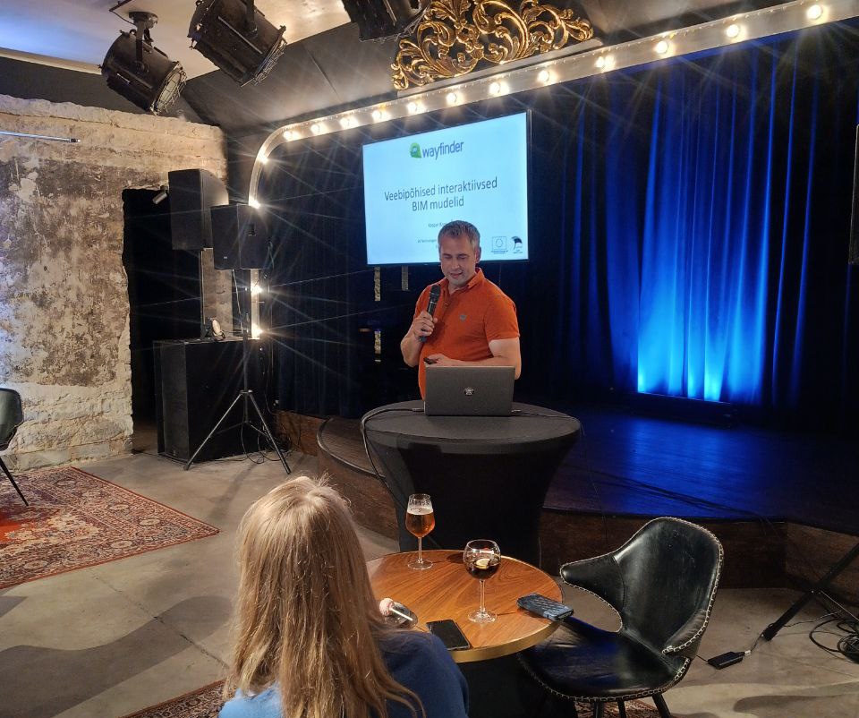
We have completed project “Web-based interactive BIM models” which has been grant by e-leap in construction program. It is possible to use BIM models (IFC files) with 3D Wayfinder now.
BIM, or building information model, is a format that allows you to add and manage information about every detail of a building, and is useful during all the stages of building construction from construction itself to finalising and maintenance. The recent trend is that the construction sector increasingly relies on BIM models at every stage of construction
IFC (Industry Foundation Classes) is commonly used to share building information between parties during specific project stages. For instance, architects might share design models with owners, who in turn may pass them to contractors for bidding. Contractors can then provide detailed as-built models with equipment and manufacturer data. IFC is also useful for archiving project data throughout design, construction, and for long-term facility management.
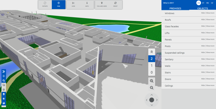
Our solution takes it a step further by using a novel format developed by BIM Corner, dotbim, it simplifies the data from the IFC file that we then convert into GLTF format. Resulting in a web-based workflow that needs no additional software. On upload, the data from IFC is parsed into our admin along with the model. All building elements are neatly organized into groups that can be effectively managed by the user to get the required use case out of the BIM model.
To further set our solution apart, we have integrated our new BIM model solution with our web based augmented reality application. As a result, the user can view the desired IFC elements and the data linked to them live on-site just by pointing the phone and looking at the building through the phone camera. Checking construction and manufacturer data of building elements and viewing details hidden behind walls like electrical wiring and water pipes has never been easier and all that can be done through a web link, no additional software needed.
Our solution is ever growing and easily integratable. Current services include augmented reality and taking measurements, but here is room for many more. Should there be a need for additional tools and services, our team is able and willing to create and implement them. During the “Web-based interactive BIM models” project our BIM solution was integrated with the Ministry of Climate’s domestic E-building platform. A big perk of web based solutions is the ease of integration with different platforms.
A guide for using our solution can be found on our webpage in manual.
The development of 3D wayfinder “Web-based interactive BIM models” was supported by EU through The State Shared Service Centre (official abbreviation SSSC).
3D Wayfinder is expanding into the construction sector with 3D BIM models. Our many years of experience in creating convenient web-based 3D wayfinding solutions is a good basis for bringing a convenient web-based solution to the sector.Which increasingly relies on 3D models to ensure work efficiency.
Building information model, is a format that allows you to add and manage information about every detail of a building. It is useful during all the stages of building construction from construction itself to finalizing and maintenance. The recent trend is that the construction sector increasingly relies on BIM models at every stage. However, it is a relatively new format. Therefore opening the file and effective use of it is limited by the need for specific high-performance software.
The State Shared Service Centre (official abbreviation SSSC) has supported the development of 3D wayfinder “Web-based interactive BIM models”. In order to create a comprehensive and simple solution for web-based display of BIM models for implementation and management within the Ministry of Climate’s domestic e-leap in construction program. Without the need to use any complicated external software.
Presenting project in e-construction event in June 2024.
How it is works
As part of the development, we will add to our existing application the ability to upload a BIM model. Manage the content of the model in a simple administration environment. The capability of displaying everything in a web-based environment, the design of which can be altered to fit the need. Thus giving the customer the opportunity to display for himself exactly the information about the building. That is need in the given situation, from the type of screws to the location of water pipes. Along with different tools like taking measurements for example, our BIM solution would be a worthy addition asset.
As a web-based application, it also provides the opportunity to integrate the BIM model solution we are developing with our already developed web-based augmented reality application. Which through the camera image allows to display all the information hidden in the BIM model in real time at the exact place where you point the phone. For example, giving you the ability to see all the electrical cables and water pipes inside the walls without having to use any destructive trial and error method. As an additional bonus. It is worth pointing out that all these exciting and effective possibilities of use are planned to be made available on the national E-construction portal.
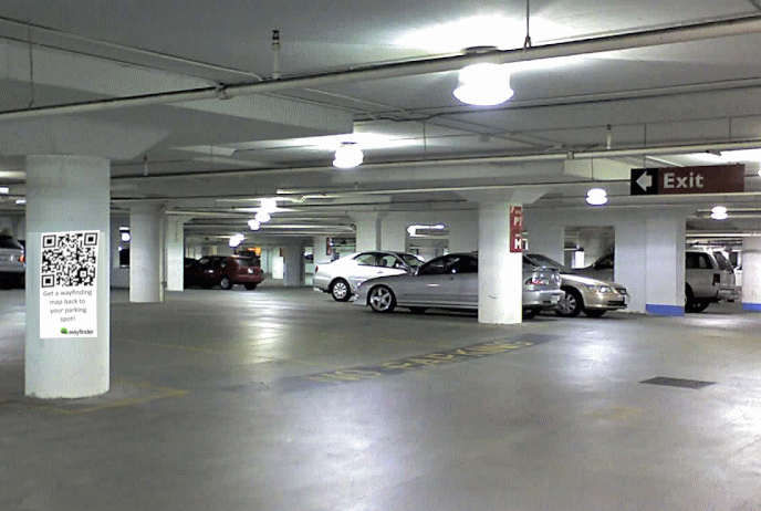
What if you lose your car in parking house? It might have happened to anybody and it is not a pleasant discovery. But with wayfinding software these kinds of situations can be avoided. Look up your car on wayfinding map or by your car number – no more hassles and another good reason to use wayfinding software in large buildings.
Losing your car in a parking house can be a frustrating experience and make you really anxious. It’s a scenario that many people can relate to, especially in large, multi-level parking structures where rows upon rows of vehicles can seem to blend together. Lately we have completed many wayfinder projects with features for looking up parked cars. There are different options for this and below we will give short overview.
Look up your car on wayfinding map
Easiest solution is to use QR-codes near each parking space or area. By scanning the QR code user will initialize 3D Wayfinder with right place on map (where the car was parked). This is kept in mobile browser cache, so the Wayfinder maps don’t even have to be kept opened. Next time user opens Wayfinder application, all they have to do is press a shortcut pointing to parked car and directions can be automatically displayed to get to their car. QR-codes are easy to print and 3D Wayfinder provides option to get printable QR-codes from 3D Wayfinder administration panel.
More advanced way is to integrate wayfinding software with camera software that automatically detects all car numbers. In case visitor forgets where the car is parked, all they need to do is to open wayfinding application on touchscreen kiosk or mobile application and enter the car number.
3D Wayfinder can be easily integrated to any software that supports communication over web-based protocols. We have integrated 3D Wayfinder with Park Assist and by just looking up the car in parking house, visitors can also see the route to the right place.
To learn more about parking place options with 3D Wayfinder, please contact our sales team.
What if You don’t Like that Visitors are Able to Move the 3D Map?
March 11, 2024
3D wayfinding maps give better understanding where you are and where would you like to go. In 3D Wayfinder, there are a lot of settings to manage how the 3D maps can be operated by users – main actions are moving, zooming and rotating. Now there is an easy way to disable any movement of 3D maps at all.
Both 3D and 2D maps have their own advantages and are suitable for different purposes. The choice between 2D and 3D for wayfinding depends on the specific needs of the user and the context in which the map is being used. One important thing with 3D maps is that you can configure view to the map and it can be on any angle you like. The initial view and option to zoom, rotate and move the map makes the 3D maps realistic and easily understandable for users. 3D Wayfinder supports 2D and 3D, in many projects, we are using both maps in wayfinding software. Simple and fast loading 2D maps for mobile devices and 3D maps for interactive kiosks.
What kind of maps to prefer depends on many factors, you can read our blog posts about the differences of 2D and 3D maps in our blog post from 9 year ago. Our latest developments are in the field of Augmented Reality or simply AR, that is consider to be based on 3D models. But actually, 3D Wayfinder can use AR featured without having the actual 3D map. So quite everything is possible with 3D Wayfinder, but what if customers want the 3D without the main features – moving, zooming and rotating?
We have been ask to limit the movement of the 3D maps, so we added a new setting, that allows to lock the map.
These settings disable the end-users to move, zoom or rotate the map:
mouse.enable-moving
mouse.enable-touch-moving
First settings allows the maps to be moved by mouse and the second is for touch. To change these, open Advanced menu in 3D Wayfinder administration panel. Then choose settings and find the settings by their code-names. By default, they are checked. So, uncheck them and click “Save”.
Most of the settings can be changed also by Javascript when building 3D Wayfinder templates. This is done by simply changing the value of setting:
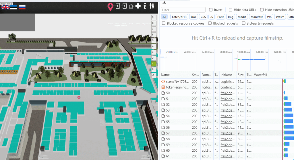
We have updated our WebGL rendering engine FRAK 2. Many old code parts have been removed and loading 3D models is now much faster.
Two months ago we released new version of our open-source rendering engine FRAK. As there has been many important changes, it is called FRAK 2 now. New FRAK engine can be used in 3D Wayfinder through “development” template. FRAK 2 will be more GLTF oriented and it is built for using AR (Augmented Reality) in 3D Wayfinder. This opens up a lot of new features we have been waiting to see in our wayfinder software.
FRAK 2 will soon be in all 3D Wayfinder templates. But before this, we still need some fixes and improvements. For now – we have mostly removed “old” code and made it better and faster for 3D Wayfinder. In the dynamic realm of technology, where innovation is the heartbeat of progress, the need to rewrite code has become more than just a periodic necessity — it’s a strategic imperative for us. As applications evolve and user expectations skyrocket, the demand for robust, scalable, and efficient wayfinding software has never been higher. As browsers and mobile devices develop constantly further, so are we, with our wayfinder software.
In this fast-paced landscape, clinging to outdated code can be a barrier to growth and a breeding ground for vulnerabilities. Let’s delve into why rewriting code is not just a luxury but a crucial step towards ensuring the longevity and success of any application.
Most important things we have done:
Removing Hammer.js for touch events
We have been using Hammer.js for touch-enabled screens (wayfinding kiosks). The purpose of using hammer.js was lacking support for touch-devices. But nowadays many Windows and Linux devices have also touchscreens and browsers have much better support for touch events. So removing Hammer.js gives us cleaner code and better handling for controlling map movements.
2. Enabling parallel loading of 3D models and other files
Parallel loading of 3D models and other files gives faster initial loading for 3D Wayfinder. We are still capable of rendering maps before loading textures.
By loading larger 3D models simultaneously provides shorter overall loading time. Faster loading is better for wayfinding kiosks, but mostly it gives advantage for mobile devices. As modern mobile devices are quite good for showing 3D maps, we are focusing on making 3D Wayfinder to work on mobile devices also. Faster loading will also be important for AR and VR options, that will be soon available in our wayfinder software.
We introduced 3D Wayfinder software and presented new features last week at ISE 2024. This year’s exhibition was largest ISE event so far.
The show was the biggest and the largest show floor space (82,000 sqm net) and attracted nearly 74 thousand unique verified attendees from 162 countries. This is a record since the show’s inception in Geneva in 2004 and an increase of 27% on the 2023 edition.
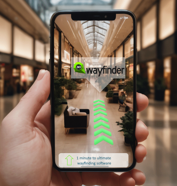
We are developing AR features to 3D Wayfinder. AR will provide wayfinding functionality through mobile device camera and it can mix location info from 3D Wayfinder with real camera image. AR functionality can be seen in ISE 2024 next week.
AR or Augmented reality means rendering information and 3D content on real time camera image. Digital information will be overlayd onto the real-world environment, enhancing our perception and interaction with the surroundings. Unlike virtual reality, which immerses users in a completely digital environment, AR seamlessly integrates virtual elements with the physical world. This integration opens up a myriad of possibilities, especially in the realm of navigation.
As Augmented Reality (AR) continues to advance, its integration with wayfinding software holds immense potential for transforming how we navigate the world around us. The marriage of these technologies not only simplifies our daily journeys but also opens up new possibilities for personalized, dynamic, and inclusive navigation experiences. As we embrace this technological frontier, the future of navigation looks increasingly promising, offering a seamless blend of the digital and physical realms. Augmented Reality and wayfinding software are not just tools; they are the architects of a more connected, efficient, and user-centric navigation landscape.
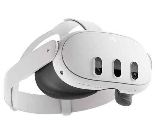
We are releasing pretty soon updated 3D Wayfinder with AR features. It will be based on new version of our 3D rendering engine FRAK. To add more fun to our developers, we are testing and building AR version of 3D Wayfinder also for Meta Quest VR glasses. Comparing with the Quest 2 glasses, the cameras are far better and not black-and-white anymore. So it would be fun to walk around with live information from 3D Wayfinder on top of the camera image.
AR with 3D Wayfinder means, that:
Path can be seen in front of the camera image. As we are supporting 3D maps, our software can tell exactly what part of the path is visible and what will be hidden besides walls and other elements.
Billboard information about locations can be shown ontop of the camera image. So, you can look through the camera and see more than without your mobile or AR glasses.
Shortcut icons and other places can be floating signs. So you know in which direction is toilet, how far are exits or atm-machines.
As 3D Wayfinder has a powerful API, we can present any kind of external information on top of the camera image. Transportation times or daily offers are just one of the easiest things to integrate with 3D Wayfinder.
To work properly, 3D Wayfinder needs a location of the user. By QR codes, we can track the location where the QR code was scanned. For indoor positioning we have been working with iBeacons, but this is not supported by web-applications. 3D Wayfinder can be easily ported to any mobile app framework that supports HTML-content, so it will not be a problem. This is how we have done mobile applications for our customers. But soon we will be launching reverse bluetooth positioning, meaning that any user is able to connect positioning network of Bluetooth routers, by linking automatically bluetooth MAC address. Reverse bluetooth positioning (for indoor, where there is no GPS signal) is a powerful technology for web-based applications and we will write more about this topic in near future.
AR features can be seen at ISE 2024, where we are presenting our solutions. ISE 2024 will take place already next week from 30th of January till 2nd of February in Barcelona. Come to visit us to see the new features of 3D Wayfinder.
ISE 2024 will be from 30th of January till 2nd of February in Barcelona. This is the biggest event for digital signage and this year we will be there with our booth. Come to visit us to see the new features of 3D Wayfinder.
Integrated Systems Europe or ISE is the world’s leading audiovisual and systems integration exhibition. 2024 has been promised to be the largest exhibition ever. It takes place from Tuesday 30 January till Friday 2 February at Fira Barcelona exhibition center.
We have been at ISE for many years, but not always as exhibitors. Now we will be out with our exhibition booth and with larger team. There are many new features, we are presenting at ISE. Most important things to see, are following:
If you like to appoint a time for discussion, please contact our sales team. We have also invitation codes for ISE exhibition to our customers and partners. You can find us at Congress Square booth CS416. Don’t miss the biggest digital signage event of the 2024!
We have made significant changes in our WebGL rendering engine called FRAK. New version will be FRAK 2 and it can be test in beta version with all 3D Wayfinder projects.
FRAK engine is a JavaScript library/API for creating interactive 3D applications using WebGL. The purpose of the library is to provide a framework for simplifying the creation of complex interactive 3D applications. It has been built for 3D Wayfinder and it is optimized for showing 3D building models in web applications. FRAK is open source and the code can be found in Github.
New features in FRAK 2 are:
New deferred rendering engine
Option for more lights and light sources
Better performance
Physically based rendering
FRAK engine was develop by 3D Technologies R&D for 3D Wayfinder. 3D Wayfinder is a floor plan visualization and content management platform, mainly used for wayfinding applications.
Deferred rendering is an alternative approach to rendering 3D scenes. Deferred rendering has been option in 3D Wayfinder besides forward rendering for quite a long time, but it has not been used much. The classic (Forward rendering) rendering approach involves rendering each object and applying lighting passes to it. So, if an object is affect by 5 lights, it will be render 5 times, once for each light, in order to accumulate the effect of each light. With FRAK 2 there is only one rendering option which is based on Deferred rendering, but it is now much faster and without lights it works as forward rendering before.
Physically based rendering is for GLTF 3D models. Physically based materials are different type of materials, that can use reflections, metal-look etc. New features like image-based lightning, dynamic shadows etc are coming also in near future.
How to test FRAK 2?
So far, the FRAK 2 can be tested with “development” template. This means that if you replace the template (for example “Default”) in project URL with “development” you can see the 3D maps rendered with FRAK 2 WebGL engine. With larger models it will give significant performance increase in FPS thanks to optimizations we have made.
Public Transportation Schedules with Wayfinding Software
October 20, 2023
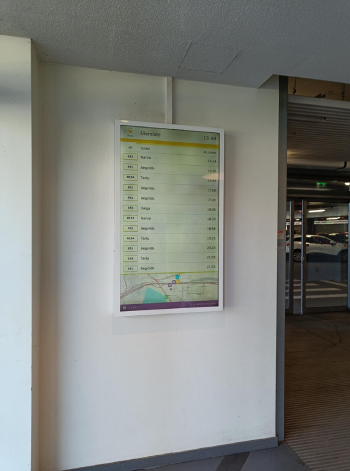
In our fast-paced world, efficient and reliable public transportation is essential for the daily commute of millions. Whether it’s the bustling metropolis or a smaller town. However the need for accurate and up-to-date transportation information cannot be overstated. One significant development in this regard is the introduction of digital public transportation schedules integrated to 3D Wayfinder software.
Gone are the days of deciphering cryptic timetables and struggling with maps. Because modern technology is transforming how we access and interact with public transportation information. Besides wayfinding, visitors of malls and other public buildings would like to see how to get to bus or train. Also when will the bus, train or other transportation vehicle departure.
We have developed special module for 3D Wayfinder software to show public transportation schedules. These schedules are optimize for public screens. And these can work with touchscreens or just LCD screens and can be in any resolution and size. In other hand touchscreens provide more features as schedules can be scroll or filter, but can be use as well on regular screens. In this case we will filter transportation schedules by time and switch between modes automatically. Similar to screens of arrivals and departures in airports.
Transportation schedules may be part of wayfinding software. For example visitors can be guided to right bus- or train stop or they can be used on separate screens. We are supporting transportation schedule standards, so for most countries it would be easy to integrate to get the schedules working.
Real time updates
One of the most significant advantages of digital transportation schedules is their ability to provide real-time updates. Gone are the days of relying on static paper schedules that may not reflect sudden delays or changes in services. With digital displays, computers can access live information about their transportation options, ensuring they are always in the know. It is even possible to visualize busses or trains on wayfinding map. With 3D Wayfinder, the vehicles can be 3D models and with billboards we can even show the destination of specific train.
Accessibility for All
Digital public transportation schedules are designed to be accessible to everyone, including individuals with disabilities. With our wayfinding software, we have set the accessibility as one of the top priorities. The same is with transportation schedules. Public buildings are increasingly incorporating features like large fonts, clear visual elements, and even audio announcements for the visually impaired. This ensures that transportation information is available to everyone, promoting inclusivity and independence in the daily lives of all citizens.
Reduced Environmental Impact
Digital displays significantly reduce the environmental impact of public transportation schedules. The production of paper schedules and their disposal can contribute to deforestation and waste. Also which can be minimized with the use of digital alternatives. Furthermore, cutting down on paper usage aligns with sustainability goals and reduces carbon footprints. Besides that, public transportation is always greener than using cars. Therefore making public transportation convenient to use makes people also prefer public transportation.
Intermodal Connectivity
Many public buildings now offer integrated digital information hubs that provide not only bus and train schedules but also information on other forms of transportation like bike-sharing services and ride-sharing options. This holistic approach to transit information allows commuters to make informed choices about their journey and to combine different modes of transportation seamlessly.
Interactive Maps
Digital displays often come equipped with interactive maps that help commuters plan their journeys more effectively. These maps can display routes, stops, and connections, making it easier for travelers to navigate unfamiliar public transportation systems. Integrating bus schedules into wayfinding software, makes it easy for visitors to see, how to plan their trips inside malls and other large buildings.
Paper schedules can be a breeding ground for confusion, especially when multiple services share the same timetable or when there are frequent service updates. Digital schedules minimize this confusion by clearly displaying the relevant information in an easy-to-understand format. We are using maps provided by OpenStreetMap to show the transportation routes. So it would be easy to understand where you have to go, and what bus or train route you should take.
Cost Savings
While the initial investment in digital displays may be larger than printed posters, the long-term cost savings are substantial. Digital screens can show advertisements while on idle mode or between the transportation schedules. 3D Wayfinder advertisement module is able to define different frames and even split the screen between different application. This means that digital screens earn back the investment pretty quickly. Maintenance and updates are often less expensive than printing and distributing paper schedules, making it a sound financial decision for public transportation providers.
The integration of digital public transportation schedules in public buildings is undoubtedly a game-changer for both commuters and transit authorities. The benefits of real-time updates, accessibility for all, reduced environmental impact, intermodal connectivity, interactive maps, reduced confusion, and cost savings make it a worthwhile investment in our urban infrastructure. It would be good add-on to your wayfinding application, especially in buildings that are transportation hubs.
If you like to know more about our public transportation schedules integrated to 3D Wayfinder software, please contact sales.