3D Wayfinder Development Template is Now Available

January 11, 2017

A new template for development purposes has been published with simplified javascript API. Now it is even easier to get started with 3D Wayfinder and the integration of 3D maps into web applications.

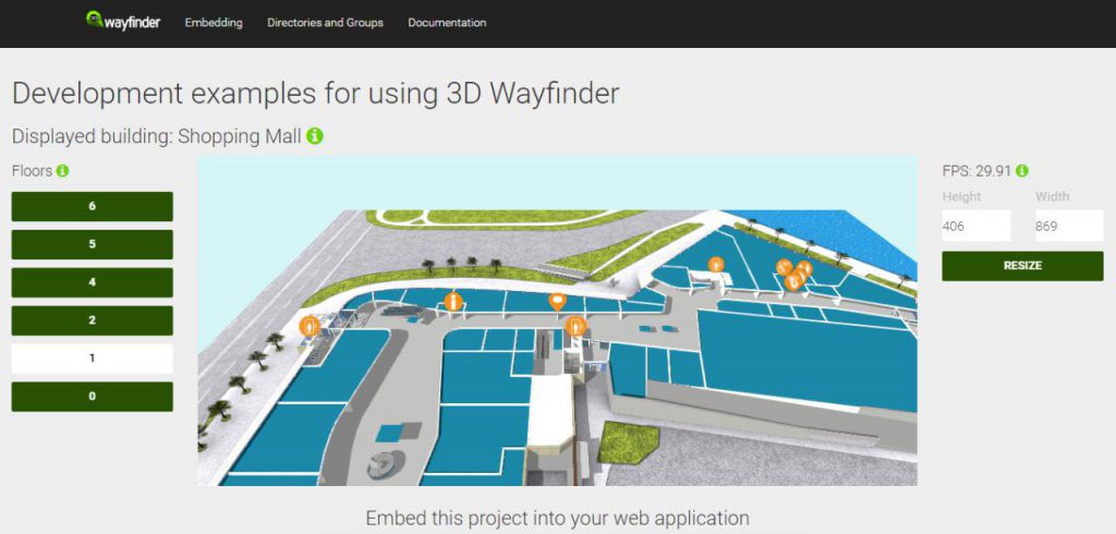
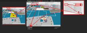
We have published a special template for development purposes. It includes a 3D map with resize function, floor buttons, list of locations and groups etc. Also each part in template has a tooltip, where it is possible to see the javascript function which has been used for that specific section.

3D Wayfinder development template

In Addition with the template we are releasing a new SimpleWayfinderApi class that extends the existing Wayfinder class. You can find the SimpleWayfinderApi documentation here. To use the SimpleWayfinderApi in Your application embed with <script src=”//static.3dwayfinder.com/projects/shared/js/simpleWayfinderApi.js”></script >

It includes basic functions for getting floor, group and location data. Functions for getting specific objects (floor, group, location) to accept the object’s ID as a selector instead of using the object itself as a parameter.

The development template is a good way to start building your web-based 3D applications.
You can use this template by getting the embedded code from the template page. The template itself can be accessed via the administration panel at admin.3dwayfinder.com when selecting the view with template “DevTemplate”.

In addition to the new development template it is possible to test the new SimpleWayfinderAPI in a sandbox at CodePen.

Both the development template and simple wayfinder API will be updated with new features and functions regularly.

« »

We’ve Cut the Prices for 3D Floor Plan Modelling

November 28, 2016

We have redesigned our 3D modelling process and now we are able to provide more competitive prices for custom 3D modelling. New prices are almost 40% lower than before.

When using our wayfinding application with 3D floor plans, you need 3D models of the buildings. With new public buildings, it is not a problem, as there are usually 3D models created for architectural or advertisement purposes. These 3D models still need some optimization and fine-tuning, so they can run smoothly and look nice in 3D Wayfinder application. But when there are no existing 3D models, then they need to be created.

We have developed a unified modelling process for creating 3D floor plans. Thanks to this we are capable of offering reasonable prices with fast and guaranteed delivery. Usual time for 3D floor plan modeling is 7 to 28 days depending on the complexity of floor plans and detail level. There are 3 specified detail levels:

Lite – Simple and easily understandable floor-plan in real 3D. Rooms look like “boxes”, but important elements for navigation (escalators, stairs, lifts) are modelled with good detail.

Standard – Optimized 3D floor plans with good compromise between details and performance. This is most common pick by our customers.

Premium – High detail and life-true 3D floor plans.

Custom modelling work depends on many things, like number of rooms in the building, building complexity etc. We have developed a modelling process, which enables us to give the price of the custom modelling instantly. Have a look at our 3D Price Calculator.

We have recently started a co-operation with the local Univeristy of Arts, where 3D modelling is one of the major subjects. This has helped us to widen our 3D modelers community.

The new prices are about 40% lower then before. For example we used to have a price of 13 euros per additional room, now it is 8 euros per additional room. The base prices have also decreased significantly.

« »

Using QR-codes in Wayfinding Application

November 10, 2016

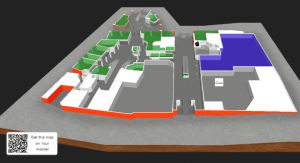
The easiest way for the visitor to get the wayfinding map into their mobile device is to add a QR-code to the kiosk application. By scanning the QR-code, the map of the building will open on the visitors mobile phone.

QR codes are getting more and more popular for sharing links for app downloads, promotions, additional information etc. QR-codes provide an easy way to share maps from wayfinding kiosks to mobile devices. Just scan the code and get the map to your device. No need for downloading any app or looking through the menus for your destination.

3D Wayfinder supports dynamic QR-codes for following cases: “You are here” location, path to selected location and location on the map.

Generating QR-code automatically

“You are here” in 3D Wayfinder is a node. That can be configured for each kiosks separately by simply using attribute in wayfinder URL. The QR code will be generated automatically using the same kiosk
parameters. There is no additional work with QR-codes. Even when using 20 or more wayfinding kiosks in a shopping mall, hospital or university campus.

Using QR-codes in wayfinding application

It is also possible to provide the entire path from current location to the selected location on the map. In this case the QR codes redirects to the 3D Wayfinder application with an attribute that shows the path immediately after it finishes loading. The Visitor can have the path visualized in their mobile phone. Without the need to search or select anything.

The third possibility is to show the specific location. Each location in 3D Wayfinder is a node. That can have its own view (including direction and zoom in 3D). By selecting any location on the kiosks, it is possible to show the QR code for this location. So the link behind the QR will open the map with the view to this location. By using positioning it is possible to capture the real location of the visitor and guide the visitor to the location that was scanned from the kiosk application.

« »

Request for a 3D Wayfinder Demo

October 27, 2016

Our sales team can help You to find the best wayfinding solution for You or Your customer. We can help You with creating 3D floorplans, designing a custom template and integrating wayfinding with other software. Now you can request for a 3D Wayfinder demo. 

We have made getting to know our software and our projects even easier for you than before. You can now find the request for a 3D Wayfinder demo button on our homepage.

Exploring 3D Wayfinder with your own resources is the most common way of getting to know our software. But it is even simpler if you ask for a demo and can have an interactive conversation with our people to clear out all the details of your floor plans creation needs and wayfinder requirements.

We will show you the basics you need to get started and will answer all of your questions about the software. During the demo we can also discuss any custom solutions and requests you might have.

Request for a 3D Wayfinder demo

« »

How to Create a Multilingual Wayfinding Application

October 20, 2016

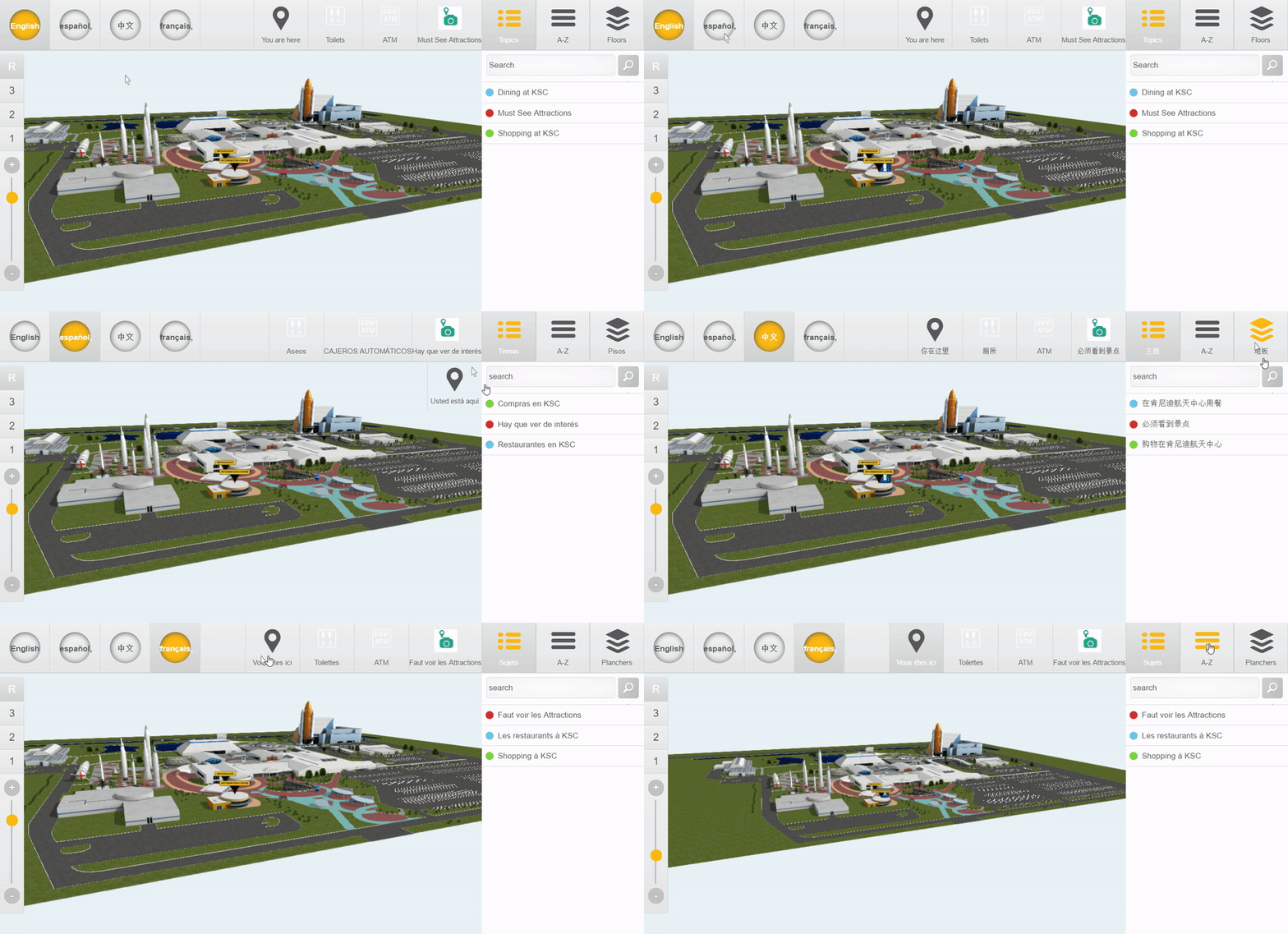
3D Wayfinder supports multilingual content. Follow these simple steps to make your wayfinding application support multiple languages.

To make your wayfinding application multilingual You have to add the desired languages into your wayfinding project. This can be done on the “Setup” page in the “Languages” section. Read more here. One of the languages is always marked as default, the default language is the one that the wayfinder application will display by default, i.e. the language that the application is first loaded with.

For each language you can select an image to display in the applications front-end language buttons. Usually we use country flags.

3D Wayfinder supports all the languages based on ISO language code.

After selecting the languages it is possible to enter the translations of the content to the selected languages. Each content type (like location name and description, group name etc.) now has an option to add translations. Usually by clicking on the “Translate” button in the “Edit” menu.

3D Wayfinder supports multilingual content. Follow these simple steps to make your wayfinding application support multiple languages.

Besides regular content, there are also GUI (Graphical User Interface) elements that can be translated. These are texts like “You are here”, “go to floor”, “take the elevator” etc. These texts can be translated on the “Setup” pages “GUI” section.

You can also add a keyboard layout for each of these languages on-screen keyboard. We have the following keyboards built into our common templates: Arabic, English, Estonian, Norwegian, Cyrillic and many more.

We also support right-to-left and top-to-bottom text direction in case the language demands it.

With the 3D Wayfinder Statistics module, it is possible to see what languages are being used and what visitors are looking for in each language.

« »

Creating Your 3D Visualizations Paths is Now Easier

September 12, 2016

Hello 3D Wayfinder users, we have put together an instruction for you to make adding locations faster and simpler. Creating your 3D visualizations paths its easier than ever before with 3D Wayfinder.

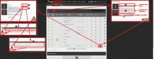
The following information diagram shows how to add locations to your floor plans step-by-step. After adding the locations you can link them to your wayfinding paths.

The first graphic shows you how to add a location to the list of locations:

3D_visualizations_paths_in_3D_Wayfinder_admin_panel

The second graphic displays the instructions how to link the roof of the location in your floor plans to the Point of Intrest in your locations list :

3D_visualization_paths_when_adding_a_new_store

Following these instructions you will be able to add locations to the 3D Wayfinder software in a couple of minutes.

Good luck in creating your 3D visualizations paths!

« »

3D Wayfinder Mobile Applications for Android and IOS

July 28, 2016

The development of our new 3D Wayfinder mobile applications for Android and IOS is in the final stages. It will be available in a short time. You will be able to create 3D Wayfinder applications for your venues and enable the download for people that will make it easy to find the way.

The app is based on the popular Ionic framework (Web based). Ionic is a very easy to setup and customizable mobile app framework. It uses AngularJS and Cordova. We will OpenSource the application source code so you can make Your own version.
We will also add Geolocation and iBeacon based positioning support in the near future.

« »

New 3D Demonstration Projects to Get Your 3D Wayfinder Started

July 11, 2016

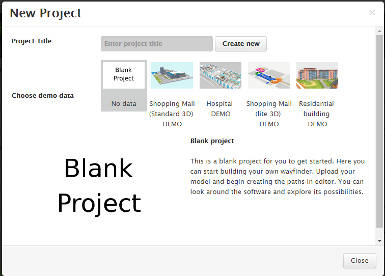
We have uploaded new demo projects into 3D Wayfinder. These new 3D demonstration projects with 3D visualized models allow our users to start checking out 3D Wayfinder. Without having to upload their own model or floor plans. You can start creating a new project instantly. You can look around in our demonstration data to learn how the 3D Wayfinder works.

The new models cover a variety of different kind of buildings and model qualities. You can see the modelling of Standard and Lite versions of shopping malls. In addition to a residential building and a hospital. This allows you to access our 3D architectural visuals with our Free user. You can see the different kind of structures and textures yourself. All these functions are available for use by registering with 3D Wayfinder.

New_3D_demonstration_projects_shopping_mall_and_hospital

You can also use the projects to take a look at the options of editing and creating your own paths into the 3D architecture. In the “editor” panel you are able to create and delete paths made out of nodes and direct people where you want them to. This will allow you to see how the software will look like in the wayfinding kiosk.

You just need to create an account and start discovering the possibilities of 3D Wayfinder.

Get a quote

« »

New Free Plan for 3D Wayfinder

June 10, 2016

To start the summer on a positive and even more client-friendly note, we have decided to enable our customers to use our software free of charge with our new pricing plan.

We created this new option so more people could access the 3D Wayfinder and will be able to use it without charge for smaller projects. Our new free plan for 3D Wayfinder is great for creating and exhibiting 3D models and for smaller wayfinding projects. You will be able to do everything yourself and get to know the software. The purpose of this plan is to make our software easier to access for the benefit of our clients. The plan allows you to create one project in our system and start developing your own model and pathing.

Signing up with the free account will allow you to upload any 3D model into our system, manually create pathfinding for you building as you like and much more. We have also updated our other pricing plans to give our customers better deals and more projects they can work on with 3D Wayfinder.

The free version of 3D Wayfinder as all the other versions comes with a demo model that enables you to look around and make changes to see how it works. Soon we will add more demo models of different types of buildings to suit our client’s needs. All you have to do is register your free user and start exploring the options we have designed for you.

Contact our sales team for more information.

« »