Creating Your 3D Visualizations Paths is Now Easier

September 12, 2016

Hello 3D Wayfinder users, we have put together an instruction for you to make adding locations faster and simpler. Creating your 3D visualizations paths its easier than ever before with 3D Wayfinder.

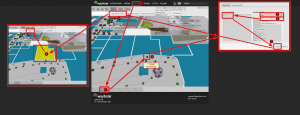
The following information diagram shows how to add locations to your floor plans step-by-step. After adding the locations you can link them to your wayfinding paths.

The first graphic shows you how to add a location to the list of locations:

3D_visualizations_paths_in_3D_Wayfinder_admin_panel

The second graphic displays the instructions how to link the roof of the location in your floor plans to the Point of Intrest in your locations list :

3D_visualization_paths_when_adding_a_new_store

Following these instructions you will be able to add locations to the 3D Wayfinder software in a couple of minutes.

Good luck in creating your 3D visualizations paths!

« »

Guidelines for Creating 3D Models

June 14, 2016

We have listed some guidelines for creating 3D models, that look nice and run smoothly in web-browsers. 

3D Wayfinder uses regular 3D models, so there is no special format or way how the 3D floorplans should be modeled. As 3D Wayfinder works in web-browsers through WebGL technology, then in order to get better results the 3D models should be optimized. Read below for some useful tips and tricks on optimizing 3D models for the best performance.

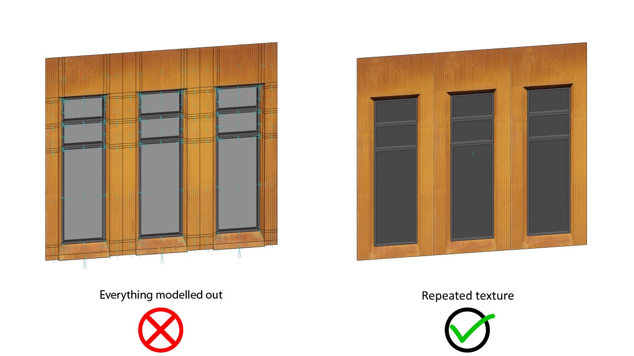
For example keep the 3D geometry simple and use textures, that can be repeated:

Guidelines_for_creating_3D_models_repeating_texture

An important element of 3D floorplans are different kinds of vegetation (trees, bushes etc.). They help to make the floorplans look more life-like and in some cases are also important for navigating on the map. It is easy to use transparent textures on the simple planes, just never model out the leaves or branches:

Guidelines_for_creating_3D_models_transparent_PNG_texture

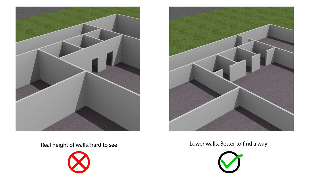
With 3D it is possible to create really life-like buildings, but when using 3D for maps, it is always good to keep the models simpler. For this we suggest removing un-important furniture and making the walls as low as possible without losing the general idea of the height of the room. This way the visibility of the visualized path is far greater.

Guidelines_for_creating_3D_models_lower_walls

You find the full list of guidelines for creating 3D models are added 3D Wayfinder page here.

« »

Portals in Wayfinding Software

May 25, 2016

We have implemented new type of nodes – portals. This makes it possible to guide visitors instantly from one point to another.

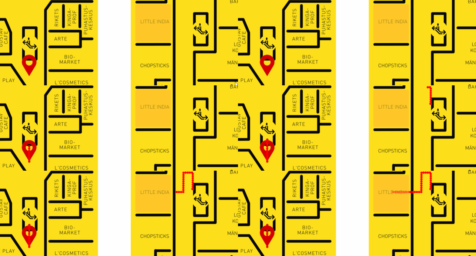
Portals in wayfinding software can be used for creating an instant path between a large number of floors or when floors are drawn on the same map as shown in the image below.

Portals_in_wayfinding_software

In the case where a building has a large number of floors the portal nodes become exceptionally useful they allow the path to “jump” instantly from one floor to another making the path visualization instant.
The portal nodes are useful in the case where there is a greater distance between locations where you don’t need to show the way. For example in the case when using a train or a tunnel in between locations.

The nodes operate the same way as in the popular videogame Portal. The main idea is that you can create two gateways in between which the path can move freely either way.

Currently the portal nodes only operate on 2D maps, but at the moment we are working on developing portal nodes for 3D maps. They will be available soon to make your wayfinding solutions even more flexible.

« »

Moving Camera According to Path

March 2, 2016

There is option now to moving camera with path animation. This makes the path visualization even more effective with 3D floor-plans and maps. Especially when combining with directions.

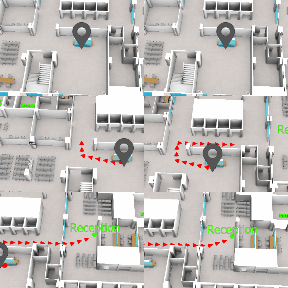
So far there were 2 ways to show the path: draw the path animation or show the walk from first person view. Like you see the 3D in computer games. With usual path visualization the map was zoomed out, to fit the whole path on the screen. But this might make the understanding of recommended path a bit complicated. Mostly when the map is large and complicated.

moving_camera_with_path_animation

With moving the camera with path animation it is possible to keep the “You are here” view to the map, including angle and zoom level. Of course it is always possible to zoom in or out during the path animation and rotate the map (if it is allowed). The camera will keep following the path to the guided destination.

Path visualization behavior can be adjusted under Settings in 3D Wayfinder Administration panel.

« »

New Features in 3D Wayfinder

January 15, 2016

With the end of 2015 and the beginning of this year there are many new features added to 3D Wayfinder. The goal of these changes was to add flexibility to customizing the behavior of the 3D map and wayfinding. Custom models for path, path types, POI options and many more.

In parallel with large customer projects, we have added many new features to 3D Wayfinder. Most of them were requested by our customers and we have added them as features/settings for all our users. Below are listed the most important ones.

Custom models for path visualizationcustom_path_models_wayfinding
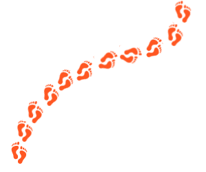
It is now possible to choose your own custom models for path visualization. Path models can be different kind of arrows, footprints or simple tubes/lines. Changing path visualization models can be done under settings.

In near future we’ll add some sample path models also to our blog.

Path types and accessibility paths

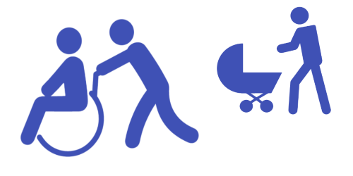
It is now possible to add different kind of inaccessibility attributes to the path . This can be used for defining paths  that are also accessible with wheelchairs and/or baby strollers. This also enables defining other kinds of areas, like paths for service personnel etc.

Currently it has to be entered to the node attributes in json object format:

{

“inaccessibility”: [

 “wheelchair”

]

}

wheelchair_wayfinding_inaccessibility_Path_types_and_accessibility_paths

The nodes with these kind of restrictions cannot be used for path finding with “wheelchair” option. It is useful to set these restrictions for stairs or doors.

To use the inaccessibility in user interface, you have to change the accessibility option first:

this.wayfinder.accessibility = “wheelchair”;

Then it is possible to use the same show path method:

this.wayfinder.showPath(poi.node, poi);

And after showing path, just change the accessibility option back to blank:

this.wayfinder.accessibility = “”;

Also check out our blog post about how to set up time dependent navigation rules.

POI specific options

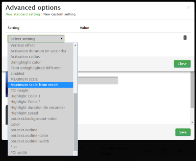
Advanced_POI_settings_specific_options

It is now possible to create special settings for each POI (location). These settings can be chosen from the list of all POI settings, like the size of the billboard image or billboard text size, highlight color, activation radius, billboard height etc.

This feature allows to customize the map by locations, for examples larger shops can have larger texts or text colors can be set by each shop. Also it makes easier to use logos or icons on the map, as the billboard images don’t have to be the same size anymore.

In the future it is possible to add new settings that can be used when developing your own template.

Top-down view for Path showing

path-top-down-view-for-path-showing

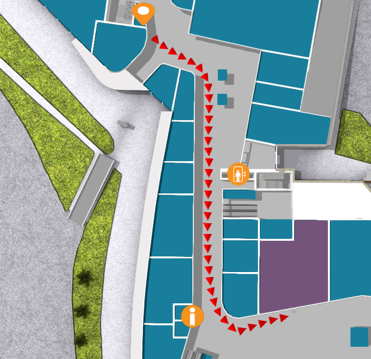
Now there is a simple option under settings to turn the map to top-down view when showing the path.

In general it is not a good idea to show the “You are here” location from top-down view, but rather  from certain angle (especially when it is possible with real 3D models as in 3D Wayfinder), which provides a better overview of the map and also makes the map look better.

Now when using the same angle, as displaying the “You are here” location, and visualizing the path, it may happen that the visualized path might not be visible. This is due to tall objects like walls that might block the view of the path. Using the top-down view during path visualization solves this problem.

Pause options between changing floors

According to valuable customer feedback, the transition of switching floors happens too quickly , which might be a bit confusing for the end-users. We solved this issue by adding the “pause-time” option to the settings. With this option it is possible to adjust the duration of the pause before switching to the next floor. The pause duration can be defined in seconds,  which makes it easiest to find  the proper delay that helps  all wayfinder users to understand, which floor they have to go to.

Kiosk view enhancements

In addition to being able to save the view angle, it is now possible to save the zoom factor for “kiosk view”. By clicking the “You are here” button, the map assumes the “kiosk view” saved in the editor.

In the future we will add this view option as a separate object so the view can be linked with any location or node.

« »

Node Weights in Path Calculation

August 21, 2015

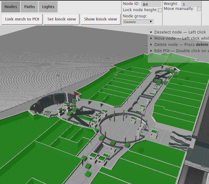
We have updated path finding functionality and path calculation. Now it is possible to change the weights of navigation nodes in 3D Wayfinder floor plan editor.

Path-finding application calculates automatically the shortest route from the starting node to the required location. In mobile applications, the Kiosk node can be your position inside the building. With 3D Wayfinder, the shortest route is calculated in a 3 dimensional room. It means the shortest path through all the floors.

Now it is possible to change the weights of the connection nodes. With this wayfinding application calculates optimal route, which doesn’t have to be the shortest. For example when you would like to guide your visitors to use the path inside the building instead of going around the building. Then you can set the weight for outdoor nodes higher. The weight is basically virtual length that will be added to the route, when passing the navigation node with a weight.

path_finding_functionality_in_3D_WayfinderTo use the weights you have to select the navigation node in 3D Wayfinder floor plan editor and change the node weight from the text box. By default all the weights are 0.

For example lets, say that waiting for the elevator takes usually 3 minutes. Lets assume, that visitors are moving with a speed of 3 km per hour, which is 50 meters per minute. So with waiting the elevator, visitor can pass 150 meters (3*50). If we would like to take account this in path calculation. Then we can add weight of 150 to the navigation node, that is marked as elevator.

Pathfinding functionality comes bundled in an add-on you can order from 3D Wayfinder Administration panel. It is also included in the Pro plan.

Read more about 3D Wayfinder’s path-finding capabilities.

« »