ISE 2023 Technology Expo Experience

February 14, 2023

ISE 2023 Expo is probably most important technology expo in Europe. This year it was biggest yet. ISE 2023 attracted 58,107 unique attendees from 155 countries, making 133,606 visits to the show floor. Especially busy was Multi-Technology hall. There we had most fun meeting companies too. Special thanks goes to for citizens of Barcelona. Even with limited English they left to us superb expression. We were pleased that the event was in city where people are kind and helpful for the first time visitors.

ISE 2023 Expo is probably most important technology expo in Europe. It placed in Barcelona.

ISE 2023 Expo organization

ISE 2023 Expo experience is that was really well organized Expo. There were large halls and easy to access booths. The catering was also very well organized and managed. We saw some very unique solutions. Especially interesting was 4K LED screens with IR touch. Making it suitable to use in interactive digital signage and 2D or 3D wayfinding solutions.
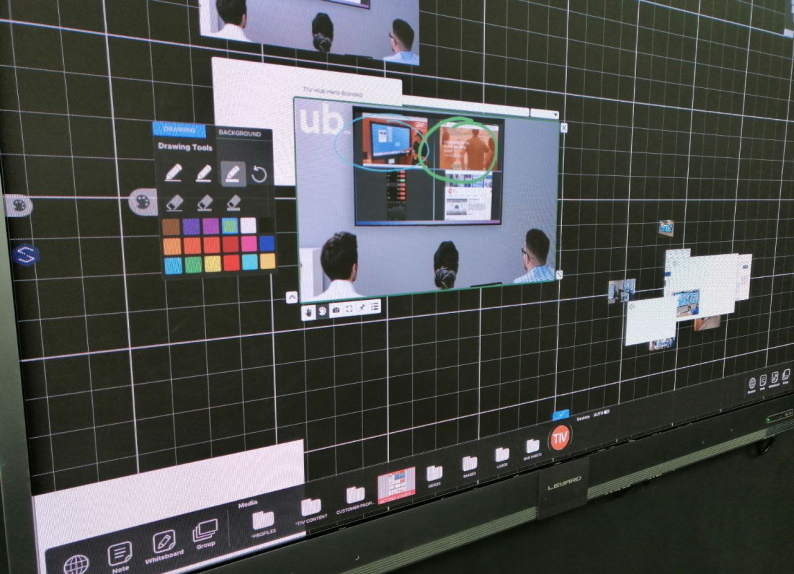
We saw some very unique solutions. Especially interesting was 4K LED screens with IR touch. Making it suitable to use in interactive digital signage and 2D or 3D wayfinding solutions.

In two days we when we visited expo, we got a lot of positive feedback for our software. Companies were most interested in our 3D maps that we have built for indoor navigation. Some of the companies we visited needs to be highlight also in our blog.

Nice meetings at the event

With representatives of Cisco we quickly found a common topic of conversation. We talked about smart rooms and today’s business environment. We understood in that moment how right our direction has been for years. Also especially happy to see that we have yet to offer more opportunities then international corporations like Cisco can do. This motivates us to keep working hard.
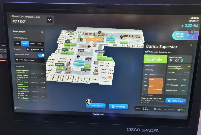
With representatives of Cisco we quickly found a common topic of conversation. We understood in that moment how right our direction has been for years.

Highly interested meeting we had was with BrightSign. Their digital signage players were interesting that can be potentially used for our software. We talked about to give better hardware tools for our clients. Especially interested us plug and play solution. Also it may be solution for our clients, who have little experience with digital signage and players for interactive screens. If everything goes well then we will have also hardware for our clients that is reliable with good price range.

We also visited booths of Clebex and Telelogos. Both are big IT companies and with very interesting field. They are definitely worth to explore. We started of right a way with productive talks and of course our topic was about potential of 3D Wayfinding. 3D Wayfinder software gives additional tools build powerful business solutions for end-clients!

Interactive displays manufactures at ISE

We got new and interesting knowledge in Chinese display manufacturer HCTek. Interactive displays is what future holds. HCTec is large interactive display manufacturer providing OEM, ODM and OTM solutions. Many well known display brands get their interactive displays from that factory. For us it was important to know what future brings. Talking was very productive and we had good laughs and took picture!
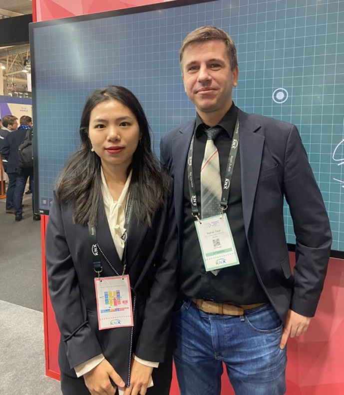
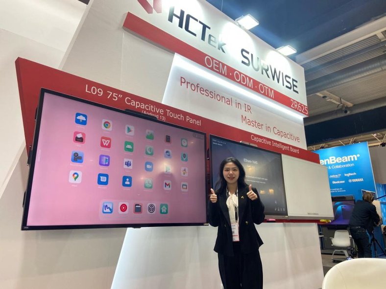
We got new and interesting knowledge in Chinese display manufacturer HCTek. HCTec is large interactive display manufacturer providing OEM, ODM and OTM solutions.  Picture with 3D Wayfinder director Rainer Saar.
Chinese display manufacturer HCTek. Interactive displays is what future holds.

Then we met LED manufacturer AOTO. In our talks we covered many aspects of today digital signage market directions. Also we both agreed that future will be LED. Especially in indoor and outdoor digital signage field. We were also invited to their 30th anniversary celebrations to Happy Hour.
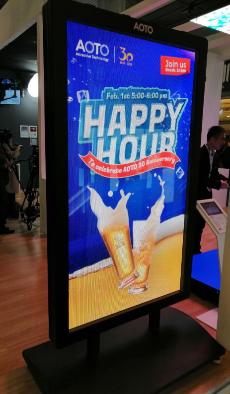
LED manufacturer AOTO. Future will be LED, especially in indoor and outdoor digital signage field.

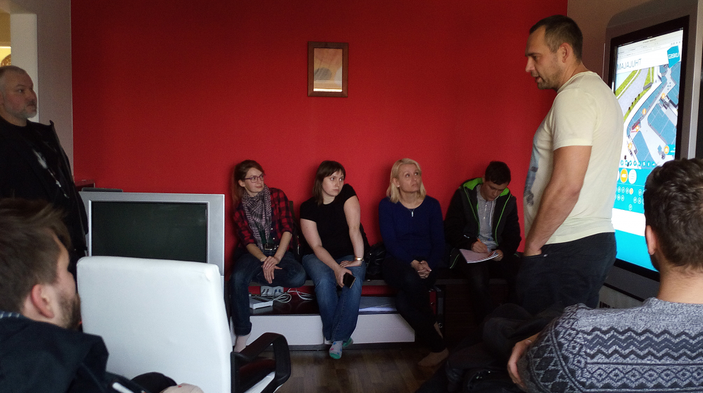
Our sales director Rainer Saar shared his experiences.

« »

How to Cut Costs With Wayfinding Software?

November 16, 2022

It is obvious that the economy is currently in a downward trend. More and more questions rise in this regard. How can we save money and energy? Globally, more and more people are talking about saving energy. This is definitely one place where different service companies could save. In addition to energy savings, financial savings are also important. By using the 3D Wayfinder software, it is also possible to save money quite realistically.

We have previously introduced you how to earn revenue with wayfinder software, in this post we will talk about how to save through the wayfinding software.

Certainly, many shopping center managers notice that purchasing power is decreasing. The global economic recession is mainly to blame for this. When the economy is booming, people shop more and spend more money. When the economy is down, people think more carefully about where they spend their money. Might be that some people even deliberately distance themselves from shopping malls so as not to make reckless spending.

Save on labor costs

The biggest cost savings comes from labor costs. Have you thought that there is an employee in your company or institution whose work could be done by some software? For example, there are often information workers in various office buildings, shopping centers or airports. What role do the employees at the information desk mainly play? Most of the time they guide people. People use information boards to find a way to store or special room. By using the 3D Wayfinder, it would be possible to save on the salary costs of one or even several information/help workers. This is probably one big and thought-provoking place where you can cut costs with wayfinding software.

Save money by reducing printed signs

In public buildings one of the administrative expenses is certainly different signs. Business signs must be changed when someone moves out or joins. 3D Wayfinder can also help here. Using wayfinding software reduces needs for different signs and printed floorplans. Building directories and maps can be digital and can be changed without the need for printing and changing physical signs. It is even possible to install digital screens in elevators.

Using digital wayfinding also helps to save on administrative costs. In addition, it is easier for the administrative manager of the building to change tenant or rental information in one place digitally than replacing installed physical signs.

Less energy with sleep mode

One of the ways to save energy is forcing wayfinding kiosks to go to sleep mode. Sleep mode is a widely known term and probably everyone who uses a computer or smartphone is familiar with it. It is possible that many 3D wayfinder customers may not know that sleep mode can also be set for wayfinding kiosks. When there is no activity in the building and the doors are locked, the wayfinding kiosk can also be in sleep mode.

Sleep mode can also be used when the building is open. The kiosk can be set in such a way that the screen is completely dark or, for example, with the text “Click here for building map” etc. when no one is using the kiosk. When a person touches the screen, the screen becomes active and can be used.

Save with dark mode

How else would it be possible to save with wayfinder software? One of the ways to save energy could also be using dark mode. At wayfinding kiosks, it is possible to set the screen light to be brighter and darker. Darker screen use less energy.

Save with wayfinding software. Energy saving and financial savings is important for service companies.
Landscape template normal bright version
Save with wayfinding software. Energy saving and financial savings is important for service companies. Cut for labor costs and use darker mode.
Landscape template dark mode

The difference between the two images is quite large and can be startling when compared like this. In addition to saving energy, it is also better for the eyes. In any case, the customer receives the information in exactly the same way as if it were on a screen with full brightness.

3D Wayfinder offers the possibility to set the display of the kiosk in time. For example, it is possible to set the time when the screen goes into dark mode. It is also possible to set the screen based on the surrounding light. For example, if the lighting in the building is bright or the sun is shining, the screen will be brighter. If the lighting is darker, the screen will also automatically darken. Dark mode saving is easy way fot cut costs with wayfinding software.

There is also an option to use a different background color. You can choose the background colors for building maps in 3D Wayfinder. If you want to save energy, it would be wise to use a darker background. If the card has a darker background, it saves more energy because the screen doesn’t have to be so bright. Also, a darker background can sometimes work even better. On a darker background, it’s better to highlight some objects that don’t come out as smooth on a light background. This is an option that should be considered when starting to order a house manager or create one yourself.

Smart wayfinding

Do you know that 3D Wayfinder indoor positioning software using smart wayfinding technology?

Smart wayfinding is easy. The person who makes 3D Wayfinder map can choose how they want the path to be guided. For example, it is possible to guide the way that elevators are avoided. Moving the elevators up and down is probably also a big administrative expense. However, if people are guided so that they are directed to the stairs, it is possible to regulate the use of elevators.

3D Wayfinder supports energy saving. We support saving people’s time by providing innovative wayfinding software. We are environmentally friendly and recommend it to all our customers. If you are already using 3D Wayfinder you can change settings for saving energy or ask help from our team. If you are not yet using wayfinding software, then please contact our sales department. We will definitely find the best solution for you and help you cut costs with wayfinding software.

« »

How to Create 3D Wayfinding Maps by Yourself?

May 28, 2022

How to create DIY 3D wayfinding maps? It is not that hard as it may sound.

Following post will give you an overview on how to create 3D models for wayfinding software. In addition we will share you videos of the modeling process.

Here are some general guidelines to keep in mind:

Maintain a clean quad topology and keep poly count low, no need for edge beveling and subdivisions, when the situation does not require it.

The floor, outer walls, inner walls, details, locations, stairs, elevators, locations and greyed out areas must be separate objects, please do not combine them into one.

Its also recommended to group objects of the same kind and name them accordingly.

The following videos will show some tips and tricks to make your workflow faster.

The solidify modifier will help you create quick walls for your model. You can either first model the walls and then apply solidify or do it the other way around.

Using the Archimesh addon (comes with Blender) you can make great looking stars with just a couple of moves.

NB! When you are in the process of cleaning up your Blender file like shown above, sometimes the spare material doesn’t disappear after using the purge function. If that happens then just restart your Blender project.

For a more in-depth guide go to Blender Modeling Tutorial.

Read more about modelling guidelines.

We hope you got a better understanding of how to create 3D wayfinding maps.

As always we are pleased to help you for creating a wayfinding solution for you or your customer. If you like us to make the maps, please also look our floorplan campaign and don’t hesitate to contact us.

« »

New Top View Feature in Our Editor

January 2, 2018

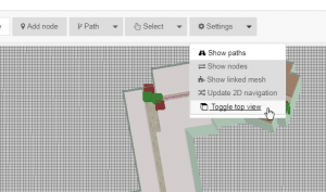
Sometimes it’s the small things that make all the difference. New “Toggle top view” feature in 3D Wayfinders administration panels editor is a useful tool that will give needed help to our users.

Toggle top view shows all the maps straight from the top and it works with both 2D and 3D maps. While this feature is selected, the rotation is disabled. This is most useful when marking paths on the map. It could also be used if you want to set kiosk view straight from the top on 3D maps.

New feature in editor

“Toggle top view” can be found on the top of the editor under “Settings“.

« »

3D Model Converting Problems Partially Fixed

November 8, 2017

In recent days, we were having problems with 3D model converter. These problems are partially fixed now, so converting non-corrupted 3D files shouldn’t cause any interruption anymore.

3D Wayfinder’s model file converter has stopped quite often lately, when converting corrupted 3D floor-plan files. Every time converter stopped, we had to start the process manually and clean the converting queue.
All 3D files are converted to JSON format, so they can be load in 3D Wayfinder. Our converter supports many 3D file formats, most common are FBX and DAE.
The problems were with couple of models, that caused invalid JSON when converting.
We have added error catching for this, so the rest of the converting process can resume and these corrupted models don’t interrupt other 3D models to be converted.
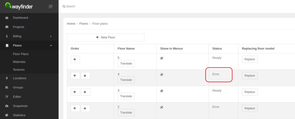
If converting of 3D floorplan model fails, you’ll get “ERROR” response in 3D Wayfinder Administration:

3D_model_converting_error

Other reasons, that 3D files couldn’t be converted are mainly caused by using non-UTF characters in mesh names.

« »

3D Wayfinder had Guests From Tartu Art School

October 2, 2017

Our office was really crowded last week when we had visitors from Tartu Art School. More than 20 people who have just started their studies to become 3D modellers.

uus

Tartu Art School is the only school in Estonia that teaches 3D modelling and visualization as a vocation. As a part of their curriculum the students visit different companies to see how their skills could be used in the future.

Since 3D models have such a big part in our work, it is also important for us to introduce our company to potential future employees or users of our app.

photo_2017-10-02_11-59-01 visitors

So we talked about what we do and how we do it and how students could use our product. 3D Wayfinder is currently used for mostly way-finding applications. But that doesn’t mean it couldn’t be used in variety of cases. It’s also perfect for presenting architectural models or – why not – make a virtual art gallery.

It is interesting and useful for us to see what kind of applications the students can find for 3D Wayfinder. So we can make it more flexible and beneficial for a wider range of customers.

« »

3D Wayfinder User Manual is Updated

September 28, 2017

Many things in our new administration panel work a little bit differently than they used to. If you need help to figure things out, check 3D Wayfinder user manual.

User Manual

We have updated all the topics and we add information when new features are added. You can find 3D Wayfinder user manual from our web page under “Docs” from main menu or you can use the direct link https://3dwayfinder.com/documentation/user-manual/

User manual for our previous administration panel is also still available, you can find it here: https://3dwayfinder.com/documentation/user-manual/#5

« »

Keeping Floor Plan Editor Idle in the Background

August 1, 2017

The new 3D Wayfinder Administration Panel is centered more around the floor plan editor. To provide better usability we keep the 3D editor idle when moving away to other pages. So switching between editor and other views is much faster now.

The new Administration Panel has been publicly available for testing since the beginning of this year. At the end of the summer we will only support the new administration panel. Although the current administration environment will be available for some time.

Loading the 3D floor plan editor takes a couple of seconds because we need to load 3D floor-plans models and also additional editor tools. Now when the editor is always in the background. We do not need to load the 3D editor again. This makes the usage more faster and user friendly.

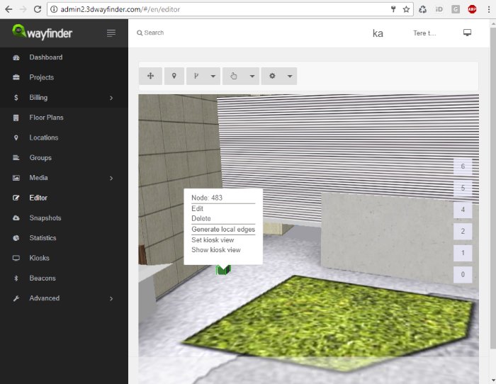
new 3D floorplan editor

Our new administrator panel is being built on Angularjs. To achieve loading of editor once we have created the service that holds the canvas element. It is also attached our editor API to it. Controller then adds canvas to the editor view and provides connection to API actions.

To see and test new Administration panel and floor plan editor, please log in here. If you don’t have an account with 3D Wayfinder, you can create it here for free.

« »

Wayfinding Kiosk with Raspberry Pi

July 11, 2017

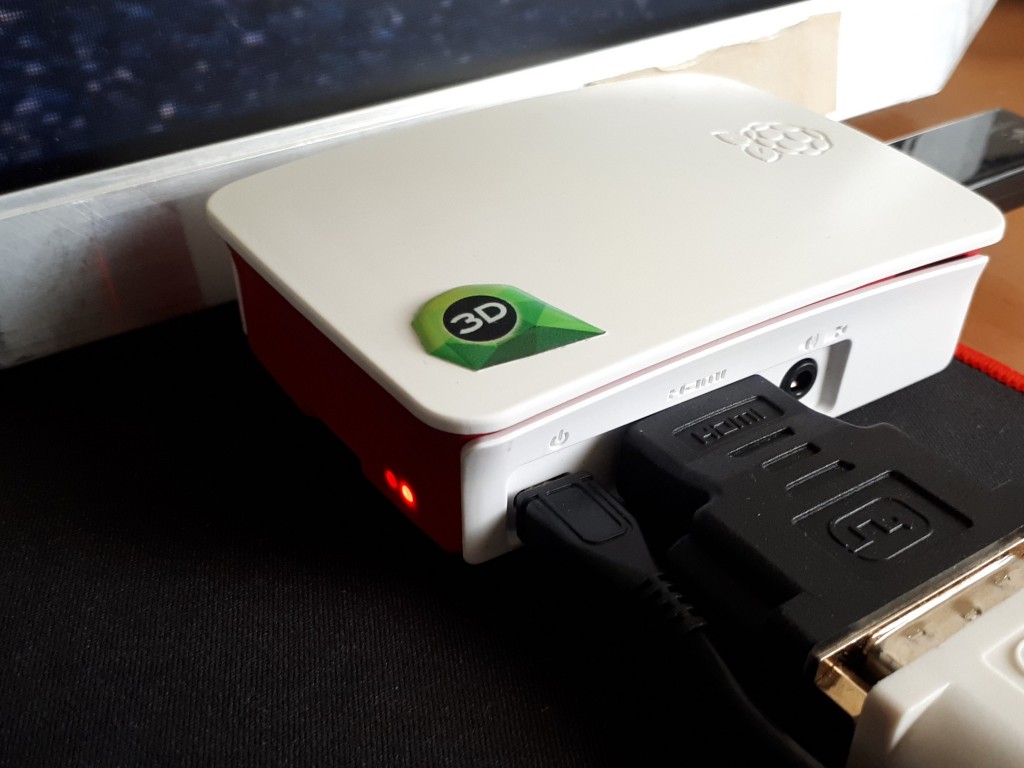
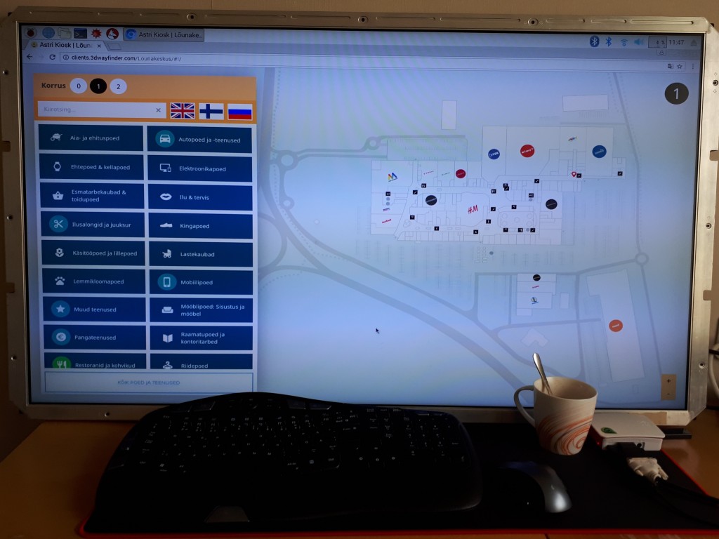
We have recently experimented with a Raspberry Pi 3 Model B, to see how it can work as media player for digital signage display or wayfinding information kiosk. As a result we can say, it works well with 2D wayfinding maps and with 3D Wayfinder Advertisement Module.

What is Raspberry Pi?

Raspberry Pi is a small credit card sized linux based open source computer. It is equipped with:
– Broadcom 64-bit quad core CPU clocked @ 1.2 GHz,
– 1GB of RAM,
– built-in WLAN and BLE modules,
– HDMI output.

But everything is soldered to the board hence there is no option to upgrade, except for the microSD card. You can also have a nice box for it, so it doesn’t look like a hackers development board.

Raspberry Pi

Compared to other small form factor computers like Intel NUC or Gigabyte BRIX, it is much cheaper. Raspberry Pi with a nice case and microSD card would cost about 50..70 USD. The NUC or BRIX boxes start at 110..130 USD new, and you still need to equip them with a hard drive (SSD/HDD) and memory module(s) (DDR3/DDR4 SO-DIMM RAM) which would cost you about an extra 30 USD for a 32GB SSD and ~25 USD for DDR3 or ~30 USD for DDR4. Totalling up to about 165..190 USD.

Raspberry PI plays in Full HD, so it is not a problem to use large resolution screens.

Wayfinding with Raspberry Pi

Enable WebGL

For 3D the Raspberry is still a bit weak and by default it doesn’t have WebGL enabled. To enable WebGL you have to:
1. Open up the terminal application (or command prompt if you prefer to call it that)
2. run command sudo raspi-config
3. navigate to Advanced Options
4. enable GL support.

The GPU on the Raspberry PI 3 Model B doesn’t support floating point textures, so we cannot use transparent textures.

To build wayfinding or digital signage project based on Raspberry Pi you need to use a special linux distribution that opens a browser in full-screen mode instead of the regular desktop interface.

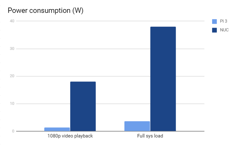
At the same time the kiosk based on Raspberry Pi is quite bullet-proof. There’s no need to worry about excessive power consumption as it actually only consumes about 3.7W under full load and only about 1.4W when playing a FullHD video, which is roughly 10% of the Intel NUCs ~38W while under full system load and ~18W while watching a FullHD video.

chart

It boots up fast from a microSD card which can be easily replaced when it wears out or breaks.

Although remote managing a kiosk that uses a Raspberry Pi can prove to be quite a cumbersome task as you cannot use regular GUI remote management tools like Teamviewer or LogMeIn. The fastest way to remote manage the Raspberry Pi is to use SSH, which is a CLI (Command Line Interface) and this might scare-off most of the users that are not used to poking around via a CLI.

« »

Faster Loading of 3D Projects

April 25, 2017

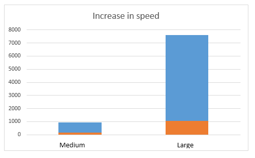
We have changed the logic of initializing POI data in 3D Wayfinder. This gives up to 80% faster project initialization for medium and large projects. In very large projects, the increase is even larger – more than 90%.

After data is loaded from the API 3D Wayfinder system had to setup the 3D scene. That also included generating polygons and textures for each POI. These included a POI icon or the name of the POI on a billboard (facing the user all the time). POIs without icons needed to have the name displayed but the only way to display a text in 3D space is to generate or load a image. So we used a canvas element to draw these names. But this is a costly procedure. 

Now we create only these images that are flagged as “Always visible” at the start. So the startup time is a lot faster. Check the following comparison table. That gives faster loading of 3D projects. 

Project Before After Setup Gain Total Gain
Medium 765 ms 174 ms 77,25% 5.63%
Large 6563 ms 1039 ms 84,17% 11.52%
Very large 26710 ms 403 ms* 6627% 54.86%

* Project doesn’t have any “Always visible” POIs

Initialization time before and after change compared with medium and Large projects:

wayfinder_loading_speed_increased_grapgh

Initializing is only a part of the whole loading. Loading the data and 3D models from server is another component of the whole loading process, so the afterall loading process is better about 5-55% (with connection 20Mb/s).

« »