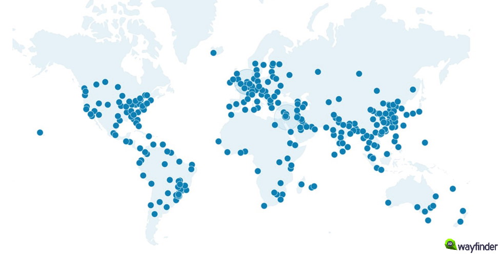
We have added CDN support in 3D Wayfinder. CDN makes loading 3D Wayfinder application faster especially outside Europe. Currently it is available only for custom projects, but soon it will be option for all 3D Wayfinder customers.
CDN or Content Delivery Network is a geographically distribute servers that cache content close to end users. A CDN allows for the quick transfer of files, media etc. It works best for static content. In 3D Wayfinder it is basically possible to load all wayfinding content including maps, location data, images, application files etc. CDN is widely used by sites with huge traffic like Facebook, Netflix, and Amazon.
CDN is currenlty available for 3D Wayfinder custom projects and we have to make manual changes to make it work. We would like to open it for all 3D Wayfinder users, but this will still need some development and testing.
CDN server network copies files to more than 200 locations over world and when the wayfinding application is load, the files will be served from closest server.
During the testings we got loading improvement more than 60%. Lodaing speed was around 6 seconds from CDN compare to 16 seconds from 3D Wayfinder server.
Delivering content over CDN needs static content. This means that the content from databases has to be cached first. For any live-data like positioning or statistics, CDN cannot use. As wayfinding maps don’t change that often, it is easy to make the location information and maps to be as static content. Just after every change in 3D Wayfinder administration panel, the content has to be submit to CDN network also.
If you are already 3D Wayfinder customer and like your wayfinding to be load over CDN, please contact our sales department or your contact person in 3D Wayfinder. We will keep you posted through our blog and let you know when CDN-option will be available for all users in administration panel.
In this post, we will introduce different options for designing 3D map. A map mostly serves the task of guiding people, but there are many different ways to design a map. When designing a map, a lot depends on what the map is designed for, which people use it, what kind of user experience they expect and what added value the map should create.
Detailed designing of 3D model
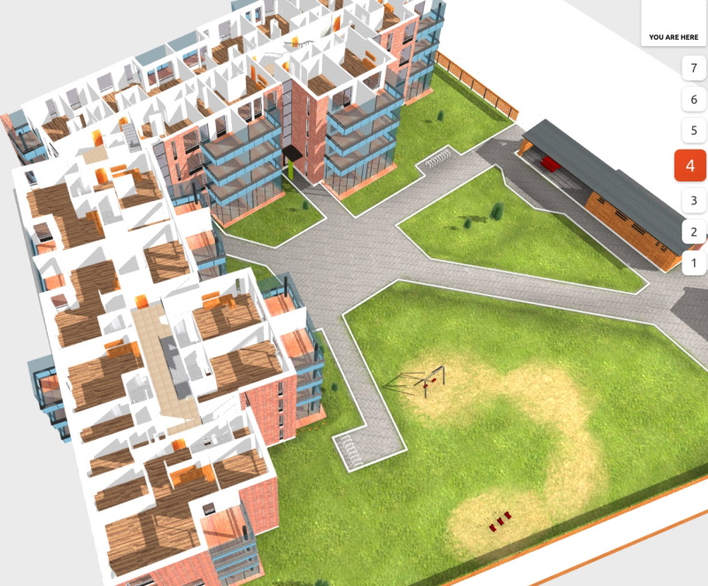
With 3D Wayfinder, you can design your own 3D map, but we also offer a complete solution with several detail levels. One way is to create very detailed designing 3D map. These are models where the textures are precise, so that it looks as real as possible. Such a 3D model is important for advertising apartment buildings, so future residents can get a very accurate idea of their home.
Detailed 3D model view of the apartment building and the courtyard
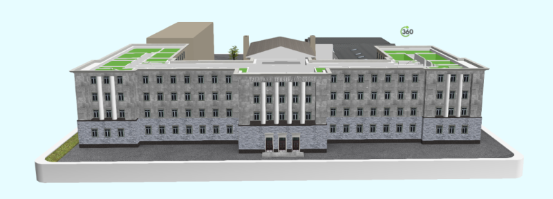
It is not always necessary to create detailed models for the purpose of selling houses or apartments. For example, the building of the University of Applied Sciences in Tallinn has historical value. They wanted to bring a historical feel to the 3D map as well. Therefore, a detailed and realistic model was created for them.
Tallinn University of Applied Sciences 3D model view of the main building
Funway 2D map
A complete opposite to the realistic models are 2D maps. This is a map drawn using the FunWay method, which does not convey a real image, but has a nice design and is understandable to all users.
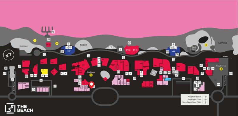
2D map view of Beach Mall in Dubai
We have also prepared a detailed 3D model for them, which is much more realistic and the icons on the model are slightly more emphasized.
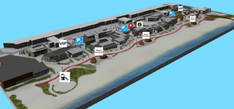
3D model view of Beach Mall in Dubai
Simplified map view
Everyone is probably familiar with the feeling of getting lost in a hardware store and spending time for lookinf certain products. We have prepared an interior map for the hardware store in Estonia, by shelves and departments. Pins for products from specific companies have been added to the shelves and departments, which makes it much easier for customers to search for specific products. Creating such a card is quick and easy. For customers, it makes the experience of visiting a hardware store more pleasant.
A simplified map view of the hardware store with product brands
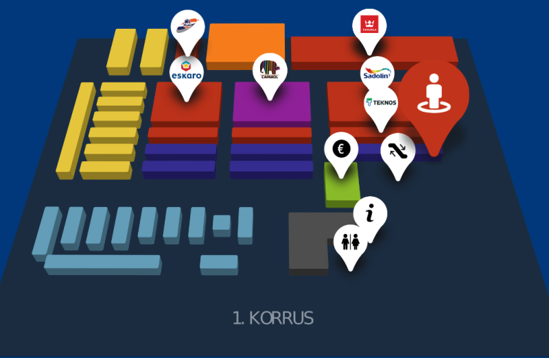
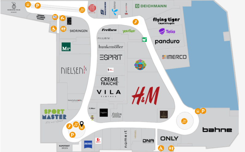
A similar simplified map is suitable for shopping centers, where different businesses can advertise themselves by the logo attached to the map, and it is much easier for the customer to find the desired location.
Wayfinder solution of a large shopping center in Denmark with logos
Color based design
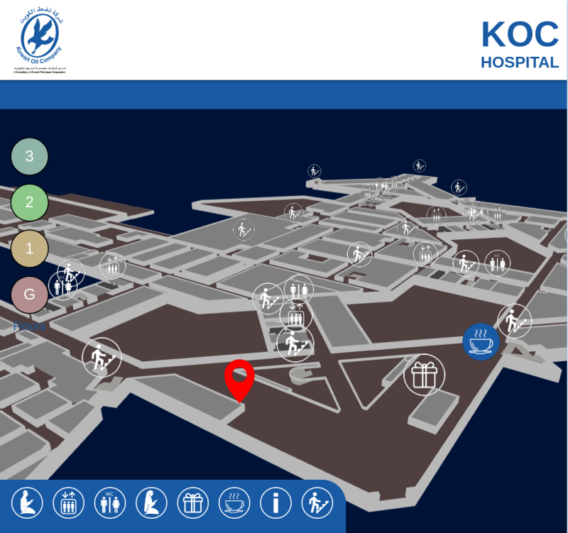
The designing 3D map can be based on the colors of the website or logo. For example the Kuwait Oil Company hospital map is inspired by the dark blue color of their website and logo.
Kuwait Oil Company Hospital Wayfinder map
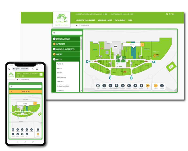
Similar to the color scheme of the Kuwait hospital, a map has also been created for IdeaPark based in Finland. The color scheme of the IdeaPark shopping center is green, and a map was made for them with the same color scheme.
Map solution for the IdeaPark shopping center in Finland with mobile integrations
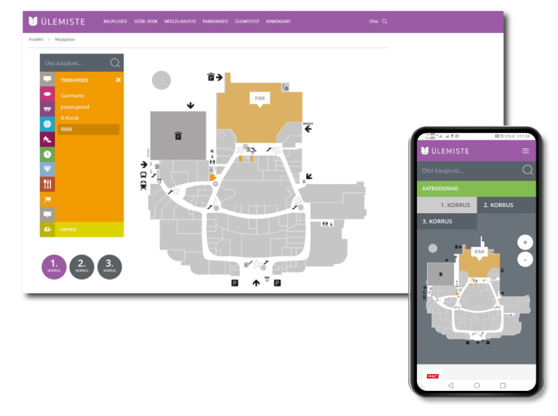
In addition to 3D models and maps, 3D Wayfinder also offers the option of creating a mobile app. The Ülemiste Center in Estonia has requested such a solution. Clients of the center can use the map application on a personal mobile device. The background of the Ülemiste Center mobile application map is displayed in a dark color to make it more visible on a small screen.
Map of the Ülemiste center with the solution of the app on the mobile device
As you have seen, 3D Wayfinder can design very unique looking maps. In addition to the big picture, there are many options for fine tuning. For example, it is possible to choose colors of the ceiling, floor, walls and other similar surfaces. It is also possible to change shapes and colors of the road guidance, shape and color of the adjacent menu and much more. All this affects the user experience and creates value for the branding of the building or company.
New 3D Demonstration Projects to Get Your 3D Wayfinder Started
July 11, 2016
We have uploaded new demo projects into 3D Wayfinder. These new 3D demonstration projects with 3D visualized models allow our users to start checking out 3D Wayfinder. Without having to upload their own model or floor plans. You can start creating a new project instantly. You can look around in our demonstration data to learn how the 3D Wayfinder works.
The new models cover a variety of different kind of buildings and model qualities. You can see the modelling of Standard and Lite versions of shopping malls. In addition to a residential building and a hospital. This allows you to access our 3D architectural visuals with our Free user. You can see the different kind of structures and textures yourself. All these functions are available for use by registering with 3D Wayfinder.
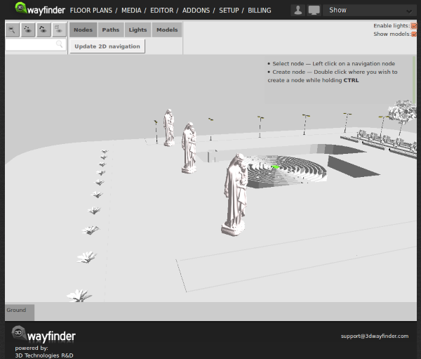
You can also use the projects to take a look at the options of editing and creating your own paths into the 3D architecture. In the “editor” panel you are able to create and delete paths made out of nodes and direct people where you want them to. This will allow you to see how the software will look like in the wayfinding kiosk.
You just need to create an account and start discovering the possibilities of 3D Wayfinder.
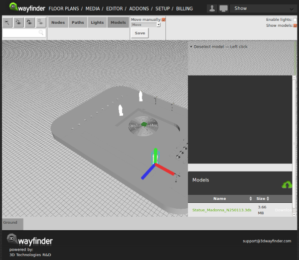
Preview of Inserting External 3D Models to Floor Plans
June 17, 2015
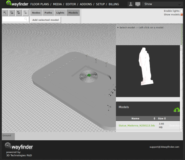
Currently we are developing features to insert external 3D models to floor plans. With this it would be possible to add these “little details” (like escalators, benches, trees or even cars). That make the floor-plans look realistic. The best thing is, that it doesn’t require any 3D modelling skills. So all our users can detail the floor plans by themselves.
3D object library can be opened in Editor window with object thumbnails:
Added objects appear on the 3D scene. The good part here is, that the same model can be used inside the scene many times. Therefore it doesn’t increase the downloadable model sizes as each model will be loaded only once.
With external 3D models. We will definitely provide common library of models we are using to detail the floor plans. For example these will include trees, cars, different indoor plants, escalators, tables, stairs and so on. See our user manual.