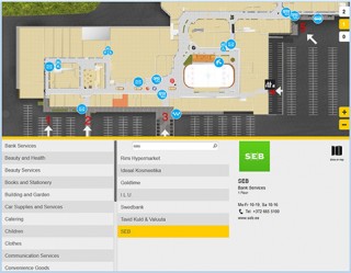
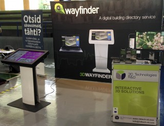
Wayfinder With Digital Signage Software

November 2, 2017

We have tested 3D Wayfinder integration with Digitalsignage.com software. Integrating wayfinding with digital signage media management gives additional purpose for advertising screens.

DigitalSignage.com is created by MediaSignage Inc. It is free digital signage software. Including signage player and media content management. Their software is used in over 200 countries. Since the first release, the software has been installed on hundreds of thousands of PCs.

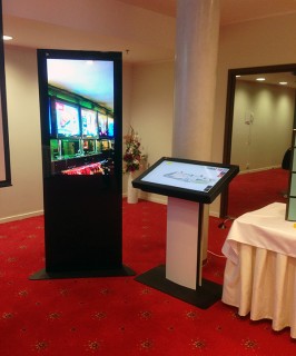
DigitalSignage.com software is web-based. So it is really easy to use 3D Wayfinder as a part of the media player screen layout. Let’s say, that there are top and bottom advertisement banners on the portrait screen and wayfinding application is set-up on the middle of screen.
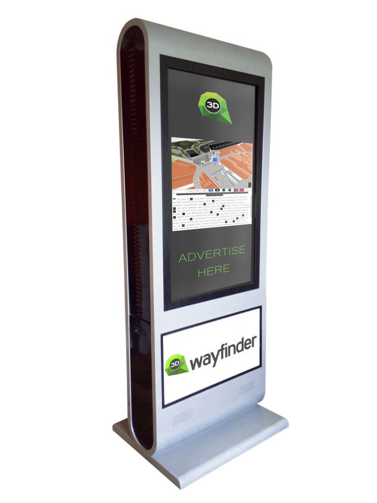
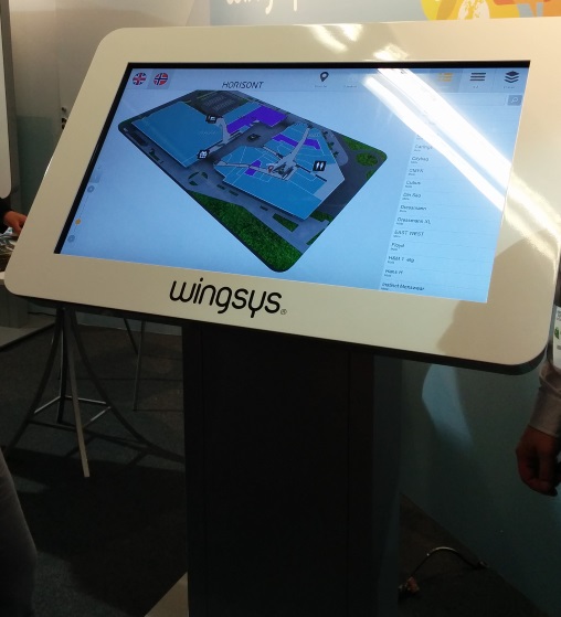
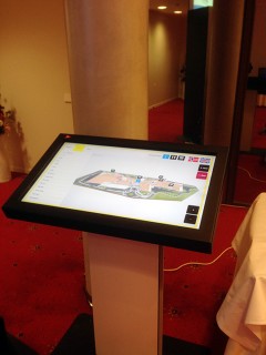
Wayfinder kiosk

Screensaver mode

More advanced integration is switching advertisements with wayfinding application. This is something, we call “screensaver mode” when creating layouts for 3D Wayfinder. With Digital Signage software the simple way is to switch between wayfinding and advertising screen. Digital signage itself lets you create switching timelines, channels and content. We do not go into that much. Because there are plenty of examples in their documentation.

More sophisticated way to change between 2D map and screensaver can accomplish with event and triggers. Under Digitalsignage.com documentation http://docs.digitalsignage.com/ look for remote values. It describes what should be include in your app to be able to send event to their server.

Two functions that are important in 3D Wayfinder events case are ‘onSessionStart’ and ‘onSessionEnd’. They both are used by our statistics module. But if you do not have any need for statistics then you could overwrite these functions.

With signage free version you can use our 2D map with ease. Just include HTML component into your campaign and add link to your project.
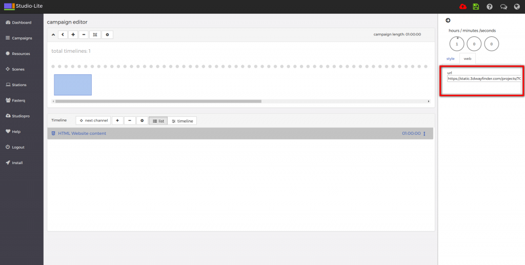
digital signage

From documentation we could find out that signage players HTML component does not support webgl. But according to docs we should be able to get out 3D maps working with Browser component and signage player should be working on windows machine. Browser component is available for enterprise users.

« »

Wayfinding Kiosk with Raspberry Pi

July 11, 2017

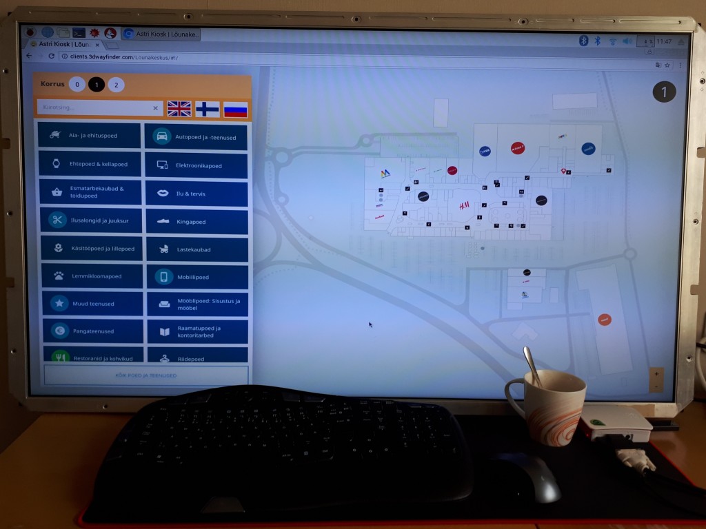
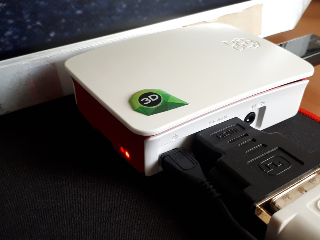
We have recently experimented with a Raspberry Pi 3 Model B, to see how it can work as media player for digital signage display or wayfinding information kiosk. As a result we can say, it works well with 2D wayfinding maps and with 3D Wayfinder Advertisement Module.

What is Raspberry Pi?

Raspberry Pi is a small credit card sized linux based open source computer. It is equipped with:
– Broadcom 64-bit quad core CPU clocked @ 1.2 GHz,
– 1GB of RAM,
– built-in WLAN and BLE modules,
– HDMI output.

But everything is soldered to the board hence there is no option to upgrade, except for the microSD card. You can also have a nice box for it, so it doesn’t look like a hackers development board.

Raspberry Pi

Compared to other small form factor computers like Intel NUC or Gigabyte BRIX, it is much cheaper. Raspberry Pi with a nice case and microSD card would cost about 50..70 USD. The NUC or BRIX boxes start at 110..130 USD new, and you still need to equip them with a hard drive (SSD/HDD) and memory module(s) (DDR3/DDR4 SO-DIMM RAM) which would cost you about an extra 30 USD for a 32GB SSD and ~25 USD for DDR3 or ~30 USD for DDR4. Totalling up to about 165..190 USD.

Raspberry PI plays in Full HD, so it is not a problem to use large resolution screens.

Wayfinding with Raspberry Pi

Enable WebGL

For 3D the Raspberry is still a bit weak and by default it doesn’t have WebGL enabled. To enable WebGL you have to:
1. Open up the terminal application (or command prompt if you prefer to call it that)
2. run command sudo raspi-config
3. navigate to Advanced Options
4. enable GL support.

The GPU on the Raspberry PI 3 Model B doesn’t support floating point textures, so we cannot use transparent textures.

To build wayfinding or digital signage project based on Raspberry Pi you need to use a special linux distribution that opens a browser in full-screen mode instead of the regular desktop interface.

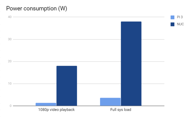
At the same time the kiosk based on Raspberry Pi is quite bullet-proof. There’s no need to worry about excessive power consumption as it actually only consumes about 3.7W under full load and only about 1.4W when playing a FullHD video, which is roughly 10% of the Intel NUCs ~38W while under full system load and ~18W while watching a FullHD video.

chart

It boots up fast from a microSD card which can be easily replaced when it wears out or breaks.

Although remote managing a kiosk that uses a Raspberry Pi can prove to be quite a cumbersome task as you cannot use regular GUI remote management tools like Teamviewer or LogMeIn. The fastest way to remote manage the Raspberry Pi is to use SSH, which is a CLI (Command Line Interface) and this might scare-off most of the users that are not used to poking around via a CLI.

« »

New Features in 3D Wayfinder

January 15, 2016

With the end of 2015 and the beginning of this year there are many new features added to 3D Wayfinder. The goal of these changes was to add flexibility to customizing the behavior of the 3D map and wayfinding. Custom models for path, path types, POI options and many more.

In parallel with large customer projects, we have added many new features to 3D Wayfinder. Most of them were requested by our customers and we have added them as features/settings for all our users. Below are listed the most important ones.

Custom models for path visualizationcustom_path_models_wayfinding

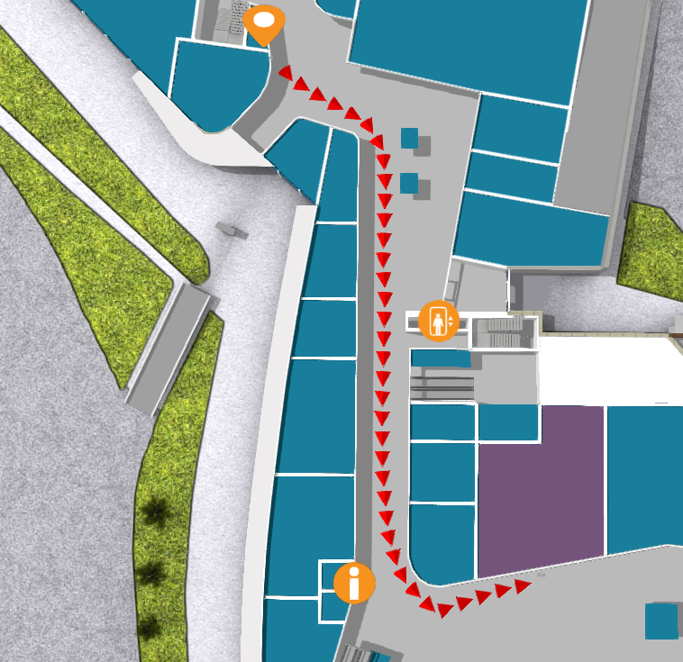
It is now possible to choose your own custom models for path visualization. Path models can be different kind of arrows, footprints or simple tubes/lines. Changing path visualization models can be done under settings.

In near future we’ll add some sample path models also to our blog.

Path types and accessibility paths

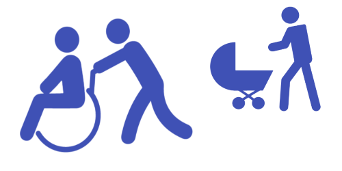
It is now possible to add different kind of inaccessibility attributes to the path . This can be used for defining paths  that are also accessible with wheelchairs and/or baby strollers. This also enables defining other kinds of areas, like paths for service personnel etc.

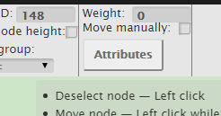
Currently it has to be entered to the node attributes in json object format:

{

“inaccessibility”: [

 “wheelchair”

]

}

wheelchair_wayfinding_inaccessibility_Path_types_and_accessibility_paths

The nodes with these kind of restrictions cannot be used for path finding with “wheelchair” option. It is useful to set these restrictions for stairs or doors.

To use the inaccessibility in user interface, you have to change the accessibility option first:

this.wayfinder.accessibility = “wheelchair”;

Then it is possible to use the same show path method:

this.wayfinder.showPath(poi.node, poi);

And after showing path, just change the accessibility option back to blank:

this.wayfinder.accessibility = “”;

Also check out our blog post about how to set up time dependent navigation rules.

POI specific options

Advanced_POI_settings_specific_options

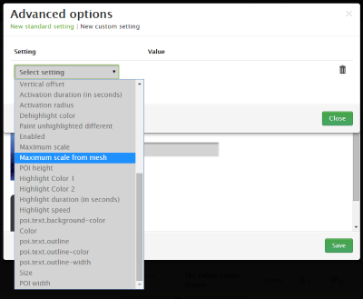
It is now possible to create special settings for each POI (location). These settings can be chosen from the list of all POI settings, like the size of the billboard image or billboard text size, highlight color, activation radius, billboard height etc.

This feature allows to customize the map by locations, for examples larger shops can have larger texts or text colors can be set by each shop. Also it makes easier to use logos or icons on the map, as the billboard images don’t have to be the same size anymore.

In the future it is possible to add new settings that can be used when developing your own template.

Top-down view for Path showing

path-top-down-view-for-path-showing

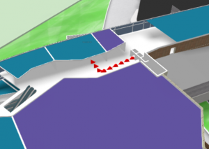
Now there is a simple option under settings to turn the map to top-down view when showing the path.

In general it is not a good idea to show the “You are here” location from top-down view, but rather  from certain angle (especially when it is possible with real 3D models as in 3D Wayfinder), which provides a better overview of the map and also makes the map look better.

Now when using the same angle, as displaying the “You are here” location, and visualizing the path, it may happen that the visualized path might not be visible. This is due to tall objects like walls that might block the view of the path. Using the top-down view during path visualization solves this problem.

Pause options between changing floors

According to valuable customer feedback, the transition of switching floors happens too quickly , which might be a bit confusing for the end-users. We solved this issue by adding the “pause-time” option to the settings. With this option it is possible to adjust the duration of the pause before switching to the next floor. The pause duration can be defined in seconds,  which makes it easiest to find  the proper delay that helps  all wayfinder users to understand, which floor they have to go to.

Kiosk view enhancements

In addition to being able to save the view angle, it is now possible to save the zoom factor for “kiosk view”. By clicking the “You are here” button, the map assumes the “kiosk view” saved in the editor.

In the future we will add this view option as a separate object so the view can be linked with any location or node.

« »

Towards Rule-Base Wayfinding

September 25, 2015

Future in wayfinding includes definitely possibility to create complex rules for path finding. Now there are also node restrictions in 3D Wayfinder to specify working days etc.

One of the last addition to 3D Wayfinder was node weights for calculating optimal paths. This made possible to guide visitors in some recommended way. Now there is also possible to restrict some nodes based on time and day.node_restrictions_wayfinding_paths_by_date_and_time

In many public buildings, there are rules for locking doors, elevators or gates. There can be different areas open during working hours than weekends or night times. This is common for shopping malls, train stations, university campuses etc. Even large office buildings are keeping some doors open during the weekends as there might be service providers like dentists, children playrooms etc. When providing wayfinding to your visitors, it is important to follow the same rules.

With 3D Wayfinder, it is possible now to create path restrictions according to work-day and time. To create this kind of restrictions, just open node attributes under editor.
Under Node attributes in 3D Wayfinder Editor, there can be entered JSON. In future we will provide also special UI for that.

Here is the example that will allow to pass the navigation node from 10AM to wayfinding_paths_restriction_node_attributes9PM:

{
“allowedTimes”: [
[
10,
21
]
]
}

Adding other blocks, you can also specify by days.

We are currently developing also other rule types, like security or accessibility. These rules help to create adaptable and user-friendly way-finding applications which are useful and finally elementary for large buildings.

« »

3D Wayfinder Redesigned Website Launched

February 17, 2014

We are proud to announce the release of our newly redesigned website which goes live today 17.02.2014. It is located at the same address www.3dwayfinder.com. New website is more modern and user-friendly. Improved and re-designed landing page welcomes visitors with clean exquisite design. With featured content focused on providing our clients and partners the most accurate product information. You will immediately notice simple navigation options. Also easy access to information that is important. The website will be updated on regular basis with news, events, product updates and other new contents.

We hope You will like and enjoy the new website. Also we would very flattered if You will stop by at the new site.

If You have any suggestions on how we could make the website even better, don’t hesitate to share it with us by clicking here.

Wayfinder

3D Wayfinder MobileNew website includes many improvements and new features. Some of the most important ones are listed below:

  • Improved navigation.
  • Precise overview of kiosk, mobile and web application.
  • Overview of different maps (3D, semi 3D and 2D).
  • Technical information.
  • Categorized resellers and their contact details.
  • New design is fully responsive. Which means You can now enjoy all of the content on mobile phones and tablets.

« »

Welcome to ISE 2014.

January 17, 2014

We are pleased to invite You to join us at Integrated Systems Europe 2014 trade show.

ISE may be the world’s most attended trade shows for the professional AV and electronic system’s industry. 3D Technologies R&D will be attending with one of our hardware partner Astro Baltics.

What is the trade show about?

There are a lot of new exciting technology solutions and we want You to have the opportunity to see all of them. In 2013 ISE attracted over 44,000 attendees, where 894 exhibitors occupied more than 33,000 square meters of total net floor space. There were more than 1,000 new products launched and because of that it is one of the most waited and important events in the industry.

When and where?

4-6 of February in Amsterdam. Information about location, opening hours & admission prices You can find by clicking here.

How to register? 

All the information about the registration You can find from here.

You can find us at booth8-F312.

Hope to see You there.

« »

October 2013 Newsletter

October 4, 2013

We are pleased to announce that we have made ​​significant progress in the development of a WebGL version of 3D Wayfinder. We are planning to implement it in Atrium shopping center in Russia. WebGL and the power of HTML5 gives new cool designing opportunities for upcoming projects.

Our partner, Akzia Apps has created a super-awesome design. In the near future we will offer You this exclusive chance to be one of the first who gets a glimpse of this cool project. We plan to create all our future projects in WebGL to provide better user experience.

3D Wayfinder does not mean 3-dimensional buidling directory

The whole 3D Technologies R&D team is putting a lot of energy into product development to provide better navigation (wayfinding) for our existing and future partners. We are devoting a lot of time into innovating and testing new solutions. Our team is convinced that the best solutions grow out from engaging in dialogue with users of our products.

Our latest customer surveys revealed that there is also a market for more simpler version of 3D Wayfinder for smaller buildings with smaller budgets. We already receive requests for such solutions and hopefully first one will realize soon.

2Dmap-LK

Maximize ROI

Advertising on smartphones and tablets has shown rising trends in the world and it is becoming more important information channel. 3D Wayfinder is an excellent channel for advertising to reach all user groups. It enables to advertise on all three platforms kiosk, mobile and web, which makes the solution an effective e-commerce channel.

Mobile & Web version

To meet the needs of our customers we have launched a mobile version for Android and iOS users. Windows Phone users can expect the mobile app soon. It has all the basic functions – search, deals, map etc. The building map is 2D so it could work smoothly and simply on most smartphones and tablets. The map is converted from 3D to 2D, to preserve its preciseness and to automate the process of updating. Exactly the same content that is in the kiosk and web version. All managed from one CMS. Mobile offer even more possibilities to integrate different custom solutions like social networks, loyal customer schemes, timetables and other useful features.

You can download the mobile app from your app store by searching “Lounakeskus” or, simply just scan the QR code below.

qrcode_256

If you wish to see the web directory in action then visit Lõunakeskus website (South Center).

We would appreciate any feedback, so if You have any questions, recommendations or desire for cooperation, just let us know.

« »

3D Wayfinder at Rock IT Con

August 27, 2013

3D Technologies R&D presented it’s 3D Wayfinder software at Rock IT Con 2013 fair from 24-25 of August. It was a first time event specialized on bringing together IT companies from Russia and Estonia. Our software got a lot of attraction by many companies and also by visitors from the street. We had a good opportunity to present some of our projects on our partners ML Novator’s kiosk.

3D Wayfinder @ Rock IT

« »