QR Code, Why and How in Wayfinder Software!

July 26, 2022

We have all seen QR codes in product labels, marketing ads, on business cards, in logistic labels, self service solutions and many other places. Today you can even get it free on online platforms like QR Code-Monkey . But did you know that QR code is very handy in indoor tracking and wayfinder software?

Here are five ways we can apply QR code to make life easier for end users:

QR code scanned indoor positioning map on smart phone - 3D Wayfinder

1. QR code helps you avoid viruses!

QR code scan allows to use indoor positioning software on your phone with out need to touch kiosk glass. This option is in use especially in healthcare industry. It is easier for older people as well, as you do not need to download anything to your smartphone. After scanning QR code you can open HTML page with map and use it like on self-service kiosk but on your phone. And there is no fear that you can catch viruses by touching public use self-service kiosks.

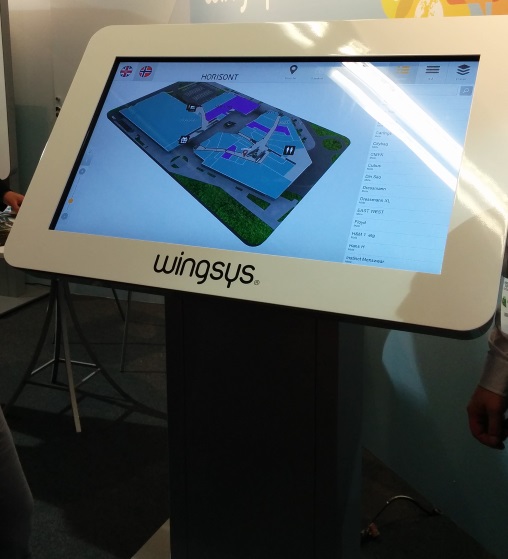
2. QR code on 2D & 3D wayfinder software UI!

Self-service kiosks are often pricey and placing it in every floor is out of the question. This is especially case in big hotels, hospitals and universities with more than 5 floors. Even departments stores like to use this option for their visitors and they have self-service kiosk on every floor. Placing QR code on kiosk UI then visitors can easily scan it and carry on their journey with map on phone. There is no need to find another digital signage stand, you have it now on your smartphone. When done, you can easily close HTML page and no software stays on your phone.

3. QR solution for city blocks or old town map!

I understand, first question is: “but everyone can use Google maps?”. Yes of course, it is absolutely an option. But there are time when city or business centers with multiple buildings want more customized solution. This allows to use unique design and better search option, for example tourist attractions. When outdoor self service kiosk can be vandalized or climate is not very welcoming for hardware then QR code can be user proof solution. Then tourist can scan QR code from printed outdoor city maps and get map to phone. Outdoor we can use GPS tracking and get live movement on software making it like customized Google maps.

4. QR code with native app!

Using QR solutions and ibeacons with native app gives a lot more option. iBeacons gives you live movement on map, knowing exactly where visitors are positioned. For example, if we cover parking lots with QR codes, then client can save their location and app remembers your location. After shopping you can get direction back to your car with out hassle. You might think: “But I have never seen this anywhere”. In reality, it is used extensively in Middle-Eastern countries where department stores are huge. You can apply this practice in many other sector, for example in healthcare. To find a way in hospitals you scan QR code, specially made for specific floor and hospital wing. Scan it, get your location and find quickly way to next doctor cabinet. Same way you can apply it in larger business centers.

5. QR code inside indoor positioning software!

Indoor positioning software is not a place you put extended information of companies and stores. Simply, people just use kiosks for direction, read quick intro or look when businesses or stores are open. In this case it is good option to use QR code to give extra information or listed company e-store link. If store is closed, visitor can still check kiosk and scan QR code to open e-store link on smartphone and save it for later purchase.

You have QR code project in mind or idea but not sure id it can be done.

Contact us or get a quote from us we will find just right solution for you!

3D Wayfinder team.

« »

Compass Widget for 3D Floor Plans

February 15, 2017

We have added compass widget for Developers Template. Compass arrow can be shown on top of the map canvas to point to the north (or any other direction) of the 3D floor plan.

Compass is one of the tools and widgets that is needed for one of our larger building information (BIM) project. There are also other tools under development that provide building information and help work with different data related with building 3D model.3D_Wayfinder_using_compass_widget

Compass widget is using 0-point of the Y-axis. It is called with Camera view-port service orbitController.  It has property currentRotation, which holds the model’s rotation data.  Needle of compass is animated using that data.
Compass example is integrated into Development template. Template can be accessed via the administration panel at admin.3dwayfinder.com when selecting the view with template “DevTemplate”.

When using compass, it is important to notice, that the 3D floorplan has to be modelled north pointing to Z axis. Otherwise you need to make adjustments in widget’s javascript code, which calculates the compass’ position.

« »

New Features in 3D Wayfinder

January 15, 2016

With the end of 2015 and the beginning of this year there are many new features added to 3D Wayfinder. The goal of these changes was to add flexibility to customizing the behavior of the 3D map and wayfinding. Custom models for path, path types, POI options and many more.

In parallel with large customer projects, we have added many new features to 3D Wayfinder. Most of them were requested by our customers and we have added them as features/settings for all our users. Below are listed the most important ones.

Custom models for path visualizationcustom_path_models_wayfinding

It is now possible to choose your own custom models for path visualization. Path models can be different kind of arrows, footprints or simple tubes/lines. Changing path visualization models can be done under settings.

In near future we’ll add some sample path models also to our blog.

Path types and accessibility paths

It is now possible to add different kind of inaccessibility attributes to the path . This can be used for defining paths  that are also accessible with wheelchairs and/or baby strollers. This also enables defining other kinds of areas, like paths for service personnel etc.

Currently it has to be entered to the node attributes in json object format:

{

“inaccessibility”: [

 “wheelchair”

]

}

wheelchair_wayfinding_inaccessibility_Path_types_and_accessibility_paths

The nodes with these kind of restrictions cannot be used for path finding with “wheelchair” option. It is useful to set these restrictions for stairs or doors.

To use the inaccessibility in user interface, you have to change the accessibility option first:

this.wayfinder.accessibility = “wheelchair”;

Then it is possible to use the same show path method:

this.wayfinder.showPath(poi.node, poi);

And after showing path, just change the accessibility option back to blank:

this.wayfinder.accessibility = “”;

Also check out our blog post about how to set up time dependent navigation rules.

POI specific options

Advanced_POI_settings_specific_options

It is now possible to create special settings for each POI (location). These settings can be chosen from the list of all POI settings, like the size of the billboard image or billboard text size, highlight color, activation radius, billboard height etc.

This feature allows to customize the map by locations, for examples larger shops can have larger texts or text colors can be set by each shop. Also it makes easier to use logos or icons on the map, as the billboard images don’t have to be the same size anymore.

In the future it is possible to add new settings that can be used when developing your own template.

Top-down view for Path showing

path-top-down-view-for-path-showing

Now there is a simple option under settings to turn the map to top-down view when showing the path.

In general it is not a good idea to show the “You are here” location from top-down view, but rather  from certain angle (especially when it is possible with real 3D models as in 3D Wayfinder), which provides a better overview of the map and also makes the map look better.

Now when using the same angle, as displaying the “You are here” location, and visualizing the path, it may happen that the visualized path might not be visible. This is due to tall objects like walls that might block the view of the path. Using the top-down view during path visualization solves this problem.

Pause options between changing floors

According to valuable customer feedback, the transition of switching floors happens too quickly , which might be a bit confusing for the end-users. We solved this issue by adding the “pause-time” option to the settings. With this option it is possible to adjust the duration of the pause before switching to the next floor. The pause duration can be defined in seconds,  which makes it easiest to find  the proper delay that helps  all wayfinder users to understand, which floor they have to go to.

Kiosk view enhancements

In addition to being able to save the view angle, it is now possible to save the zoom factor for “kiosk view”. By clicking the “You are here” button, the map assumes the “kiosk view” saved in the editor.

In the future we will add this view option as a separate object so the view can be linked with any location or node.

« »

Towards Rule-Base Wayfinding

September 25, 2015

Future in wayfinding includes definitely possibility to create complex rules for path finding. Now there are also node restrictions in 3D Wayfinder to specify working days etc.

One of the last addition to 3D Wayfinder was node weights for calculating optimal paths. This made possible to guide visitors in some recommended way. Now there is also possible to restrict some nodes based on time and day.node_restrictions_wayfinding_paths_by_date_and_time

In many public buildings, there are rules for locking doors, elevators or gates. There can be different areas open during working hours than weekends or night times. This is common for shopping malls, train stations, university campuses etc. Even large office buildings are keeping some doors open during the weekends as there might be service providers like dentists, children playrooms etc. When providing wayfinding to your visitors, it is important to follow the same rules.

With 3D Wayfinder, it is possible now to create path restrictions according to work-day and time. To create this kind of restrictions, just open node attributes under editor.
Under Node attributes in 3D Wayfinder Editor, there can be entered JSON. In future we will provide also special UI for that.

Here is the example that will allow to pass the navigation node from 10AM to wayfinding_paths_restriction_node_attributes9PM:

{
“allowedTimes”: [
[
10,
21
]
]
}

Adding other blocks, you can also specify by days.

We are currently developing also other rule types, like security or accessibility. These rules help to create adaptable and user-friendly way-finding applications which are useful and finally elementary for large buildings.

« »

Offline Indoor Wayfinding

July 29, 2015

3D Wayfinder provides offline snapshot add-on to create static wayfinding application that can be used without internet connection. Read more about offline indoor wayfinding. 

Offline_Indoor_Wayfinding_with_3d_wayfinder

When kiosks or digital signage screens don’t have internet connection, then there are 2 options:
1) to use offline snapshot or
2) to install the 3D Wayfinder Enterprise Server locally.

Offline indoor wayfinding snapshot Add-on enables to save 3D Wayfinder projects for offline use. The add-on creates static files of all the assets and modifies the template file for local use. Also to use the snapshot files You need a local web server. Because modern browsers do not allow requests to local files. Read more from the offline snapshot tutorial.

Kiosk or totem set-up is the same as with using 3D Wayfinder from the web.

The only thing with offline snapshots is that after each update the files in kiosk need to be updated.

We are also offering 3D Wayfinder Enterprise Server with Administration panel and everything else, that is needed to administrate wayfinding kiosks locally. For more information, please contact our sales team.

« »