How to Cut Costs With Wayfinding Software?

November 16, 2022

It is obvious that the economy is currently in a downward trend. More and more questions rise in this regard. How can we save money and energy? Globally, more and more people are talking about saving energy. This is definitely one place where different service companies could save. In addition to energy savings, financial savings are also important. By using the 3D Wayfinder software, it is also possible to save money quite realistically.

We have previously introduced you how to earn revenue with wayfinder software, in this post we will talk about how to save through the wayfinding software.

Certainly, many shopping center managers notice that purchasing power is decreasing. The global economic recession is mainly to blame for this. When the economy is booming, people shop more and spend more money. When the economy is down, people think more carefully about where they spend their money. Might be that some people even deliberately distance themselves from shopping malls so as not to make reckless spending.

Save on labor costs

The biggest cost savings comes from labor costs. Have you thought that there is an employee in your company or institution whose work could be done by some software? For example, there are often information workers in various office buildings, shopping centers or airports. What role do the employees at the information desk mainly play? Most of the time they guide people. People use information boards to find a way to store or special room. By using the 3D Wayfinder, it would be possible to save on the salary costs of one or even several information/help workers. This is probably one big and thought-provoking place where you can cut costs with wayfinding software.

Save money by reducing printed signs

In public buildings one of the administrative expenses is certainly different signs. Business signs must be changed when someone moves out or joins. 3D Wayfinder can also help here. Using wayfinding software reduces needs for different signs and printed floorplans. Building directories and maps can be digital and can be changed without the need for printing and changing physical signs. It is even possible to install digital screens in elevators.

Using digital wayfinding also helps to save on administrative costs. In addition, it is easier for the administrative manager of the building to change tenant or rental information in one place digitally than replacing installed physical signs.

Less energy with sleep mode

One of the ways to save energy is forcing wayfinding kiosks to go to sleep mode. Sleep mode is a widely known term and probably everyone who uses a computer or smartphone is familiar with it. It is possible that many 3D wayfinder customers may not know that sleep mode can also be set for wayfinding kiosks. When there is no activity in the building and the doors are locked, the wayfinding kiosk can also be in sleep mode.

Sleep mode can also be used when the building is open. The kiosk can be set in such a way that the screen is completely dark or, for example, with the text “Click here for building map” etc. when no one is using the kiosk. When a person touches the screen, the screen becomes active and can be used.

Save with dark mode

How else would it be possible to save with wayfinder software? One of the ways to save energy could also be using dark mode. At wayfinding kiosks, it is possible to set the screen light to be brighter and darker. Darker screen use less energy.
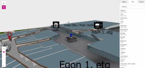
Save with wayfinding software. Energy saving and financial savings is important for service companies.
Landscape template normal bright version
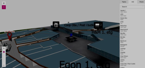
Save with wayfinding software. Energy saving and financial savings is important for service companies. Cut for labor costs and use darker mode.
Landscape template dark mode

The difference between the two images is quite large and can be startling when compared like this. In addition to saving energy, it is also better for the eyes. In any case, the customer receives the information in exactly the same way as if it were on a screen with full brightness.

3D Wayfinder offers the possibility to set the display of the kiosk in time. For example, it is possible to set the time when the screen goes into dark mode. It is also possible to set the screen based on the surrounding light. For example, if the lighting in the building is bright or the sun is shining, the screen will be brighter. If the lighting is darker, the screen will also automatically darken. Dark mode saving is easy way fot cut costs with wayfinding software.

There is also an option to use a different background color. You can choose the background colors for building maps in 3D Wayfinder. If you want to save energy, it would be wise to use a darker background. If the card has a darker background, it saves more energy because the screen doesn’t have to be so bright. Also, a darker background can sometimes work even better. On a darker background, it’s better to highlight some objects that don’t come out as smooth on a light background. This is an option that should be considered when starting to order a house manager or create one yourself.

Smart wayfinding

Do you know that 3D Wayfinder indoor positioning software using smart wayfinding technology?

Smart wayfinding is easy. The person who makes 3D Wayfinder map can choose how they want the path to be guided. For example, it is possible to guide the way that elevators are avoided. Moving the elevators up and down is probably also a big administrative expense. However, if people are guided so that they are directed to the stairs, it is possible to regulate the use of elevators.

3D Wayfinder supports energy saving. We support saving people’s time by providing innovative wayfinding software. We are environmentally friendly and recommend it to all our customers. If you are already using 3D Wayfinder you can change settings for saving energy or ask help from our team. If you are not yet using wayfinding software, then please contact our sales department. We will definitely find the best solution for you and help you cut costs with wayfinding software.

« »

QR Code, Why and How in Wayfinder Software!

July 26, 2022

We have all seen QR codes in product labels, marketing ads, on business cards, in logistic labels, self service solutions and many other places. Today you can even get it free on online platforms like QR Code-Monkey . But did you know that QR code is very handy in indoor tracking and wayfinder software?

Here are five ways we can apply QR code to make life easier for end users:

QR code scanned indoor positioning map on smart phone - 3D Wayfinder

1. QR code helps you avoid viruses!

QR code scan allows to use indoor positioning software on your phone with out need to touch kiosk glass. This option is in use especially in healthcare industry. It is easier for older people as well, as you do not need to download anything to your smartphone. After scanning QR code you can open HTML page with map and use it like on self-service kiosk but on your phone. And there is no fear that you can catch viruses by touching public use self-service kiosks.

2. QR code on 2D & 3D wayfinder software UI!

Self-service kiosks are often pricey and placing it in every floor is out of the question. This is especially case in big hotels, hospitals and universities with more than 5 floors. Even departments stores like to use this option for their visitors and they have self-service kiosk on every floor. Placing QR code on kiosk UI then visitors can easily scan it and carry on their journey with map on phone. There is no need to find another digital signage stand, you have it now on your smartphone. When done, you can easily close HTML page and no software stays on your phone.

3. QR solution for city blocks or old town map!

I understand, first question is: “but everyone can use Google maps?”. Yes of course, it is absolutely an option. But there are time when city or business centers with multiple buildings want more customized solution. This allows to use unique design and better search option, for example tourist attractions. When outdoor self service kiosk can be vandalized or climate is not very welcoming for hardware then QR code can be user proof solution. Then tourist can scan QR code from printed outdoor city maps and get map to phone. Outdoor we can use GPS tracking and get live movement on software making it like customized Google maps.

4. QR code with native app!

Using QR solutions and ibeacons with native app gives a lot more option. iBeacons gives you live movement on map, knowing exactly where visitors are positioned. For example, if we cover parking lots with QR codes, then client can save their location and app remembers your location. After shopping you can get direction back to your car with out hassle. You might think: “But I have never seen this anywhere”. In reality, it is used extensively in Middle-Eastern countries where department stores are huge. You can apply this practice in many other sector, for example in healthcare. To find a way in hospitals you scan QR code, specially made for specific floor and hospital wing. Scan it, get your location and find quickly way to next doctor cabinet. Same way you can apply it in larger business centers.

5. QR code inside indoor positioning software!

Indoor positioning software is not a place you put extended information of companies and stores. Simply, people just use kiosks for direction, read quick intro or look when businesses or stores are open. In this case it is good option to use QR code to give extra information or listed company e-store link. If store is closed, visitor can still check kiosk and scan QR code to open e-store link on smartphone and save it for later purchase.

You have QR code project in mind or idea but not sure id it can be done.

Contact us or get a quote from us we will find just right solution for you!

3D Wayfinder team.

« »

Indoor Positioning on Guide Robot, What Do You Think?

June 29, 2022

We see more and more development in robotics and machine learning. It raises the question how wayfinding software and services can be used in the future. Robots can be very helpful for visitors. Especially if we take into account older, disabled, or people in wheelchairs. Will robots help you indoor wayfinding in the future?

Today we can already see many robots in the military and in rescue. Additionally, we see great development in the service industry like in bartenders and chefs in kitchens. LG has become a significant robot developer in the service industry with their CLOi guidebot.

Robots help with indoor wayfinding

In Baltics, Hansab has their version of a service robot called Pepper. China is doing a lot of work in robotics as well, one company for example is Suzhou Pangolin Robot Co.,Ltd or Csjbot. This shows that robots are slowly but firmly entering to our everyday life.

How can robots or guide bots help with indoor wayfinding?

There are several ways how to apply robots in wayfinding:

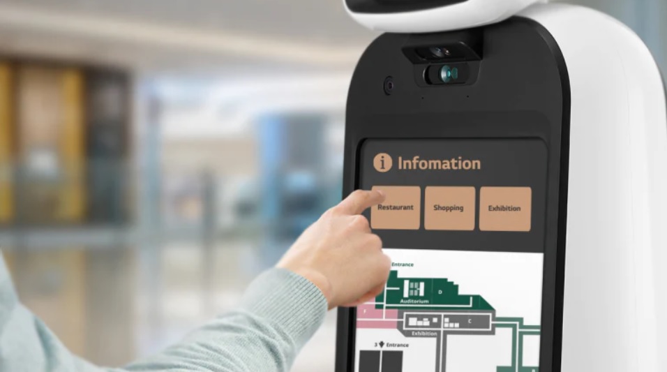
1. Robot is moving around the mall, public space, hospitals, or university. Any person who’s lost can ask floor map and directions or perform additional tasks on the robot/bot touch screen.

2. Visitor can scan a printed QR code to ask the robot to guide them to the final destination. Scanning the QR code after that robot arrives at the visitor’s location and guides him/her to the desired location. This is especially useful for visitors who are older people, disabled, or in wheelchairs. For them using self-service kiosks might be harder to do.

3. In hospitals doctors move between different rooms and services might locate even in different buildings. Robots can guide patients to the right doctor or help to find their way to the right services. Robots can be signed to one patient or for group to help and guide them. For example, after a doctor’s check-up clients can ask for directions on-screen or ask the robot to guide them all the way to a blood test and after that to X-ray. We all know how big hospitals can be, even people with a good sense of direction can be lost sometimes.

Do you have experience or ideas on how to apply robotics to wayfinding? We are happy to know your thoughts in the comment section!

Want to learn more about our software, contact us here!

3D Wayfinder team

« »

How to Create 3D Wayfinding Maps by Yourself?

May 28, 2022

How to create DIY 3D wayfinding maps? It is not that hard as it may sound.

Following post will give you an overview on how to create 3D models for wayfinding software. In addition we will share you videos of the modeling process.

Here are some general guidelines to keep in mind:

Maintain a clean quad topology and keep poly count low, no need for edge beveling and subdivisions, when the situation does not require it.

The floor, outer walls, inner walls, details, locations, stairs, elevators, locations and greyed out areas must be separate objects, please do not combine them into one.

Its also recommended to group objects of the same kind and name them accordingly.

The following videos will show some tips and tricks to make your workflow faster.

The solidify modifier will help you create quick walls for your model. You can either first model the walls and then apply solidify or do it the other way around.

Using the Archimesh addon (comes with Blender) you can make great looking stars with just a couple of moves.

NB! When you are in the process of cleaning up your Blender file like shown above, sometimes the spare material doesn’t disappear after using the purge function. If that happens then just restart your Blender project.

For a more in-depth guide go to Blender Modeling Tutorial.

Read more about modelling guidelines.

We hope you got a better understanding of how to create 3D wayfinding maps.

As always we are pleased to help you for creating a wayfinding solution for you or your customer. If you like us to make the maps, please also look our floorplan campaign and don’t hesitate to contact us.

« »

White Label Wayfinding Software is it for You?

December 1, 2021

3D Wayfinder R&D AS has much to offer. For instance, let´s talk about our white label wayfinding software. Developing your own platform is costly, long and time-consuming process. But you don´t have to develop your own wayfinding system. You can buy our state-of-the-art white label wayfinding software.

White labeling is the best way to provide a software solution without having to build it from scratch. You can save money, time, and it doesn’t require any expertise. With our white label wayfinding software you can adjust the platform with your own logo, design and colors to match your brand. You can also have your own domain name and we will provide you with all the help you might need. It is easy way to sell wayfinding system. Contact our sales team to learn more!

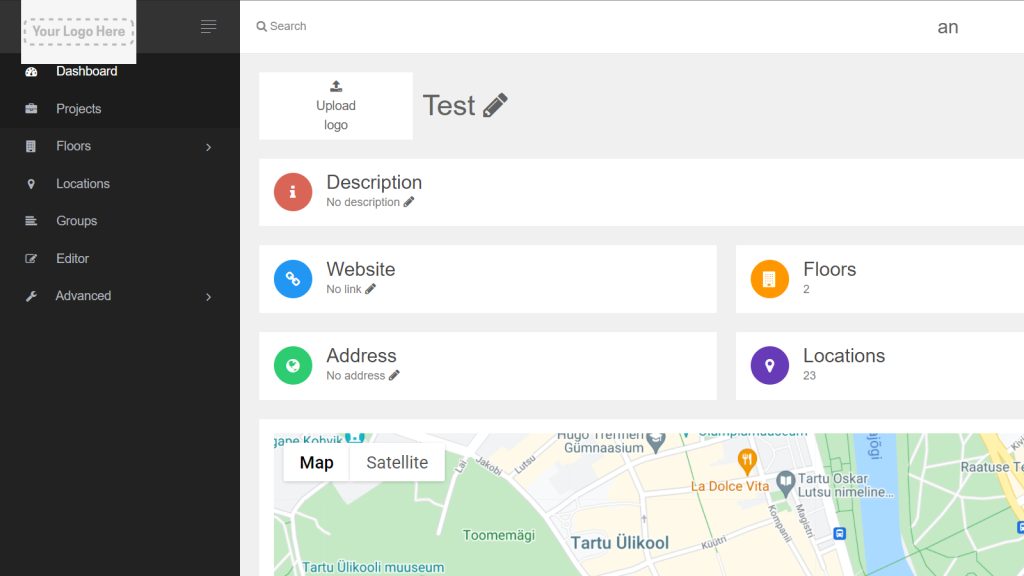
3D Wayfinder R&D AS user account insight for logo replacement.
Only one example of how we can change the logo, but we can change so much more according to your needs.

We also provide the enterprise license, which enables you to have one hundred percent control over your data and host everything locally. This makes safety one less thing less to worry about. You can customize administration panel layout, configure the security settings and decide how to integrate your wayfinding with other applications. Our 3D Wayfinder Enterprise Server license will bring you whole 3D Wayfinder application with backend software, databases, maintenance scripts etc. With any extra questions do not hesitate to contact with us.

« »

Wayfinding Advertising: Beyond the Basic

August 28, 2020

Having a wayfinding solution, for any type of establishment, is a sure way to take the visitors’ experience to a new level. Wayfinding allows people to save time and reduce stress by making navigating easy. You can get acquainted with the building and find the fastest routes. At a time of a pandemic, wayfinding also makes things safer. However there is so much more that 3D Wayfinder has to offer withour integrated solutions! For instance, let’s talk about wayfinding advertisement.

Making Full Use of Your Platform

When choosing 3D Wayfinder, you have a choice between an on-site kiosk solution, mobile application or a website integration. Or all of them! It is our view, that once you’ve chosen to have a wayfinding solution for your venue, it is silly not to apply it to it’s full potential. The two main benefits of wayfinding advertising are making the visitors’ experience more pleasant and getting a return on your investment.

Making Shopping Easier

The most obvious way to use wayfinding advertising is through banner ads displaying videos, images or animations. But we can create even more useful solutions.

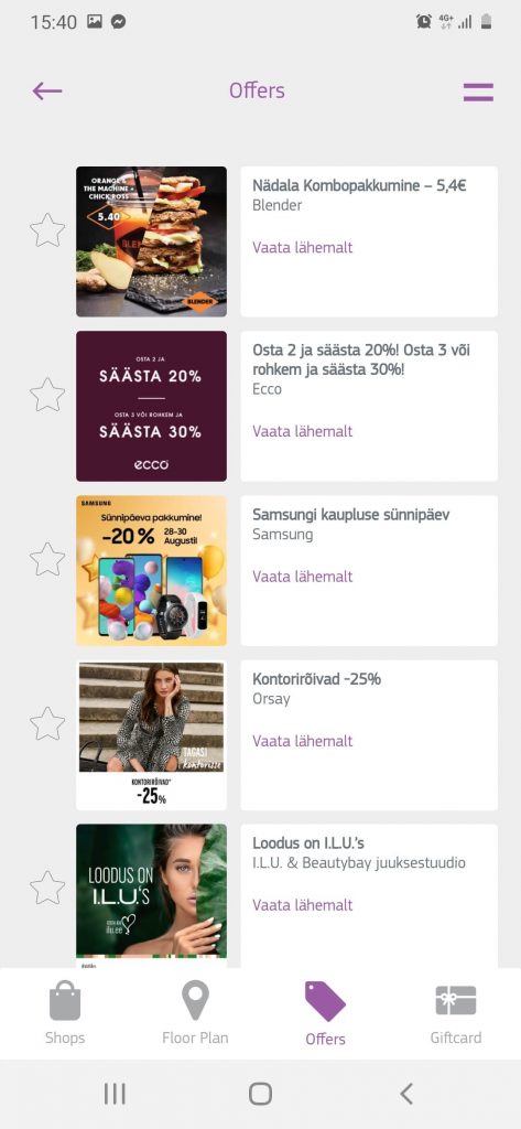
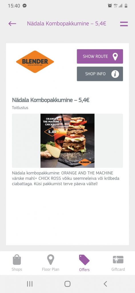
For example, imagine just going shopping without a specific item to buy in your mind. You check the nearby kiosk to see what stores there are in the center. The intuitive 3D model and building directory will give you an understanding of the building, but in addition to that, the shops with an ongoing sale are highlighted. It is also possible to develop an option to search for specific items in the mall or to browse all the items on sale. You can also give high priority stores a leg up by displaying their items first.

Another clever way to notify customers is through indoor positioning and mobile apps. As the customer is moving through the venue the mobile app can send them notifications about sales in stores that they’re passing. If the app has more detailed information about the user, like age, gender or interests, it can send out even better targeted notifications.

In conclusion, there are nearly endless ways to further integrate our wayfinding and venue management solutions into your enterprise. These innovations allow you to save money and streamline your operations. In addition the upgraded customer experience will surely keep people coming back!

To find out more you can contact us here or apply for a quote here!

« »

Increased Performance Thanks To Updates In 3D Model Rendering

April 28, 2020

Our goal at 3D Wayfinder has always been to bring affordable products and services, without sacrificing quality. Accordingly, we have made a few updates in our 3D model rendering. We are constantly updating our software to enhance your experience and to stay competitive in the venue management and digital signage market.

Like in motion pictures, computer graphics create images at a certain frequency – frames per second (FPS). This dictates how we perceive motion and the smoothness of it. For example, early silent films had a FPS of about 16-24. This was enough to give a lifelike representation of movement, that would amaze people. Our usual frame rate is 30 FPS, because anything larger is unnecessary. In addition, FPS also affects the performance of the devices that process it. Obviously, the higher the FPS and the level of detail, the more resources a device has to allocate to display it.

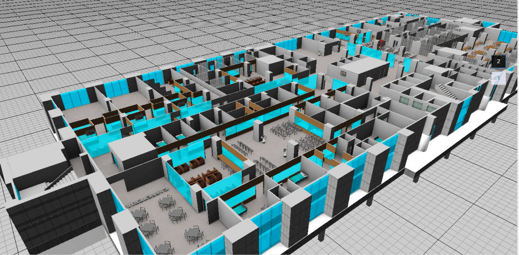
Our 3D models have a varied level of detail, according to the client’s wishes. For instance, a 3D model of a hospital can contain chairs, people and beds with pillows and blankets.

3D Wayfinder R&D AS Demo Project showcasing hospital detailed 3D map.
A screenshot from our demo projects, which you can access by signing up!

More Detailed Shadows Without Reducing Performance

In order to reduce pressure on the device’s GPU (Graphics Processing Unit) we have stopped the rendering of shadows for every frame. The position of a theoretical sun in the model is always the same. Therefore the shadows stay the same as well. There is no need to waste resources on rendering shadows again and again. The shadows still change according to the number of floors displayed. This allows the device to save energy and use it’s processing power for other needs.

Moreover, we added an option to increase the level of detail for shadows. Until now we used a 2048×2048 image for shadows, which is fine for smaller projects. Now it is possible to increase size from our settings page depending on the hardware capabilities of your project. This doesn’t reduce the device’s performance in a significant way, but does offer a more realistic experience.

These might be a small changes, but we believe that fine-tuning details like these make us the market leader!

« »

3D Wayfinder Helping Global Village Dubai Visitors to Find Their Way!

November 25, 2019

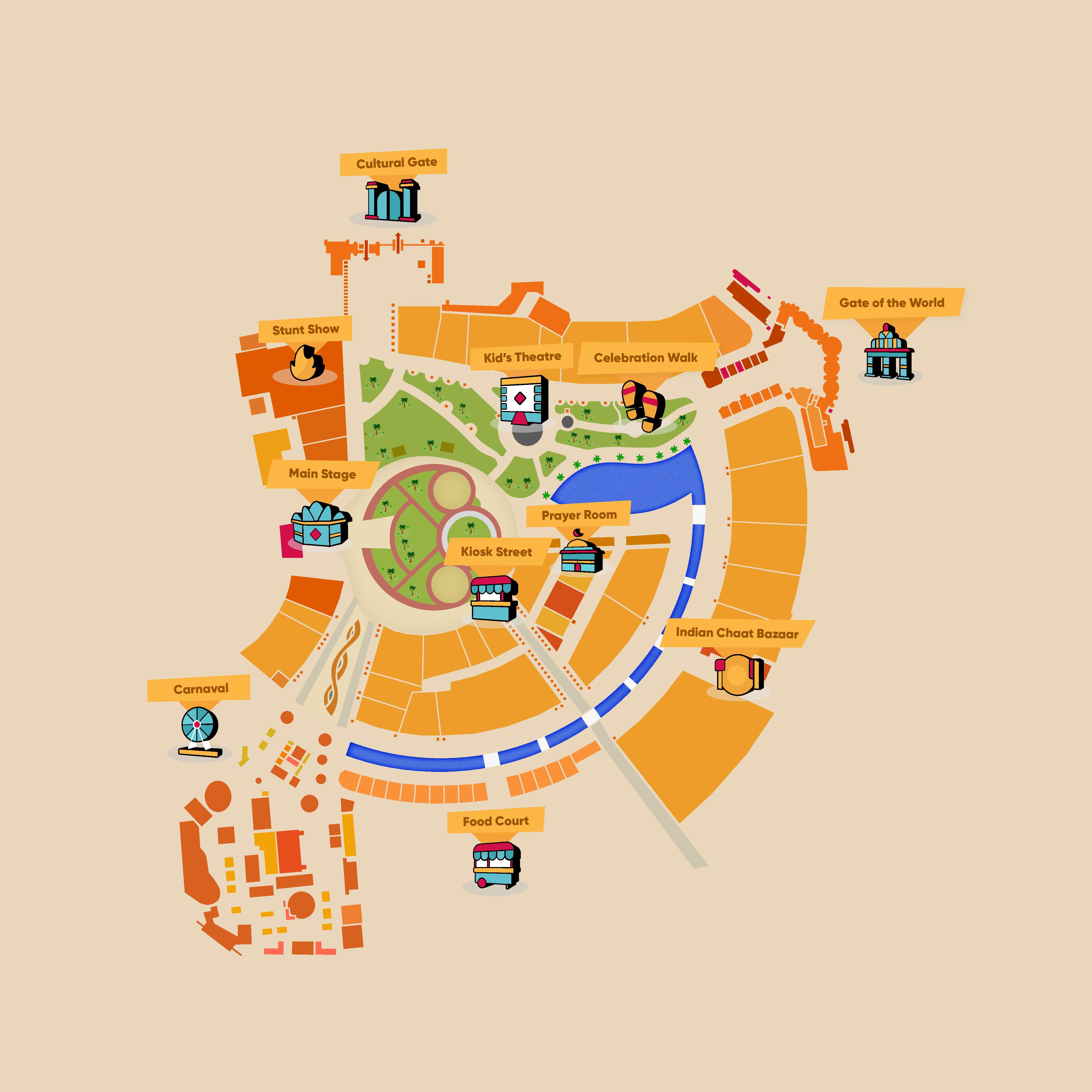
3D Wayfinder is proud to announce our new venture in helping Global Village Dubai to map their extensive theme park. Global Village is a massive theme park, where the diversity of human culture is showcased through cuisine, entertainment, music and architecture. The destination covers over 1,600,000 m2 and contains more than 200 outlets. During the 2018 season, the venue saw more than 7 million visitors! The question then becomes, how do you help guide people through this amazing maze?

3D Wayfinder helping Global Village Dubai visitors

Luckily we have the answer. In order to make navigating as simple as possible, for the very international crowd, our solution is based on Whatsapp, the most popular messenger app globally. The guest simply needs to type in where they want to go next and they will receive in return an URL, which will direct them to our Wayfinding resource. The device’s location will be located through GPS and the quickest route to the desired destination is generated. In addition, information about the attraction will be shown, e.g opening times, upcoming events or the menu. Convenient, right?

This is simply a 2D application of our capacities. We are providing our Wayfinding solution indoors as well, where relying on GPS isn’t an option. The basic concept is still based on triangulation, but instead of using satellites we utilize Bluetooth beacons. iBeacons and Eddystones are Bluetooth low energy devices that can broadcast their identifier to nearby portable electronic devices such as mobile phones or tablets. The other option is for people to insert their current location, e.g Starbucks, and their destination. This would make finding your way through an unfamiliar airport much less of a hassle. For instance, our Wayfinding solution for Changi airport in Singapore has without a doubt saved quite a few travellers from missing their flight. This is how 3D Wayfinder team helping Global Village Dubai visitors.

Contact us now to get the wayfinding solution that will meet your needs!

« »

Turning the Map, Based on the Location of the Kiosk

January 2, 2019

Lately we developed a wayfinding software for a newly renovated mall in Tartu, Estonia. The solution there is simple with just 2D map with no possibility to rotate or drag the maps on the screen. Users get to choose their point of interest on the menu and a route pops up on the map leading the way. In case the location is on another floor, the software simply switches around to show the route on the correct floor.

As 3D Wayfinder is a web-based application, then each kiosk is using web browser with kiosk specific URL for the wayfinding project. The URL specifies kiosk ID, so that wayfinding software can identify which kiosk is being used and count usage statistics. Also URL parameter can specify the rotation of 2D map.

How it´s work?

To make it easier how it works we bring you an example of changing the URL:

1)Let’s say that you have a kiosk with ID number 1. Normally the URL for that kiosk would look something like this: http://clients.3dwayfinder.com/NameOfYourProject/?kiosk=1#!/

2) To rotate that you just need to add “&map2DRotation=90#!” after the kiosk ID number. Here’s an example: http://clients.3dwayfinder.com/NameOfYourProject/?kiosk=1&map2DRotation=90#!/

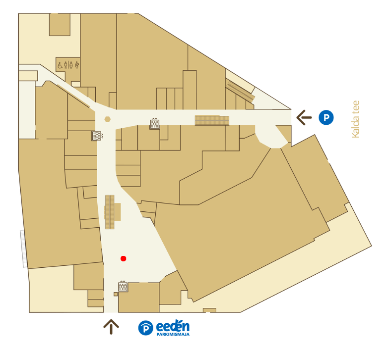
Here is an example of how the map looks on the kiosk inside the main entrance:

Screenshot 2019-01-02 at 13.55.53

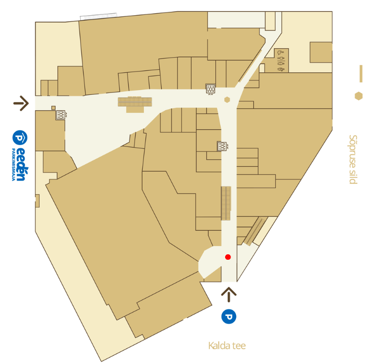
The red “You Are Here” icons make the map universal. Below is an example of the same map being used next to another entrance, the picture is just simply turned toward the user of the kiosk and the “You Are Here” icon placed in front of that particular entrance. This additional solution makes the user experience a lot more straightforward.

Screenshot 2019-01-02 at 13.41.09

It is also possible to use different kind of arrows for the ”You are here” icon. This way it is simple for the users to understand which way they are standing and how the kiosk is placed in the mall.

« »

Use of Wayfinding Kiosks After Extending a Mall

December 18, 2018

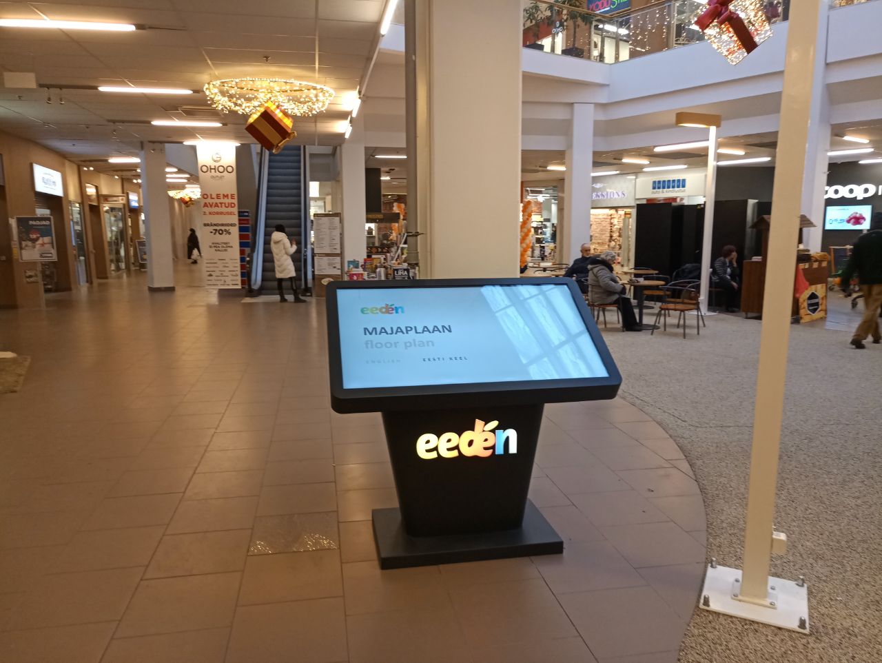
Shopping mall “Eeden” in Tartu has just got a new look with some new 9000m2 of shopping area. After rebuilding the mall three wayfinding kiosks were also placed. We were happy to deliver them a beautiful and simple wayfinding software.

Lately we had opportunity to develop a wayfinding software to a mall that had just gone thru renovation process. Considering that before the adding the extension it was rather a small shopping center with just 18 000 m2 of total area. After adding another 9000 m2 of commercial area. Including new entertainment opportunities like cinema and bowling alley. It was essential to make sure that their costumers will find their desired location. Old shops are in new places. New shops have been advertised but neither the old or new clients know where to find them. We were happy to help them out and make wayfinding fun and easy.

Eeden

Our opinion is that every mall deserves a wayfinding software to make sure that their costumers are happy and that they have a chance to discover different possibilities in the mall.

« »