Voice Recognition for Wayfinding

May 5, 2023

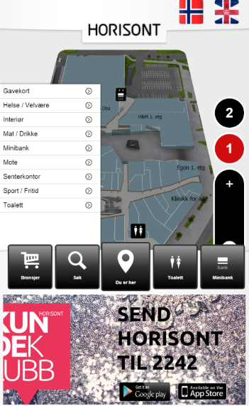
We are currently developing voice recognition feature for 3D Wayfinder. It will allow visitors to use wayfinding software without using touch-screens. Just say where you would like to go and wayfinder software will show you the way.

Voice recognition is becoming more popular and as the quality recognizing words is becoming better and mobile screens becoming smaller. It would be convenient to use voice orders instead of using touch-screens. Of course, there are privacy issues, as most of the voice recognition is done in servers. But for wayfinding software this is not an issue, as the wayfinding screens are public and nobody will make their private conversations near wayfinding screens.

How voice recognition for wayfinding works?

Let’s say you are looking for closest exit, toilet or just want to get a beer. So you just say “Exit”, “Closest toilet” or “Wayfinder, where can I get beer” and 3D Wayfinder can show you the route.

3D Wayfinder will use keywords and location names for voice recognition, the same way search functionality works. More keywords defined in wayfinder make the vocabulary larger. But definitely there will be AI implement in future. This will give much more possibilities. For example visitors canaska pint of Budweiser without “Budweiser” being entered as a keyword and still get to place where they can buy beer. Might be that the beer is not sold by pint. But at least they can get beer.

We can use languages for voice recognition, that are select in Wayfinder software. Languages can be add under settings in 3D Wayfinder administration panel. If possible, voice recognition can be active for all languages simultaniously. If not, we can use default language for voice recognition without selecting anything. After selecting prefered language wayfinder can switch also language for voice recognition. This depends capabilities of kiosk or touch-screen PC. Also, the challenge is to filter out background noise as wayfinder screens are usually in main entries and places where are more people around.

In future, voice recognition in wayfinding software will be available for all customers. It has to be turn on under settings and it would also require template that allows voice search. We will add this feature to our basic templates. So far, we can implement it in custom templates. So if you order custom template from us, we can also make search by voice available.

« »

Loading Wayfinder Application over CDN

April 6, 2023

We have added CDN support in 3D Wayfinder. CDN makes loading 3D Wayfinder application faster especially outside Europe. Currently it is available only for custom projects, but soon it will be option for all 3D Wayfinder customers.

CDN or Content Delivery Network is a geographically distribute servers that cache content close to end users. A CDN allows for the quick transfer of files, media etc. It works best for static content. In 3D Wayfinder it is basically possible to load all wayfinding content including maps, location data, images, application files etc. CDN is widely used by sites with huge traffic like Facebook, Netflix, and Amazon.

CDN is currenlty available for 3D Wayfinder custom projects and we have to make manual changes to make it work. We would like to open it for all 3D Wayfinder users, but this will still need some development and testing.

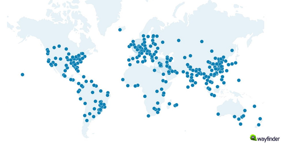
CDN server network copies files to more than 200 locations over world and when the wayfinding application is load, the files will be served from closest server.

3D Wayfinder CDN servers all over the world

During the testings we got loading improvement more than 60%. Lodaing speed was around 6 seconds from CDN compare to 16 seconds from 3D Wayfinder server.

Delivering content over CDN needs static content. This means that the content from databases has to be cached first. For any live-data like positioning or statistics, CDN cannot use. As wayfinding maps don’t change that often, it is easy to make the location information and maps to be as static content. Just after every change in 3D Wayfinder administration panel, the content has to be submit to CDN network also.

If you are already 3D Wayfinder customer and like your wayfinding to be load over CDN, please contact our sales department or your contact person in 3D Wayfinder. We will keep you posted through our blog and let you know when CDN-option will be available for all users in administration panel.

« »

Indoor Positioning on Cruise Ships

February 27, 2023

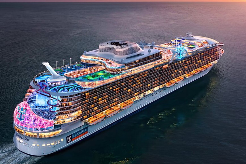
The world biggest cruise ship “Wonder Of The Seas” has more than 2800 rooms and accommodates more than 6900 people. Wonder of the Seas measures 1,188 feet (362 m) in length and has a gross tonnage of 236,857 across all 18 decks. Since all rooms and activities are compactly together on cruise ships, it is necessary for people to have all the information on important activities and locations. Indoor positioning on cruise ships is an important comfort for the passengers. We present to you the indoor positioning solution for a cruise ship created by 3D Wayfinder.

World Biggest Cruise Ship “Wonder of The Seas”

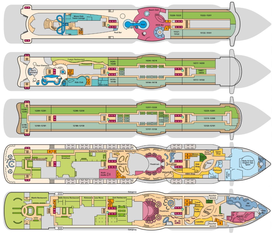
So far 3D Wayfinder has been used with a simple 2D map for small cruise ship. The ship has a total of 17 floors and around 1000 rooms. Below you see excerpts from five different floors.

Digital wayfinding kiosks and Indoor positioning in cruise ships is very important. 3D Wayfinder offer Digital navigation solutions for cruise ships.

Cruise ships have many different leisure options. As you could see on the photo, there are pools, saunas, a theatre, different shops, kids playground and many more. If you are going to be spending time on a cruise ship, it is very important to know where the different rooms and areas are from the very beginning.

Using GPS on metal vessels is difficult. Indoor positioning on cruise ships can be organized using iBeacons, WIFI or QR code that can be opened through a web browser. 3D Wayfinder has used all the proposed solutions and we know exactly how to build the system in a way that would be the most suitable for the customer.

Digital maps on cruise ships

On large ships there is a high risk of getting lost. Therefore, it is important to have interactive maps in various places on the ship. 3D Wayfinder map shows the route to the desired location with a red line. In comparison to regular printed maps, digital maps significantly reduce the time it takes to search for a location. On regular maps, it is very difficult to determine your location and then understand where you want to go.

Easily updated information boards in the elevators

In addition to the possibility of finding the location, 3D Wayfinder also offers information boards that can be installed in the elevator. Information about events on the cruise ship can be added to the screens. You can also share information about meal times and the use of other important services, which is necessary for all visitors. In addition, it is very easy for employees to exchange information on the screens.

Digital maps on a cruise ships as billboards

Most people do a lot of shopping on cruise ships as cruise ships often have better prices than regular shopping centers. In order for different shops to advertise their goods, it is possible to add advertisements to the map. This can be a good way to attract people to the store. In addition to shops, services like spa could also be advertised in a kiosk. For example, additional information could be added to the location and people could view the spa services and price list without them having to go to the spa in person.

In the world of entertainment, it is important to stand out and offer customers all the comforts possible. And one of the great conveniences for visitors is certainly a practical navigation service. If you are interested in the services offered by 3D Wayfinder, please contact our sales department.

« »

QR Code, Why and How in Wayfinder Software!

July 26, 2022

We have all seen QR codes in product labels, marketing ads, on business cards, in logistic labels, self service solutions and many other places. Today you can even get it free on online platforms like QR Code-Monkey . But did you know that QR code is very handy in indoor tracking and wayfinder software?

Here are five ways we can apply QR code to make life easier for end users:

QR code scanned indoor positioning map on smart phone - 3D Wayfinder

1. QR code helps you avoid viruses!

QR code scan allows to use indoor positioning software on your phone with out need to touch kiosk glass. This option is in use especially in healthcare industry. It is easier for older people as well, as you do not need to download anything to your smartphone. After scanning QR code you can open HTML page with map and use it like on self-service kiosk but on your phone. And there is no fear that you can catch viruses by touching public use self-service kiosks.

2. QR code on 2D & 3D wayfinder software UI!

Self-service kiosks are often pricey and placing it in every floor is out of the question. This is especially case in big hotels, hospitals and universities with more than 5 floors. Even departments stores like to use this option for their visitors and they have self-service kiosk on every floor. Placing QR code on kiosk UI then visitors can easily scan it and carry on their journey with map on phone. There is no need to find another digital signage stand, you have it now on your smartphone. When done, you can easily close HTML page and no software stays on your phone.

3. QR solution for city blocks or old town map!

I understand, first question is: “but everyone can use Google maps?”. Yes of course, it is absolutely an option. But there are time when city or business centers with multiple buildings want more customized solution. This allows to use unique design and better search option, for example tourist attractions. When outdoor self service kiosk can be vandalized or climate is not very welcoming for hardware then QR code can be user proof solution. Then tourist can scan QR code from printed outdoor city maps and get map to phone. Outdoor we can use GPS tracking and get live movement on software making it like customized Google maps.

4. QR code with native app!

Using QR solutions and ibeacons with native app gives a lot more option. iBeacons gives you live movement on map, knowing exactly where visitors are positioned. For example, if we cover parking lots with QR codes, then client can save their location and app remembers your location. After shopping you can get direction back to your car with out hassle. You might think: “But I have never seen this anywhere”. In reality, it is used extensively in Middle-Eastern countries where department stores are huge. You can apply this practice in many other sector, for example in healthcare. To find a way in hospitals you scan QR code, specially made for specific floor and hospital wing. Scan it, get your location and find quickly way to next doctor cabinet. Same way you can apply it in larger business centers.

5. QR code inside indoor positioning software!

Indoor positioning software is not a place you put extended information of companies and stores. Simply, people just use kiosks for direction, read quick intro or look when businesses or stores are open. In this case it is good option to use QR code to give extra information or listed company e-store link. If store is closed, visitor can still check kiosk and scan QR code to open e-store link on smartphone and save it for later purchase.

You have QR code project in mind or idea but not sure id it can be done.

Contact us or get a quote from us we will find just right solution for you!

3D Wayfinder team.

« »

New Improvements for 2D Floor Plans

January 30, 2018

We have added a couple of improvements for 2D floor plans, that make uploading 2D floor plan images easier. We are also working on couple of new features. That will make using 2D maps much easier.

3D and 2D maps share the same data in 3D Wayfinder. This is for using 3D and 2D side by side.

As 2D maps will be shown in 3D Wayfinder editor as textures on a plain. There are couple of requirements that have to be filled, like texture shape and size.

2D floor plans

Now we have added automatic texture resizing. So 2D map images don’t need to be square-shaped anymore. The longest side should still be at least 1024 pixels, if its less, the map will be resized to this value.

We will also resize the map to the closest larger power of two when none of the sides is 1024, 2048 or 4096 pixels. The ratio between the sides will stay the same so the map image will not be distorted after resizing.

We require the longest side to be 1024 pixels. But if you want to have a large and good quality map, then uploading an image with 4096 pixel side is a way to go.

Shopping center 2D floor map.

2D floor plans are a good start for wayfinding solution since they often already exist, so no extra effort goes into creating a map.

Right now our system allows uploading only raster files like PNG or JPG. Soon we will add new feature which enables uploading vector files like SVG. This means that maps could be zoomed in as much as needed and areas can be made clickable automatically.

We are also working towards the goal that 2D and 3D maps wouldn’t need separate templates anymore. It can be specified in the settings if you want to use the map as 2D or 3D.

This means that in the future it will also be possible to use both maps at the same time. 2D in mobile and 3D in kiosks.

« »

Wayfinder With Digital Signage Software

November 2, 2017

We have tested 3D Wayfinder integration with Digitalsignage.com software. Integrating wayfinding with digital signage media management gives additional purpose for advertising screens.

DigitalSignage.com is created by MediaSignage Inc. It is free digital signage software. Including signage player and media content management. Their software is used in over 200 countries. Since the first release, the software has been installed on hundreds of thousands of PCs.

DigitalSignage.com software is web-based. So it is really easy to use 3D Wayfinder as a part of the media player screen layout. Let’s say, that there are top and bottom advertisement banners on the portrait screen and wayfinding application is set-up on the middle of screen.

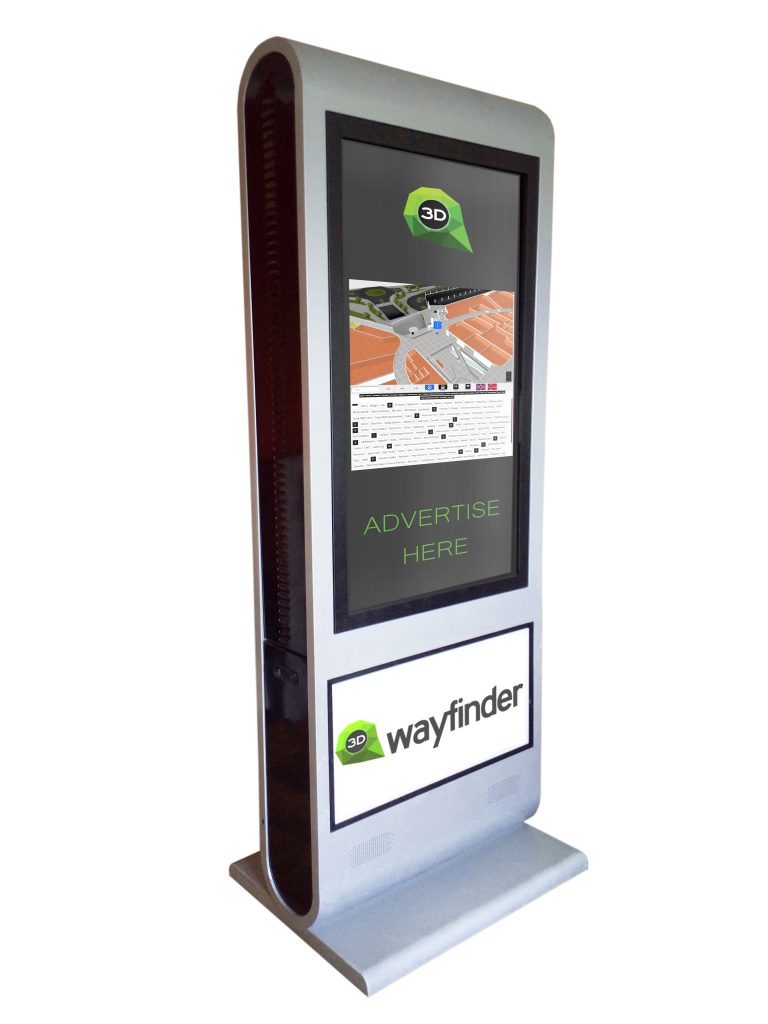
Wayfinder kiosk

Screensaver mode

More advanced integration is switching advertisements with wayfinding application. This is something, we call “screensaver mode” when creating layouts for 3D Wayfinder. With Digital Signage software the simple way is to switch between wayfinding and advertising screen. Digital signage itself lets you create switching timelines, channels and content. We do not go into that much. Because there are plenty of examples in their documentation.

More sophisticated way to change between 2D map and screensaver can accomplish with event and triggers. Under Digitalsignage.com documentation http://docs.digitalsignage.com/ look for remote values. It describes what should be include in your app to be able to send event to their server.

Two functions that are important in 3D Wayfinder events case are ‘onSessionStart’ and ‘onSessionEnd’. They both are used by our statistics module. But if you do not have any need for statistics then you could overwrite these functions.

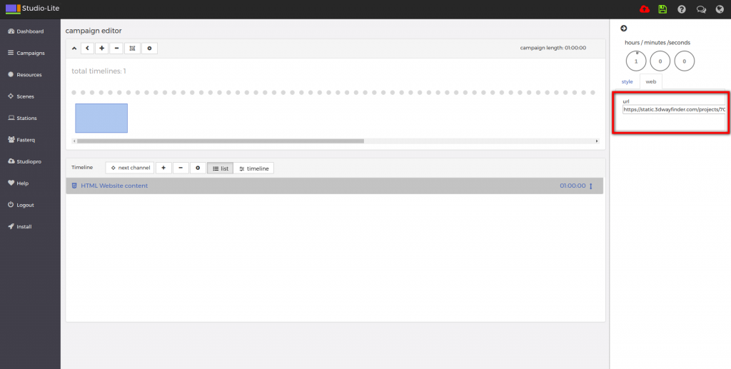
With signage free version you can use our 2D map with ease. Just include HTML component into your campaign and add link to your project.

digital signage

From documentation we could find out that signage players HTML component does not support webgl. But according to docs we should be able to get out 3D maps working with Browser component and signage player should be working on windows machine. Browser component is available for enterprise users.

« »

Request for a 3D Wayfinder Demo

October 27, 2016

Our sales team can help You to find the best wayfinding solution for You or Your customer. We can help You with creating 3D floorplans, designing a custom template and integrating wayfinding with other software. Now you can request for a 3D Wayfinder demo. 

We have made getting to know our software and our projects even easier for you than before. You can now find the request for a 3D Wayfinder demo button on our homepage.

Exploring 3D Wayfinder with your own resources is the most common way of getting to know our software. But it is even simpler if you ask for a demo and can have an interactive conversation with our people to clear out all the details of your floor plans creation needs and wayfinder requirements.

We will show you the basics you need to get started and will answer all of your questions about the software. During the demo we can also discuss any custom solutions and requests you might have.

Request for a 3D Wayfinder demo

« »

Node Weights in Path Calculation

August 21, 2015

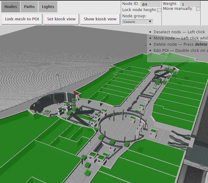
We have updated path finding functionality and path calculation. Now it is possible to change the weights of navigation nodes in 3D Wayfinder floor plan editor.

Path-finding application calculates automatically the shortest route from the starting node to the required location. In mobile applications, the Kiosk node can be your position inside the building. With 3D Wayfinder, the shortest route is calculated in a 3 dimensional room. It means the shortest path through all the floors.

Now it is possible to change the weights of the connection nodes. With this wayfinding application calculates optimal route, which doesn’t have to be the shortest. For example when you would like to guide your visitors to use the path inside the building instead of going around the building. Then you can set the weight for outdoor nodes higher. The weight is basically virtual length that will be added to the route, when passing the navigation node with a weight.

path_finding_functionality_in_3D_WayfinderTo use the weights you have to select the navigation node in 3D Wayfinder floor plan editor and change the node weight from the text box. By default all the weights are 0.
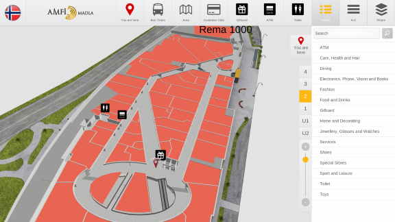
For example lets, say that waiting for the elevator takes usually 3 minutes. Lets assume, that visitors are moving with a speed of 3 km per hour, which is 50 meters per minute. So with waiting the elevator, visitor can pass 150 meters (3*50). If we would like to take account this in path calculation. Then we can add weight of 150 to the navigation node, that is marked as elevator.

Pathfinding functionality comes bundled in an add-on you can order from 3D Wayfinder Administration panel. It is also included in the Pro plan.

Read more about 3D Wayfinder’s path-finding capabilities.

« »

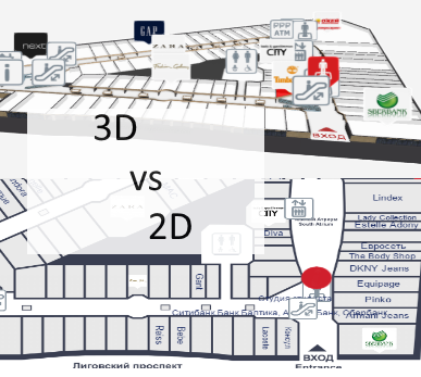
3D vs 2D Wayfinding

May 18, 2015

What is the difference between 3D vs 2D wayfinding and what are the benefits of 3D floor plans?

We have tested 3D, semi-3D and 2D floor-plans with our small focus-group and below is the short summary.

3D_vs_2D_wayfinding_maps

To see the 3D floor-plans in action, please sign up to 3D Wayfinder for creating your own 3D floor-plans, or see our 3D modelling services and examples.

3D Wayfinder supports also 2D images for creating wayfinding application.

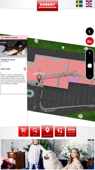
Semi-3D maps are rendered or designed floor plans, that are made to look like 3D. The map is rendered on an angle, so it is possible to see part of walls also.

We are using semi-3D maps for mobile devices, where WebGL is not supported yet.

3D vs 2D wayfinding floor plans

 3D floor plansSemi-3D floor plans2D floor plans
Overview of the building
  • 3D floor plans give a good overview of your location.
  • With 3D users see the map the way they see the building in real life.
  • It is possible to show the details, that people use for orientation inside building, for example escalators, pools, statues, tables, benches, trees etc.
  • Showing walls give a better understanding of where you are and it is easier to link the map with a real building.
  • It is easy to understand which floors have atriums and distinguish between things on different plains.
  • Semi 3D floor plans give also a good overview where you are.
  • Semi 3D can be shown only from the one angle, when looking from the other side, they can be are hard to understand.
  • Limited possibility to show the walls of the building.
  • Detailed 2D floor plans don’t give a clear overview, so it is better to use simple floor plans.
  • With simple maps the amount of details are limited.
  • It is hard for users to understand where they are and linking the map with real building is not that convenient.
  • With 2D it is not possible to show the walls of the building.
Usability of wayfinding application
  • 3D floor plans are easy to use. It is always possible to limit the zoom distances and even forbid rotation if needed.
  • Pathfinding is simple and 3D gives a good visual overview for navigating from one floor to another.
  • It is always possible to use camera view for path visualization.
  • Extra dimension enables to add more info.
  • Semi 3D floor plans are also easy to use, but it is not possible to rotate the maps.
  • Pathfinding is more convenient than 2D, as users can see some parts of the walls.
  • It is possible to add more info to the maps as 2D, but it is still not possible to add as many info/layers than 3D.
  • Rotating and moving is not that convenient, especially when looking on the vertical screen.
  • It is not convenient to guide visitors to other floors.
  • 2D floor plans should be kept simple, as there is limited space for layers and info.
  • Simple maps may not provide enough information and visitors may think, that the maps are not useful for them.
Map details and amount of information on the floor plans
  • With 3D there is one more dimension for presenting details and map related data.
  • Billboards on the map don’t disturb browsing.
  • It is possible to show details for better orientation.
  • It is possible to add more details than 2D maps, but the space for information is still limited.
  • Level of details should be kept as simple as possible, otherwise they disturb the understanding of the map.
  • Illustrated details cannot be presented in real size and it can be confusing.
Impression and imago of the building
  • 3D floor plans look nice and realistic.
  • Visitors have a sense of „controlling the building”, which makes them feel good
  • Users understand, that there has been more effort to make the wayfinding for them as good as possible.
  • Semi 3D looks prettier than plain 2D map.
  • Visitors may get disappointed when they try to turn the building, as they expect it to be real 3D.
  • With too simple 2D maps it is possible, that visitors may avoid using maps not to look foolish.
  • Detailed maps confuse visitors and they feel more lost than they were before stepping in front of the wayfinding application.
Displays and future technological possibilities
  • 3D wayfinding can work also with real 3D technologies like holograms, LED-cubes and 3D displays. Unfortunately these technologies are still in prototype phase.
  • With larger displays it is possible to add more details.
  • There is no reasonable point of showing more details with larger screen.
Advertising channel and Digital Signage integration
  • More advertisements can be shown on the maps, as the ads don’t hide the map.
  • Billboard ads on the maps look cooler and attractive.
  • Better than 2D but the advertisements still hide the map.
  • Advertisements disturb the using the wayfinding.
  • Less space for advertisements, as they hide the map behind them.

« »