Using 3D Maps in Ski Resorts

January 23, 2023

3D Wayfinder gives you innovative 3D map platform where you can build best ski resort app. All needed functions are available: 3D maps, positioning, guidance, search, filtering ski tracks and much more.

Alpine skiing is fun and many people love it. It is more than just taking the lift up and skiing down to the ski lift entrance again. Skiing is active vacation with everything it should include: planning trips, taking meals, socializing etc. You can plan your ski-routes as the longest ski tracks can be more than 10 kilometers long in Alpine region. While skiing down the hills you can enjoy the sun, have a drink in cafeterias and enjoy the social life.

3D Wayfinder gives you innovative 3D map platform where you can build best ski resort app.

There has been worries that ski resorts have less snow and the season periods of the ski resorts (when the ski-tracks can be opened) is decreasing. Weather it is temporary phenomenon or climate change is a different topics, but what we know is that ski resorts have to use modern technologies too. This is for providing better experience for all the skiers and snowboarders and manage the communication with visitors.

3D Wayfinder ski resort application

Ski resort app works on both, Android and Apple iOS, but the same way it can be used as a customized web-application or it can be embedded to any website (with some limitations in functionality).

3D maps can be very detailed because ski hill, ski tracks, lifts and objects like forests and buildings can be added. The picture shows complexity of creating 3D maps based on regular height-maps. Later there will be added ski trails, trees, houses and lifts as 3D models.
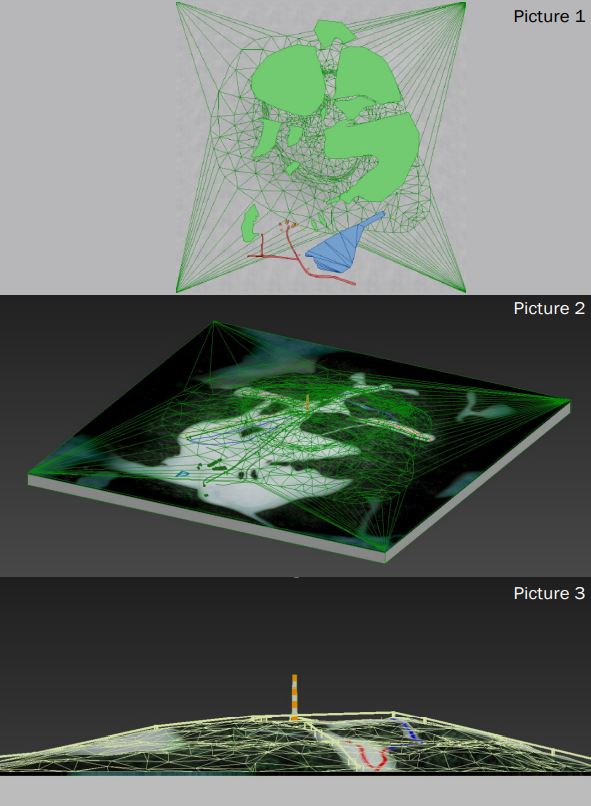
3D maps can be very detailed. The basis of the 3D Wayfinder ski resort mobile application is that app works on both, Android and Apple iOS.

To estimate the work for modelling 3D maps of the ski tracks, please contact our sales.

3D Wayfinder for ski-resorts can be accessed in different ways. 3D Wayfinder can be used in touch-screen kiosks. These can be weatherproof screens near lifts or entrances, or simple information kiosks near hotel receptions. Interactive 3D maps are certainly more advanced way to browse ski tracks than 2D drawings, we have mostly seen. 3D Wayfinder can be integrated to the website or used as web-based app. Printed signs or labels can use QR-codes to open 3D Wayfinder with the 3D map of the mountain or ski resort.

Positioning

3D Wayfinder uses Bluetooth beacons for indoor positioning as the GPS signal is weak inside the buildings. Positioning in ski resorts is much simpler as we can use regular GPS positioning. The mobile application (or web application) positions the user according to the GPS signal and will let user navigate from point A to point B. For alpine skiing, positioning allows user to see the the location so that he or she can see the tracks and find the nearest cafeterias or toilets or find the ski lift to another hill.

Application services in ski resort

3D Wayfinder offers several different options for creating a ski resort app. It is also possible to add several different services to the application. The system can be integrated with many other systems. In the application, it is possible to buy e-tickets using QR-code. In addition, you can mark the gathering places of groups anywhere on the mountain and sharing meeting point in messenger. It allow to plan your journey on mountain and select ski tracks based on your level and skills.

3D Wayfinder offers several different options for creating a ski resort app

For large mountains there is possible to add help button. If in trouble or if user need of help from ski resort staff or emergency services. User just pushes one button and their location information with help signal is sent!

Also you can use the first person view solution, which is essentially a 3D replay from descending from ski mountain. To share on social media or keep as a memory.

3D Maps and First-Person-View

In ski resorts and mountains, it is important to use 3D maps. This is because you cannot see the other side of the mountain in 2D map, but in the ski hills it is important to see the other side of the mountain where you want to go as the tracks are usually not only in one side.

First-Person-View is the term from computer games. It means you will see the game through players’ eyes. By looking the route with First-Person-View, you see how it might feels to ski down the hills in real life. It is like simulation of the skiing, so why not to go through the planned tracks by looking route in 3D.
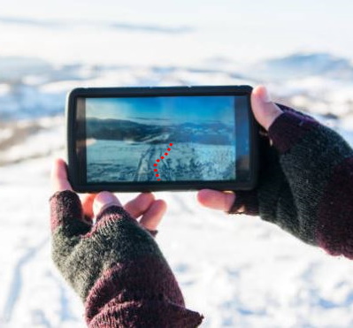
3D Maps in Ski Resorts app. 3D Wayfinder provides first person view solutions for ski resorts.

As the main land-marks on ski resorts can be modelled out in 3D, for ski lifts and tracks we can use vectors. This means that zooming out the map, will not reduce the size of the vectors. The same way you will see important roads on map applications.

For more information, please contact us.

« »

Wayfinding for Transportation Hubs

April 13, 2020

Airports, harbors, railway stations and other junctions can be massive facilities. For example, the Shinjuku Station in Tokyo is one of the busiest in the world and services a million (!) people daily. The large number of commuters, staff, supplementary businesses and the train traffic itself need to be organized efficiently. This is the reason why wayfinding for transportation hubs should be considered.

3D Wayfinding R&S AS build and develops software for transportation hubs!
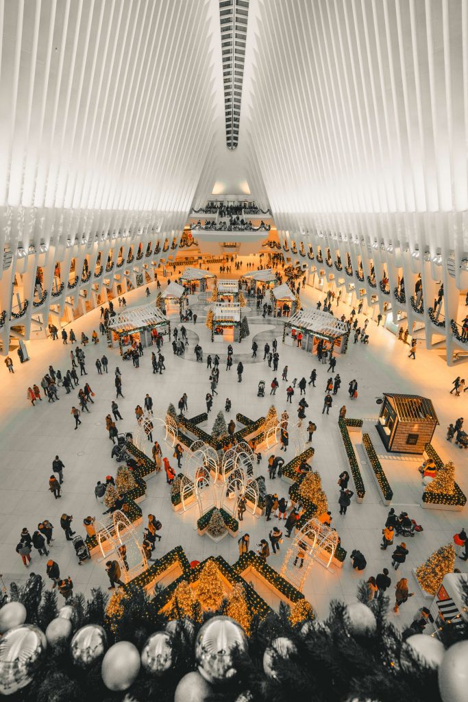
World Trade Centre Station

Comprehensive venue management systems and wayfinding for transportation hubs

Finding your way in a crowded unfamiliar place under time pressure can be a stressful experience for anyone. Having an intuitive 3D model of a transportation hub online helps people preplan their movements and also reduces the need for staff. But 3D Wayfinder solutions are so much more than just pointing people in the right direction. There are nearly endless ways to integrate the needs and functions of a a facility into our systems.

Making life easier for travelers

The kiosk solutions are an excellent example of that. Kiosks can be used to print tickets or identification cards. In the Sepinggan International Airport we created a solution that allows people to scan the barcode on their ticket and get directions exactly to the gate they need. Furthermore, it’s possible to create an integrated solution that guides travelers beyond the transportation hub. Showing relevant public transportation schedules, taxi contacts and their fares or even weather forecasts.

Untapped business potential

Implementing 3DWayfinder solutions also means opportunities for all the businesses involved with the venue. You can have local sales and special offers for the cafes, stores and restaurants. A flight is delayed? Why not have a discount for those passengers in a nearby Starbucks! With the mobile app it is easy to notify people about these kinds of special offers. Also, the mobile app is useful for letting people know about delays or other important announcements.

Increasing the venue’s efficiency

Another important aspect to consider is the managerial opportunities. It is possible to remotely control things such as lighting, humidity and ventilation. Remotely locking or unlocking doors in times of emergencies could quite literally save lives. The kiosks, website and mobile app users also provide valuable information about how travelers move and which facilities are the most popular. These insights can help make the facility more customer friendly and efficient. This in turn will increase the venues popularity over time.

Wayfinding for transportation hubs is certainly a way to take your operations to a whole new level. There are always ways to improve and to automatize certain functions. Making finding your way in a busy terminal, and therefore increasing customer satisfaction, should be a priority for all transportation hubs. Combining this with increased business and streamlined operations will be a winning combination.

Get in touch with us to learn more!

« »

Wayfinding at a Time of a Pandemic

April 3, 2020

We are facing a global public health crisis that is unprecedented. The effects of this event will have long term consequences in the social, economic, political and technological spheres. I have no doubt that we will emerge from these hard times sooner or later. It is up to us as individuals, workers and leaders to make sure that we learn from our past mistakes. Using wayfinding at a time of a pandemic can be a way to reduce human contact and to save lives.

Staying safe in these trying times

COVID-19 spreads through small respiratory droplets produced when people breathe, speak or cough. The virus isn’t airborne per se, but standing close to someone that is infected is dangerous. The best way to curb the spread of the virus is social distancing, washing your hands regularly and not touching your face with your hands.

How 3D wayfinder mobile app solutions can make user safe in pandemic time!

Many countries and enterprises have enacted measures to limit people’s movement and contact with varying results. People in the most affected areas like Europe and China are advised to stay home as much as possible. This in return means that e-commerce is booming. Everything from toilet paper and food to spare parts for machines are ordered online. Yet there are some instances where leaving the house is unavoidable.

Reducing risk through 3D Wayfinder solutions

You might need to visit the doctor in person, conduct business that might not be safe to do online or buy something essential that just isn’t available online. Making sure that these kinds of interactions are safe for everybody involved is of the utmost of importance. Using 3D Wayfinding solutions can be a useful tool in this regard and can make a small difference.

Using large screens or kiosks to guide people through buildings is an obvious way to reduce human contact. Although using kiosks should be done with caution, as it is a possible point of spreading the virus, so proper hygiene must be applied. Having an online version or a mobile app with a 3D model of the building, that tells people which corridors to use or where to find certain services saves time and is safer.

In addition to wayfinding, there are many ways to integrate other features into your solution to keep people safe. A mobile application used by a firm’s employees is a good way to communicate and to give urgent information to everybody or to specific people. For example, in case of a fire, it is possible to show people the safest route to evacuate. Or you might need to remotely lock certain doors or shut down electricity . This is also possible to integrate into your unique solution.

It is quite certain that this won’t be the last time that we face a global pandemic that requires social distancing to stay safe. Now is definitely the best time to think about your employees’ and customers’ safety and invest in it. Customers will undoubtedly recognize and gravitate towards companies that value their health. Using wayfinding at a time of a pandemic and beyond will be a worthy investment.

« »

Installing iBeacons is Easy

November 14, 2017

We have finished installation of approximately 250 iBeacons for mobile app positioning. Although the installation process is easy. There are some tricks and common practises to follow, when setting up iBeacon based indoor positioning.

iBeacons installation

iBeacons are cost effective indoor positioning devices, that are really easy to install. As each iBeacon has it’s own battery, that can last about a year, then there is no need for external power supply. Devices are very light, so it is possible to mount them by using double-sided tape.

Even though the installation of one iBeacon is a simple matter. Overall installation process can be quite long and somewhat physically exhausting due to the constant climbing up and down the ladder/platform.

At first glance it might seem that the device will disrupt the look of the building. But, as we can see from the image below, if you take into consideration the overall theme and look of the building during choosing of the device, it merges into the plethora of different sensors and equipment covering the ceiling.

Installing iBeacons

Before installing devices. It is important to mark down the specifications for each iBeacon device. Each iBeacon has it’s parameters: unique ID, name and range.

It is also a good practice to mark the iBeacons. So that you know you’re installing the correct device to the correct location. For this we used a label printer.

iBeacon

Plan before iBeacons installing

It is good to have a plan before physical installation. We used the map of the building to first draw a layout of the placement of the devices and their coverage area. It is a common practice to have a minimum of 3 iBeacons covering any part of the mappable area for the navigation to work efficiently.

iBeacon coverage map

Configuring iBeacons in 3D Wayfinder is also easy. Just create a node with type “iBeacon” and enter iBeacon parameters (UUID, Name etc.). To manage all the devices from one place, open “Beacons” from the left-side menu. You can do this prior to the actual installation when you are confident that your layout will work.

iBeacon management

It is highly recommended to install the iBeacons to a height unreachable for the visitors of the building, so no one could easily snatch them. We installed the devices onto the ceiling. For this we used a painters platform that had wheels on them so it is easy to move it around the building. We recommend setting the platform to a height so the person installing the devices could stand up straight and then reach the ceiling without having to stretch too much.

Good time to install iBeacons in a shopping mall is when there are not that many people.

Here you can find more information about using iBeacons with 3D Wayfinder. If you’d like to test iBeacon-based positioning, please submit the request form for demo iBeacons.

« »

3D Wayfinder Mobile Applications for Android and IOS

July 28, 2016

The development of our new 3D Wayfinder mobile applications for Android and IOS is in the final stages. It will be available in a short time. You will be able to create 3D Wayfinder applications for your venues and enable the download for people that will make it easy to find the way.

The app is based on the popular Ionic framework (Web based). Ionic is a very easy to setup and customizable mobile app framework. It uses AngularJS and Cordova. We will OpenSource the application source code so you can make Your own version.
We will also add Geolocation and iBeacon based positioning support in the near future.

« »

Node Weights in Path Calculation

August 21, 2015

We have updated path finding functionality and path calculation. Now it is possible to change the weights of navigation nodes in 3D Wayfinder floor plan editor.

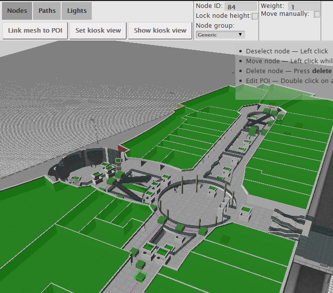
Path-finding application calculates automatically the shortest route from the starting node to the required location. In mobile applications, the Kiosk node can be your position inside the building. With 3D Wayfinder, the shortest route is calculated in a 3 dimensional room. It means the shortest path through all the floors.

Now it is possible to change the weights of the connection nodes. With this wayfinding application calculates optimal route, which doesn’t have to be the shortest. For example when you would like to guide your visitors to use the path inside the building instead of going around the building. Then you can set the weight for outdoor nodes higher. The weight is basically virtual length that will be added to the route, when passing the navigation node with a weight.

path_finding_functionality_in_3D_WayfinderTo use the weights you have to select the navigation node in 3D Wayfinder floor plan editor and change the node weight from the text box. By default all the weights are 0.

For example lets, say that waiting for the elevator takes usually 3 minutes. Lets assume, that visitors are moving with a speed of 3 km per hour, which is 50 meters per minute. So with waiting the elevator, visitor can pass 150 meters (3*50). If we would like to take account this in path calculation. Then we can add weight of 150 to the navigation node, that is marked as elevator.

Pathfinding functionality comes bundled in an add-on you can order from 3D Wayfinder Administration panel. It is also included in the Pro plan.

Read more about 3D Wayfinder’s path-finding capabilities.

« »