New map formats for 3D and 2D floorplans

August 24, 2023

3D Wayfinder supports now GLTF for 3D floorplans and SVG for 2D floorplans. This provides new features and better-looking maps.

Now there is a support for new 3D model format GLTF for 3D maps and also integrated support for SVG (vector-based images) for 2D maps. GLTF enables smaller files size and new possibilities to make 3D maps better-looking. SVG at the same time makes 2D map creation easier, as SVG is vector-based format. This allows to upload maps with mark ceilings or areas (by SVG polygons). Therefore with our wayfinding software these ceilings can be link with locations and they can be clickable and highlighted.

We will write about SVG benefits in new post also we will provide short tutorials, how to use SVG in 3D Wayfinder. Here we will cover GLTF as this opens up a whole new world for 3D maps.

In the dynamic world of web development, technology is constantly evolving to create richer and more immersive experiences for users. One such innovation that has been making waves is the GLTF (Graphics Library Transmission Format) format for 3D. GLTF is changing the game by enabling efficient and seamless integration of 3D graphics into web applications, paving the way for a new era of interactive and visually stunning online content. Now we have also GLTF support in 3D Wayfinder.

GLTF format in 3D Wayfinder

GLTF stands for Graphics Library Transmission Format. GLTF is an open standard file format design to store and exchange 3D scenes and models with the purpose to optimize transmission and rendering across different platforms and devices. The format is Develop by the Khronos Group (same consortium behind widely use standards like OpenGL and Vulkan). The goal of GLT is to remove limitations of existing 3D file formats and enabling efficient delivery of 3D content on the web.

Advantages of GLTF

  • Compact File Size: GLTF employs efficient compression techniques to minimize file sizes without compromising on visual quality. This is crucial for web applications, as smaller files ensure faster load times and smoother user experiences. With 3D Wayfinder, it will make loading 3D maps faster. Also, there is no need for converting 3D models, when uploading maps to 3D Wayfinder.
  • Ease of Integration: GLTF files are specifically designed to work seamlessly with modern web technologies like WebGL, making it easier for developers to integrate 3D content into their websites without extensive workarounds or plugins.
  • Support for PBR: Physically Based Rendering (PBR) is a technique that simulates how light interacts with surfaces in the real world. GLTF supports PBR, allowing for highly realistic and visually captivating 3D graphics.
  • Animations and Interactivity: GLTF supports animations and allows developers to define interactive elements within the 3D scene. This capability opens the door to creating engaging interactive experiences that go beyond static visuals.

Please stay tuned, as we will write more about SVG support also in near future.

« »

Voice Recognition for Wayfinding

May 5, 2023

We are currently developing voice recognition feature for 3D Wayfinder. It will allow visitors to use wayfinding software without using touch-screens. Just say where you would like to go and wayfinder software will show you the way.

Voice recognition is becoming more popular and as the quality recognizing words is becoming better and mobile screens becoming smaller. It would be convenient to use voice orders instead of using touch-screens. Of course, there are privacy issues, as most of the voice recognition is done in servers. But for wayfinding software this is not an issue, as the wayfinding screens are public and nobody will make their private conversations near wayfinding screens.

How voice recognition for wayfinding works?

Let’s say you are looking for closest exit, toilet or just want to get a beer. So you just say “Exit”, “Closest toilet” or “Wayfinder, where can I get beer” and 3D Wayfinder can show you the route.

3D Wayfinder will use keywords and location names for voice recognition, the same way search functionality works. More keywords defined in wayfinder make the vocabulary larger. But definitely there will be AI implement in future. This will give much more possibilities. For example visitors canaska pint of Budweiser without “Budweiser” being entered as a keyword and still get to place where they can buy beer. Might be that the beer is not sold by pint. But at least they can get beer.

We can use languages for voice recognition, that are select in Wayfinder software. Languages can be add under settings in 3D Wayfinder administration panel. If possible, voice recognition can be active for all languages simultaniously. If not, we can use default language for voice recognition without selecting anything. After selecting prefered language wayfinder can switch also language for voice recognition. This depends capabilities of kiosk or touch-screen PC. Also, the challenge is to filter out background noise as wayfinder screens are usually in main entries and places where are more people around.

In future, voice recognition in wayfinding software will be available for all customers. It has to be turn on under settings and it would also require template that allows voice search. We will add this feature to our basic templates. So far, we can implement it in custom templates. So if you order custom template from us, we can also make search by voice available.

« »

Indoor Positioning on Cruise Ships

February 27, 2023

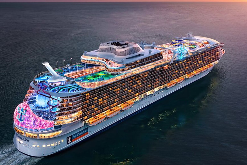
The world biggest cruise ship “Wonder Of The Seas” has more than 2800 rooms and accommodates more than 6900 people. Wonder of the Seas measures 1,188 feet (362 m) in length and has a gross tonnage of 236,857 across all 18 decks. Since all rooms and activities are compactly together on cruise ships, it is necessary for people to have all the information on important activities and locations. Indoor positioning on cruise ships is an important comfort for the passengers. We present to you the indoor positioning solution for a cruise ship created by 3D Wayfinder.

World Biggest Cruise Ship “Wonder of The Seas”

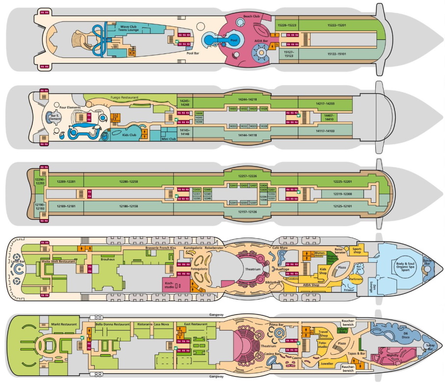
So far 3D Wayfinder has been used with a simple 2D map for small cruise ship. The ship has a total of 17 floors and around 1000 rooms. Below you see excerpts from five different floors.

Digital wayfinding kiosks and Indoor positioning in cruise ships is very important. 3D Wayfinder offer Digital navigation solutions for cruise ships.

Cruise ships have many different leisure options. As you could see on the photo, there are pools, saunas, a theatre, different shops, kids playground and many more. If you are going to be spending time on a cruise ship, it is very important to know where the different rooms and areas are from the very beginning.

Using GPS on metal vessels is difficult. Indoor positioning on cruise ships can be organized using iBeacons, WIFI or QR code that can be opened through a web browser. 3D Wayfinder has used all the proposed solutions and we know exactly how to build the system in a way that would be the most suitable for the customer.

Digital maps on cruise ships

On large ships there is a high risk of getting lost. Therefore, it is important to have interactive maps in various places on the ship. 3D Wayfinder map shows the route to the desired location with a red line. In comparison to regular printed maps, digital maps significantly reduce the time it takes to search for a location. On regular maps, it is very difficult to determine your location and then understand where you want to go.

Easily updated information boards in the elevators

In addition to the possibility of finding the location, 3D Wayfinder also offers information boards that can be installed in the elevator. Information about events on the cruise ship can be added to the screens. You can also share information about meal times and the use of other important services, which is necessary for all visitors. In addition, it is very easy for employees to exchange information on the screens.

Digital maps on a cruise ships as billboards

Most people do a lot of shopping on cruise ships as cruise ships often have better prices than regular shopping centers. In order for different shops to advertise their goods, it is possible to add advertisements to the map. This can be a good way to attract people to the store. In addition to shops, services like spa could also be advertised in a kiosk. For example, additional information could be added to the location and people could view the spa services and price list without them having to go to the spa in person.

In the world of entertainment, it is important to stand out and offer customers all the comforts possible. And one of the great conveniences for visitors is certainly a practical navigation service. If you are interested in the services offered by 3D Wayfinder, please contact our sales department.

« »

ISE 2023 Technology Expo Experience

February 14, 2023

ISE 2023 Expo is probably most important technology expo in Europe. This year it was biggest yet. ISE 2023 attracted 58,107 unique attendees from 155 countries, making 133,606 visits to the show floor. Especially busy was Multi-Technology hall. There we had most fun meeting companies too. Special thanks goes to for citizens of Barcelona. Even with limited English they left to us superb expression. We were pleased that the event was in city where people are kind and helpful for the first time visitors.

ISE 2023 Expo is probably most important technology expo in Europe. It placed in Barcelona.

ISE 2023 Expo organization

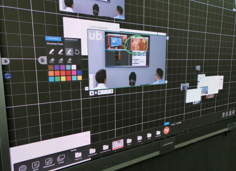
ISE 2023 Expo experience is that was really well organized Expo. There were large halls and easy to access booths. The catering was also very well organized and managed. We saw some very unique solutions. Especially interesting was 4K LED screens with IR touch. Making it suitable to use in interactive digital signage and 2D or 3D wayfinding solutions.

We saw some very unique solutions. Especially interesting was 4K LED screens with IR touch. Making it suitable to use in interactive digital signage and 2D or 3D wayfinding solutions.

In two days we when we visited expo, we got a lot of positive feedback for our software. Companies were most interested in our 3D maps that we have built for indoor navigation. Some of the companies we visited needs to be highlight also in our blog.

Nice meetings at the event

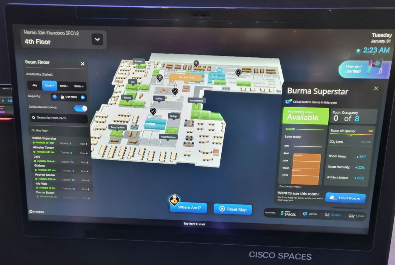
With representatives of Cisco we quickly found a common topic of conversation. We talked about smart rooms and today’s business environment. We understood in that moment how right our direction has been for years. Also especially happy to see that we have yet to offer more opportunities then international corporations like Cisco can do. This motivates us to keep working hard.

With representatives of Cisco we quickly found a common topic of conversation. We understood in that moment how right our direction has been for years.

Highly interested meeting we had was with BrightSign. Their digital signage players were interesting that can be potentially used for our software. We talked about to give better hardware tools for our clients. Especially interested us plug and play solution. Also it may be solution for our clients, who have little experience with digital signage and players for interactive screens. If everything goes well then we will have also hardware for our clients that is reliable with good price range.

We also visited booths of Clebex and Telelogos. Both are big IT companies and with very interesting field. They are definitely worth to explore. We started of right a way with productive talks and of course our topic was about potential of 3D Wayfinding. 3D Wayfinder software gives additional tools build powerful business solutions for end-clients!

Interactive displays manufactures at ISE

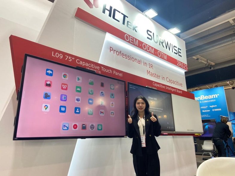
We got new and interesting knowledge in Chinese display manufacturer HCTek. Interactive displays is what future holds. HCTec is large interactive display manufacturer providing OEM, ODM and OTM solutions. Many well known display brands get their interactive displays from that factory. For us it was important to know what future brings. Talking was very productive and we had good laughs and took picture!

We got new and interesting knowledge in Chinese display manufacturer HCTek. HCTec is large interactive display manufacturer providing OEM, ODM and OTM solutions.  Picture with 3D Wayfinder director Rainer Saar.
Chinese display manufacturer HCTek. Interactive displays is what future holds.

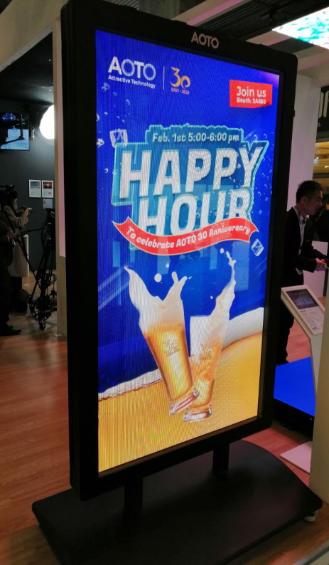
Then we met LED manufacturer AOTO. In our talks we covered many aspects of today digital signage market directions. Also we both agreed that future will be LED. Especially in indoor and outdoor digital signage field. We were also invited to their 30th anniversary celebrations to Happy Hour.

LED manufacturer AOTO. Future will be LED, especially in indoor and outdoor digital signage field.

Our sales director Rainer Saar shared his experiences.

« »

Turning the Map, Based on the Location of the Kiosk

January 2, 2019

Lately we developed a wayfinding software for a newly renovated mall in Tartu, Estonia. The solution there is simple with just 2D map with no possibility to rotate or drag the maps on the screen. Users get to choose their point of interest on the menu and a route pops up on the map leading the way. In case the location is on another floor, the software simply switches around to show the route on the correct floor.

As 3D Wayfinder is a web-based application, then each kiosk is using web browser with kiosk specific URL for the wayfinding project. The URL specifies kiosk ID, so that wayfinding software can identify which kiosk is being used and count usage statistics. Also URL parameter can specify the rotation of 2D map.

How it´s work?

To make it easier how it works we bring you an example of changing the URL:

1)Let’s say that you have a kiosk with ID number 1. Normally the URL for that kiosk would look something like this: http://clients.3dwayfinder.com/NameOfYourProject/?kiosk=1#!/

2) To rotate that you just need to add “&map2DRotation=90#!” after the kiosk ID number. Here’s an example: http://clients.3dwayfinder.com/NameOfYourProject/?kiosk=1&map2DRotation=90#!/

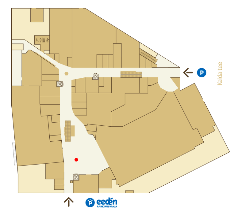
Here is an example of how the map looks on the kiosk inside the main entrance:

Screenshot 2019-01-02 at 13.55.53

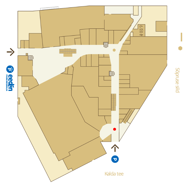
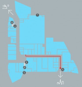
The red “You Are Here” icons make the map universal. Below is an example of the same map being used next to another entrance, the picture is just simply turned toward the user of the kiosk and the “You Are Here” icon placed in front of that particular entrance. This additional solution makes the user experience a lot more straightforward.

Screenshot 2019-01-02 at 13.41.09

It is also possible to use different kind of arrows for the ”You are here” icon. This way it is simple for the users to understand which way they are standing and how the kiosk is placed in the mall.

« »

Using Widgets in Wayfinding Application

April 13, 2018

Wayfinding applications are not just maps with “You Are Here” dot anymore. There are many possible functionalities and widgets that our customers prefer to see on their wayfinding applications. 3D Wayfinders HTML-based user interface makes it really easy to add and use such widgets in wayfinding application.

As wayfinding kiosks are usually in visible places. Visitors would also like to find other kind of information than the building map and directory listing. Large shopping malls are usually accessible via intercity bus or metro stations. It is important to find the commuting schedules. Also in larger modern shopping malls. There are integrated cinemas, which would also like to show their programme.

Nowadays people have smartphones, that can show weather forecast and date beside the clock. But still one of the things our customers are asking for quite often. This is a clock integrated to the wayfinding application.

wayfinder widgets

We have created a NPM package ‘ng.clock’ for the widget. It can be found at https://www.npmjs.com/package/ng.clock. Demo of the clocks can be found here https://codepen.io/tonister/pen/qpyBgQ. This clock widget is made as an AngularJS 1.x Directive. The choice to use AngularJS is due to the fact that almost all our latest templates have been created using AngularJS.

3D Wayfinder user interface is created with HTML. It is easy to implement any widget or integrate bus or cinema schedules inside wayfinding application user interface. Although it might be good to mention that for some of these features the API licenses are not free. If they are free then they are very limited.

Thanks to HTML5 based layouts it is easy to integrate different kind of widgets in wayfinding application. For example exchange rates, events, news, weather forecasts, social media feeds, CAP alerts, time remaining till closing.

« »

New Improvements for 2D Floor Plans

January 30, 2018

We have added a couple of improvements for 2D floor plans, that make uploading 2D floor plan images easier. We are also working on couple of new features. That will make using 2D maps much easier.

3D and 2D maps share the same data in 3D Wayfinder. This is for using 3D and 2D side by side.

As 2D maps will be shown in 3D Wayfinder editor as textures on a plain. There are couple of requirements that have to be filled, like texture shape and size.

2D floor plans

Now we have added automatic texture resizing. So 2D map images don’t need to be square-shaped anymore. The longest side should still be at least 1024 pixels, if its less, the map will be resized to this value.

We will also resize the map to the closest larger power of two when none of the sides is 1024, 2048 or 4096 pixels. The ratio between the sides will stay the same so the map image will not be distorted after resizing.

We require the longest side to be 1024 pixels. But if you want to have a large and good quality map, then uploading an image with 4096 pixel side is a way to go.

Shopping center 2D floor map.

2D floor plans are a good start for wayfinding solution since they often already exist, so no extra effort goes into creating a map.

Right now our system allows uploading only raster files like PNG or JPG. Soon we will add new feature which enables uploading vector files like SVG. This means that maps could be zoomed in as much as needed and areas can be made clickable automatically.

We are also working towards the goal that 2D and 3D maps wouldn’t need separate templates anymore. It can be specified in the settings if you want to use the map as 2D or 3D.

This means that in the future it will also be possible to use both maps at the same time. 2D in mobile and 3D in kiosks.

« »

Wayfinder With Digital Signage Software

November 2, 2017

We have tested 3D Wayfinder integration with Digitalsignage.com software. Integrating wayfinding with digital signage media management gives additional purpose for advertising screens.

DigitalSignage.com is created by MediaSignage Inc. It is free digital signage software. Including signage player and media content management. Their software is used in over 200 countries. Since the first release, the software has been installed on hundreds of thousands of PCs.

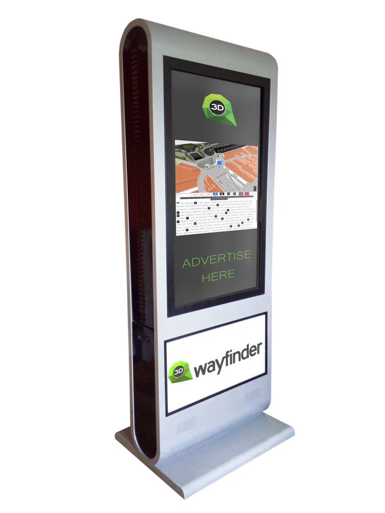
DigitalSignage.com software is web-based. So it is really easy to use 3D Wayfinder as a part of the media player screen layout. Let’s say, that there are top and bottom advertisement banners on the portrait screen and wayfinding application is set-up on the middle of screen.

Wayfinder kiosk

Screensaver mode

More advanced integration is switching advertisements with wayfinding application. This is something, we call “screensaver mode” when creating layouts for 3D Wayfinder. With Digital Signage software the simple way is to switch between wayfinding and advertising screen. Digital signage itself lets you create switching timelines, channels and content. We do not go into that much. Because there are plenty of examples in their documentation.

More sophisticated way to change between 2D map and screensaver can accomplish with event and triggers. Under Digitalsignage.com documentation http://docs.digitalsignage.com/ look for remote values. It describes what should be include in your app to be able to send event to their server.

Two functions that are important in 3D Wayfinder events case are ‘onSessionStart’ and ‘onSessionEnd’. They both are used by our statistics module. But if you do not have any need for statistics then you could overwrite these functions.

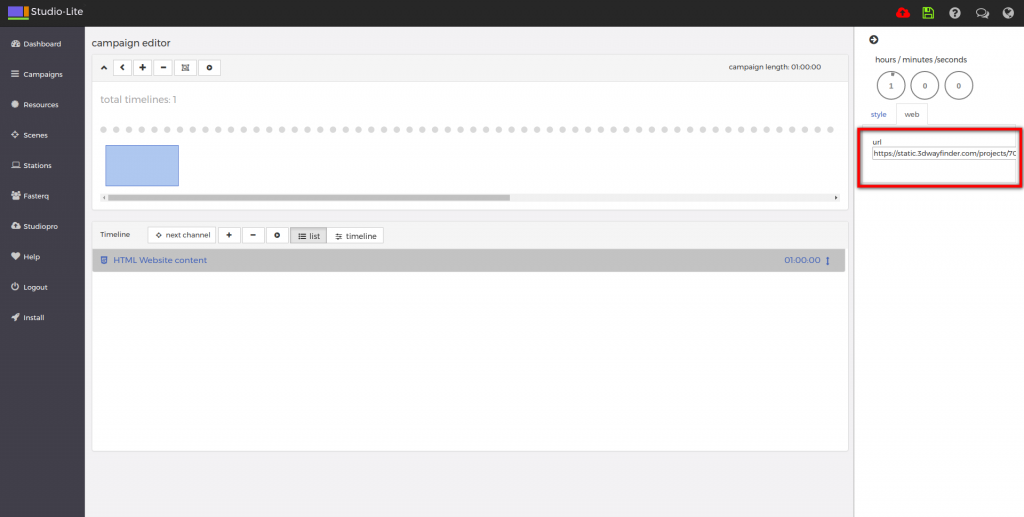
With signage free version you can use our 2D map with ease. Just include HTML component into your campaign and add link to your project.

digital signage

From documentation we could find out that signage players HTML component does not support webgl. But according to docs we should be able to get out 3D maps working with Browser component and signage player should be working on windows machine. Browser component is available for enterprise users.

« »

Keeping Floor Plan Editor Idle in the Background

August 1, 2017

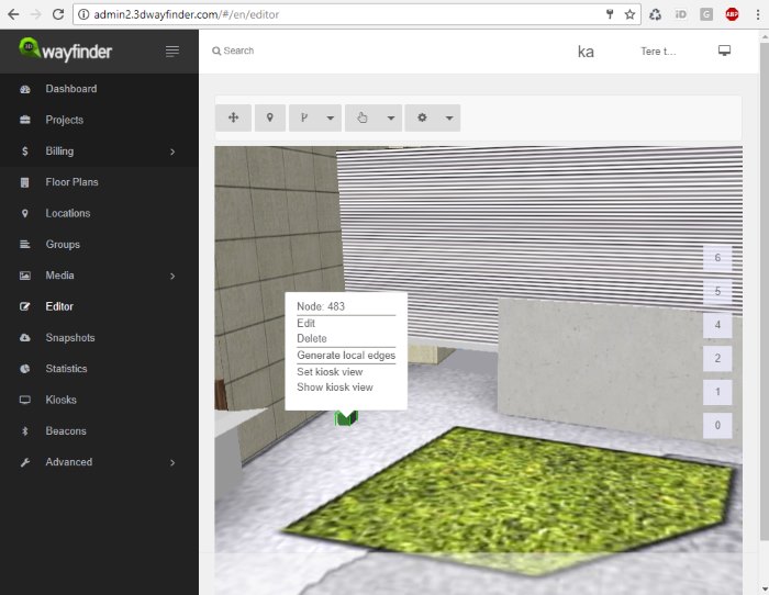
The new 3D Wayfinder Administration Panel is centered more around the floor plan editor. To provide better usability we keep the 3D editor idle when moving away to other pages. So switching between editor and other views is much faster now.

The new Administration Panel has been publicly available for testing since the beginning of this year. At the end of the summer we will only support the new administration panel. Although the current administration environment will be available for some time.

Loading the 3D floor plan editor takes a couple of seconds because we need to load 3D floor-plans models and also additional editor tools. Now when the editor is always in the background. We do not need to load the 3D editor again. This makes the usage more faster and user friendly.

new 3D floorplan editor

Our new administrator panel is being built on Angularjs. To achieve loading of editor once we have created the service that holds the canvas element. It is also attached our editor API to it. Controller then adds canvas to the editor view and provides connection to API actions.

To see and test new Administration panel and floor plan editor, please log in here. If you don’t have an account with 3D Wayfinder, you can create it here for free.

« »

Wayfinding Kiosk with Raspberry Pi

July 11, 2017

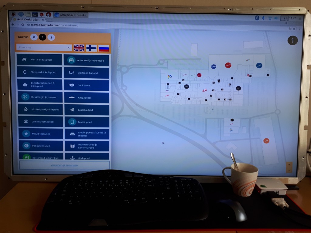
We have recently experimented with a Raspberry Pi 3 Model B, to see how it can work as media player for digital signage display or wayfinding information kiosk. As a result we can say, it works well with 2D wayfinding maps and with 3D Wayfinder Advertisement Module.

What is Raspberry Pi?

Raspberry Pi is a small credit card sized linux based open source computer. It is equipped with:
– Broadcom 64-bit quad core CPU clocked @ 1.2 GHz,
– 1GB of RAM,
– built-in WLAN and BLE modules,
– HDMI output.

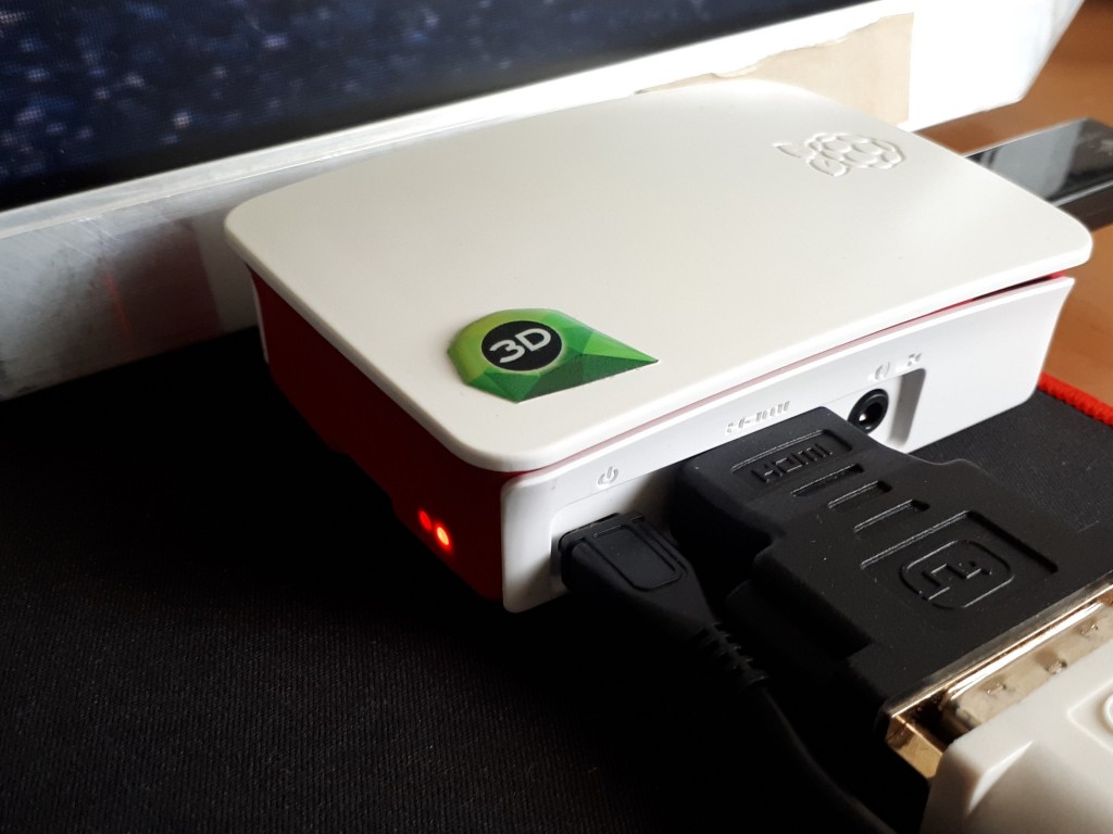
But everything is soldered to the board hence there is no option to upgrade, except for the microSD card. You can also have a nice box for it, so it doesn’t look like a hackers development board.

Raspberry Pi

Compared to other small form factor computers like Intel NUC or Gigabyte BRIX, it is much cheaper. Raspberry Pi with a nice case and microSD card would cost about 50..70 USD. The NUC or BRIX boxes start at 110..130 USD new, and you still need to equip them with a hard drive (SSD/HDD) and memory module(s) (DDR3/DDR4 SO-DIMM RAM) which would cost you about an extra 30 USD for a 32GB SSD and ~25 USD for DDR3 or ~30 USD for DDR4. Totalling up to about 165..190 USD.

Raspberry PI plays in Full HD, so it is not a problem to use large resolution screens.

Wayfinding with Raspberry Pi

Enable WebGL

For 3D the Raspberry is still a bit weak and by default it doesn’t have WebGL enabled. To enable WebGL you have to:
1. Open up the terminal application (or command prompt if you prefer to call it that)
2. run command sudo raspi-config
3. navigate to Advanced Options
4. enable GL support.

The GPU on the Raspberry PI 3 Model B doesn’t support floating point textures, so we cannot use transparent textures.

To build wayfinding or digital signage project based on Raspberry Pi you need to use a special linux distribution that opens a browser in full-screen mode instead of the regular desktop interface.

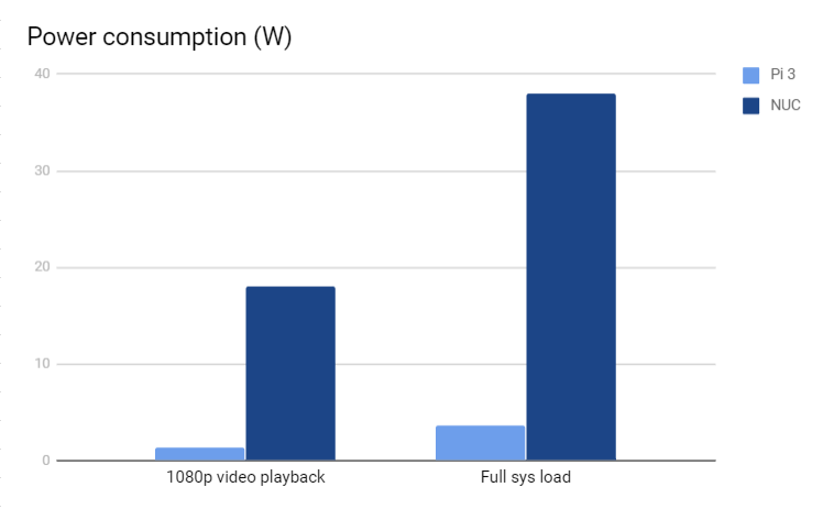
At the same time the kiosk based on Raspberry Pi is quite bullet-proof. There’s no need to worry about excessive power consumption as it actually only consumes about 3.7W under full load and only about 1.4W when playing a FullHD video, which is roughly 10% of the Intel NUCs ~38W while under full system load and ~18W while watching a FullHD video.

chart

It boots up fast from a microSD card which can be easily replaced when it wears out or breaks.

Although remote managing a kiosk that uses a Raspberry Pi can prove to be quite a cumbersome task as you cannot use regular GUI remote management tools like Teamviewer or LogMeIn. The fastest way to remote manage the Raspberry Pi is to use SSH, which is a CLI (Command Line Interface) and this might scare-off most of the users that are not used to poking around via a CLI.

« »