Branding Your Wayfinder Application

October 11, 2016

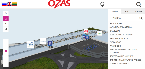
With 3D Wayfinder you can brand your wayfinding application just like it has been developed by yourself. It is possible to use custom loading bar and even get your own layout for administration panel.

We are using small watermark with 3D Wayfinder logo on 3D floor plans. But this only appears, when you are using free plan. As soon as you choose another plan, the watermark disappears.

Branding_your_wayfinder_application_using_enterprise_license

When using the Business plan it is possible to customize the loading bar of your wayfinder application.

brand_your_wayfinding_application_with_enterprise_license

With the Enterprise license it is even possible to change the branding of the Administration Panel. This way you can offer the 3D Wayfinder under your branding or integrate 3D Wayfinder inside your digital signage solution. For Enterprise licensing, please contact us.

« »

Creating Your 3D Visualizations Paths is Now Easier

September 12, 2016

Hello 3D Wayfinder users, we have put together an instruction for you to make adding locations faster and simpler. Creating your 3D visualizations paths its easier than ever before with 3D Wayfinder.

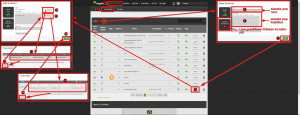
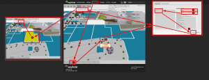
The following information diagram shows how to add locations to your floor plans step-by-step. After adding the locations you can link them to your wayfinding paths.

The first graphic shows you how to add a location to the list of locations:

3D_visualizations_paths_in_3D_Wayfinder_admin_panel

The second graphic displays the instructions how to link the roof of the location in your floor plans to the Point of Intrest in your locations list :

3D_visualization_paths_when_adding_a_new_store

Following these instructions you will be able to add locations to the 3D Wayfinder software in a couple of minutes.

Good luck in creating your 3D visualizations paths!

« »

New 3D Demonstration Projects to Get Your 3D Wayfinder Started

July 11, 2016

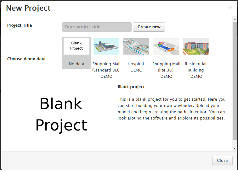
We have uploaded new demo projects into 3D Wayfinder. These new 3D demonstration projects with 3D visualized models allow our users to start checking out 3D Wayfinder. Without having to upload their own model or floor plans. You can start creating a new project instantly. You can look around in our demonstration data to learn how the 3D Wayfinder works.

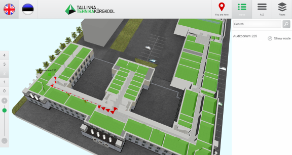
The new models cover a variety of different kind of buildings and model qualities. You can see the modelling of Standard and Lite versions of shopping malls. In addition to a residential building and a hospital. This allows you to access our 3D architectural visuals with our Free user. You can see the different kind of structures and textures yourself. All these functions are available for use by registering with 3D Wayfinder.

New_3D_demonstration_projects_shopping_mall_and_hospital

You can also use the projects to take a look at the options of editing and creating your own paths into the 3D architecture. In the “editor” panel you are able to create and delete paths made out of nodes and direct people where you want them to. This will allow you to see how the software will look like in the wayfinding kiosk.

You just need to create an account and start discovering the possibilities of 3D Wayfinder.

Get a quote

« »

New Reflection Feature in Our 3D Engine

December 18, 2015

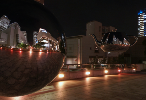
FRAK WebGL engine has now built in Cubemaps and reflection shader. This gives 3D Wayfinder access to use reflections of surrounding area.

We have added built in cubemaps and cubemap reflection shader to FRAK WebGL engine. In addition reflection with cubemaps is efficient way to create reflective surfaces like glass or mirrors.
Also cubemap reflection is a rendering method. It means that reflective surfaces reflect the cubemap textures.

Cubemaps_and_reflection_shader_frak_reflections_webGL

It will be available for 3D Wayfinder in near future. This will be the effective way to create large glass walls or buildings. It make them more realistic. It might be used also for expensive shopping mall floors.

Next feature in FRAK will be specular map to mark efficiently reflective areas.

Cubemap demo can be found under FRAK repository.

« »

Towards Rule-Base Wayfinding

September 25, 2015

Future in wayfinding includes definitely possibility to create complex rules for path finding. Now there are also node restrictions in 3D Wayfinder to specify working days etc.

One of the last addition to 3D Wayfinder was node weights for calculating optimal paths. This made possible to guide visitors in some recommended way. Now there is also possible to restrict some nodes based on time and day.node_restrictions_wayfinding_paths_by_date_and_time
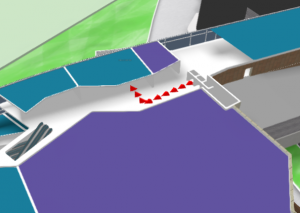
In many public buildings, there are rules for locking doors, elevators or gates. There can be different areas open during working hours than weekends or night times. This is common for shopping malls, train stations, university campuses etc. Even large office buildings are keeping some doors open during the weekends as there might be service providers like dentists, children playrooms etc. When providing wayfinding to your visitors, it is important to follow the same rules.

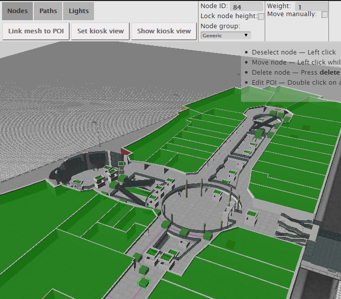
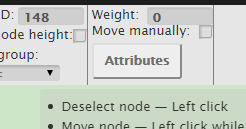
With 3D Wayfinder, it is possible now to create path restrictions according to work-day and time. To create this kind of restrictions, just open node attributes under editor.
Under Node attributes in 3D Wayfinder Editor, there can be entered JSON. In future we will provide also special UI for that.

Here is the example that will allow to pass the navigation node from 10AM to wayfinding_paths_restriction_node_attributes9PM:
{
“allowedTimes”: [
[
10,
21
]
]
}

Adding other blocks, you can also specify by days.

We are currently developing also other rule types, like security or accessibility. These rules help to create adaptable and user-friendly way-finding applications which are useful and finally elementary for large buildings.
« »

Node Weights in Path Calculation

August 21, 2015

We have updated path finding functionality and path calculation. Now it is possible to change the weights of navigation nodes in 3D Wayfinder floor plan editor.

Path-finding application calculates automatically the shortest route from the starting node to the required location. In mobile applications, the Kiosk node can be your position inside the building. With 3D Wayfinder, the shortest route is calculated in a 3 dimensional room. It means the shortest path through all the floors.

Now it is possible to change the weights of the connection nodes. With this wayfinding application calculates optimal route, which doesn’t have to be the shortest. For example when you would like to guide your visitors to use the path inside the building instead of going around the building. Then you can set the weight for outdoor nodes higher. The weight is basically virtual length that will be added to the route, when passing the navigation node with a weight.

path_finding_functionality_in_3D_WayfinderTo use the weights you have to select the navigation node in 3D Wayfinder floor plan editor and change the node weight from the text box. By default all the weights are 0.

For example lets, say that waiting for the elevator takes usually 3 minutes. Lets assume, that visitors are moving with a speed of 3 km per hour, which is 50 meters per minute. So with waiting the elevator, visitor can pass 150 meters (3*50). If we would like to take account this in path calculation. Then we can add weight of 150 to the navigation node, that is marked as elevator.

Pathfinding functionality comes bundled in an add-on you can order from 3D Wayfinder Administration panel. It is also included in the Pro plan.

Read more about 3D Wayfinder’s path-finding capabilities.

« »

Offline Indoor Wayfinding

July 29, 2015

3D Wayfinder provides offline snapshot add-on to create static wayfinding application that can be used without internet connection. Read more about offline indoor wayfinding. 

Offline_Indoor_Wayfinding_with_3d_wayfinder

When kiosks or digital signage screens don’t have internet connection, then there are 2 options:
1) to use offline snapshot or
2) to install the 3D Wayfinder Enterprise Server locally.

Offline indoor wayfinding snapshot Add-on enables to save 3D Wayfinder projects for offline use. The add-on creates static files of all the assets and modifies the template file for local use. Also to use the snapshot files You need a local web server. Because modern browsers do not allow requests to local files. Read more from the offline snapshot tutorial.

Kiosk or totem set-up is the same as with using 3D Wayfinder from the web.

The only thing with offline snapshots is that after each update the files in kiosk need to be updated.

We are also offering 3D Wayfinder Enterprise Server with Administration panel and everything else, that is needed to administrate wayfinding kiosks locally. For more information, please contact our sales team.

« »

3D Wayfinder Joined the Open Design Alliance

June 19, 2015

We have joined the Open Design Alliance to develop CAD file support to 3D Wayfinder. With CAD support it will be easy to upload building drawing files and show them directly through web.

Open_Design_Alliance_logo_wayfinder

3D Technologies R&D (developer of 3D Wayfinder) is now a member of Open Design Alliance. The Open Design Alliance (ODA) is a nonprofit organization dedicated to the promotion of open industry-standard formats for CAD. ODA was established in 1998 and now has over 1300 members.

Most of the architectural modelling is done with Autodesk CAD software packages, where DWG files are native file formats. DWG is a proprietary and closed file format and it doesn’t have open specifications. ODA has deigned Teigha library which supports the use of C++, .NET, and ActiveX interfaces. Also it allows the exchange of data through .dwg, .dgn and .stl files.

We will search the possibilities to provide also DWG file reading in 3D Wayfinder. This will open up a whole new area for 3D Wayfinder. Architects can directly upload their building drawing to 3D Wayfinder and also real estate managers, building owners etc. For example DWG files that can be viewed through 3D Wayfinder. There will be no need for converting DWG-s to common 3D formats that 3D Wayfinder currently supports.

« »

3D vs 2D Wayfinding

May 18, 2015

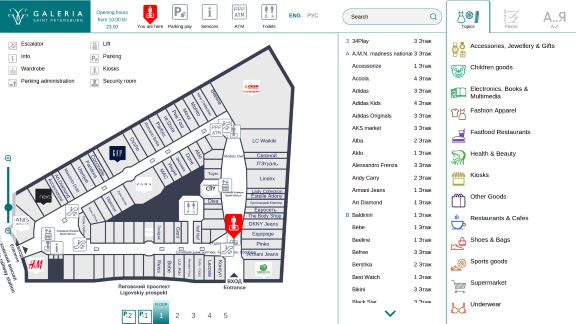
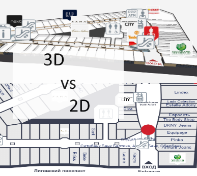
What is the difference between 3D vs 2D wayfinding and what are the benefits of 3D floor plans?

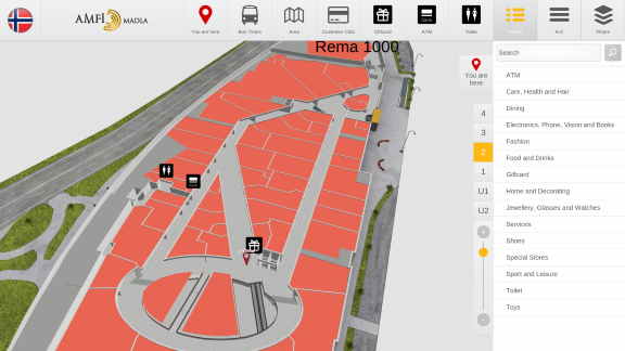
We have tested 3D, semi-3D and 2D floor-plans with our small focus-group and below is the short summary.

3D_vs_2D_wayfinding_maps

To see the 3D floor-plans in action, please sign up to 3D Wayfinder for creating your own 3D floor-plans, or see our 3D modelling services and examples.

3D Wayfinder supports also 2D images for creating wayfinding application.

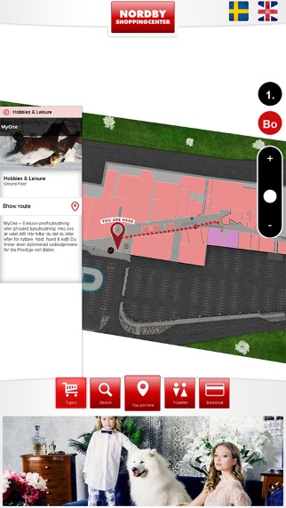
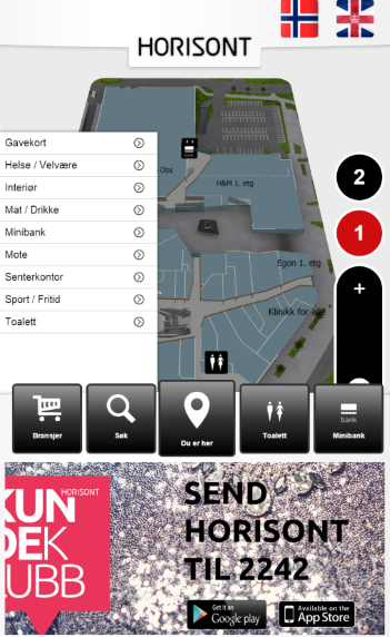
Semi-3D maps are rendered or designed floor plans, that are made to look like 3D. The map is rendered on an angle, so it is possible to see part of walls also.

We are using semi-3D maps for mobile devices, where WebGL is not supported yet.

3D vs 2D wayfinding floor plans

 3D floor plansSemi-3D floor plans2D floor plans
Overview of the building
  • 3D floor plans give a good overview of your location.
  • With 3D users see the map the way they see the building in real life.
  • It is possible to show the details, that people use for orientation inside building, for example escalators, pools, statues, tables, benches, trees etc.
  • Showing walls give a better understanding of where you are and it is easier to link the map with a real building.
  • It is easy to understand which floors have atriums and distinguish between things on different plains.
  • Semi 3D floor plans give also a good overview where you are.
  • Semi 3D can be shown only from the one angle, when looking from the other side, they can be are hard to understand.
  • Limited possibility to show the walls of the building.
  • Detailed 2D floor plans don’t give a clear overview, so it is better to use simple floor plans.
  • With simple maps the amount of details are limited.
  • It is hard for users to understand where they are and linking the map with real building is not that convenient.
  • With 2D it is not possible to show the walls of the building.
Usability of wayfinding application
  • 3D floor plans are easy to use. It is always possible to limit the zoom distances and even forbid rotation if needed.
  • Pathfinding is simple and 3D gives a good visual overview for navigating from one floor to another.
  • It is always possible to use camera view for path visualization.
  • Extra dimension enables to add more info.
  • Semi 3D floor plans are also easy to use, but it is not possible to rotate the maps.
  • Pathfinding is more convenient than 2D, as users can see some parts of the walls.
  • It is possible to add more info to the maps as 2D, but it is still not possible to add as many info/layers than 3D.
  • Rotating and moving is not that convenient, especially when looking on the vertical screen.
  • It is not convenient to guide visitors to other floors.
  • 2D floor plans should be kept simple, as there is limited space for layers and info.
  • Simple maps may not provide enough information and visitors may think, that the maps are not useful for them.
Map details and amount of information on the floor plans
  • With 3D there is one more dimension for presenting details and map related data.
  • Billboards on the map don’t disturb browsing.
  • It is possible to show details for better orientation.
  • It is possible to add more details than 2D maps, but the space for information is still limited.
  • Level of details should be kept as simple as possible, otherwise they disturb the understanding of the map.
  • Illustrated details cannot be presented in real size and it can be confusing.
Impression and imago of the building
  • 3D floor plans look nice and realistic.
  • Visitors have a sense of „controlling the building”, which makes them feel good
  • Users understand, that there has been more effort to make the wayfinding for them as good as possible.
  • Semi 3D looks prettier than plain 2D map.
  • Visitors may get disappointed when they try to turn the building, as they expect it to be real 3D.
  • With too simple 2D maps it is possible, that visitors may avoid using maps not to look foolish.
  • Detailed maps confuse visitors and they feel more lost than they were before stepping in front of the wayfinding application.
Displays and future technological possibilities
  • 3D wayfinding can work also with real 3D technologies like holograms, LED-cubes and 3D displays. Unfortunately these technologies are still in prototype phase.
  • With larger displays it is possible to add more details.
  • There is no reasonable point of showing more details with larger screen.
Advertising channel and Digital Signage integration
  • More advertisements can be shown on the maps, as the ads don’t hide the map.
  • Billboard ads on the maps look cooler and attractive.
  • Better than 2D but the advertisements still hide the map.
  • Advertisements disturb the using the wayfinding.
  • Less space for advertisements, as they hide the map behind them.

« »